National Register of Historic Places listings in Lincoln County, Oklahoma

This is a list of the National Register of Historic Places listings in Lincoln County, Oklahoma.
This is intended to be a complete list of the properties and districts on the National Register of Historic Places in Lincoln County, Oklahoma, United States. The locations of National Register properties and districts for which the latitude and longitude coordinates are included below, may be seen in a map.[1]
Three Colonial Revival houses in Chandler were subject of the "Territorial Homes of Chandler" multiple property submission, which led to the Conklin and Johnson Houses being listed.[2]
There are 46 properties and districts listed on the National Register in the county. Another property was once listed but has since been removed.
This National Park Service list is complete through NPS recent listings posted April 12, 2024.[3]
Current listings
| [4] | Name on the Register[5] | Image | Date listed[6] | Location | City or town | Description |
|---|---|---|---|---|---|---|
| 1 | Bon Ton House |  |
September 26, 1986 (#86002350) |
404 N. 4th St. 35°45′03″N 96°39′27″W / 35.750833°N 96.6575°W / 35.750833; -96.6575 (Bon Ton House) | Stroud | |
| 2 | Boston Store |  |
April 5, 1984 (#84003107) |
917 Manvel Ave. 35°42′03″N 96°52′31″W / 35.700833°N 96.875278°W / 35.700833; -96.875278 (Boston Store) | Chandler | |
| 3 | Captain Creek Bridge |  |
March 3, 2004 (#04000134) |
West of the junction of Hickory St. and State Highway 66B 35°41′35″N 97°04′16″W / 35.693056°N 97.071111°W / 35.693056; -97.071111 (Captain Creek Bridge) | Wellston | |
| 4 | Joseph Carpenter House |  |
September 26, 1986 (#86002346) |
204 W. 6th St. 35°45′06″N 96°39′19″W / 35.751667°N 96.655278°W / 35.751667; -96.655278 (Joseph Carpenter House) | Stroud | |
| 5 | Chandler Armory |  |
March 14, 1991 (#91000276) |
Junction of Mickey Clarkson Ave. and 1st St. 35°42′34″N 96°52′36″W / 35.709444°N 96.876667°W / 35.709444; -96.876667 (Chandler Armory) | Chandler | |
| 6 | Chandler Baseball Camp |  |
October 12, 2011 (#11000339) |
2000 W. Park Rd. 35°42′22″N 96°54′06″W / 35.706111°N 96.901667°W / 35.706111; -96.901667 (Chandler Baseball Camp) | Chandler | |
| 7 | Chandler Bookstore |  |
April 5, 1984 (#84003110) |
713 Manvel Ave. 35°42′12″N 96°52′31″W / 35.703333°N 96.875278°W / 35.703333; -96.875278 (Chandler Bookstore) | Chandler | |
| 8 | Chandler High School |  |
April 4, 1996 (#96000372) |
515 Steele Ave. 35°42′18″N 96°52′55″W / 35.705°N 96.881944°W / 35.705; -96.881944 (Chandler High School) | Chandler | |
| 9 | Clapp-Cunningham Building |  |
April 5, 1984 (#84003112) |
1021 Manvel Ave. 35°41′59″N 96°52′52″W / 35.6997°N 96.8811°W / 35.6997; -96.8811 (Clapp-Cunningham Building) | Chandler | |
| 10 | Conklin House |  |
September 28, 1984 (#84003116) |
206 W. 8th St. 35°42′09″N 96°52′56″W / 35.7025°N 96.882222°W / 35.7025; -96.882222 (Conklin House) | Chandler | Along with the NRHP-listed Johnson House, one of three pre-statehood Colonial Revival houses in Chandler recognized in "Territorial Homes of Chandler" multiple property submission. |
| 11 | Crane Motor Company Building |  |
February 23, 1995 (#95000036) |
722 Manvel Ave. 35°42′10″N 96°52′49″W / 35.702778°N 96.880278°W / 35.702778; -96.880278 (Crane Motor Company Building) | Chandler | |
| 12 | Crescent School |  |
April 4, 1996 (#96000373) |
2.5 miles east and 0.25 miles north of the junction of U.S. Route 62 and State Highway 18 35°30′23″N 96°51′01″W / 35.5064°N 96.8503°W / 35.5064; -96.8503 (Crescent School) | Meeker vicinity | |
| 13 | Davenport Broadway Avenue Brick Street |  |
May 27, 2004 (#04000518) |
1-600 Broadway St. 35°42′09″N 96°45′53″W / 35.7025°N 96.764722°W / 35.7025; -96.764722 (Davenport Broadway Avenue Brick Street) | Davenport | |
| 14 | Fairview School |  |
September 18, 1997 (#97001149) |
2.25 miles north-northwest of the junction of U.S. Route 62 and State Highway 18 35°32′11″N 96°54′09″W / 35.5364°N 96.9026°W / 35.5364; -96.9026 (Fairview School) | Meeker vicinity | |
| 15 | First Presbyterian Church of Chandler |  |
September 28, 1984 (#84003118) |
8th and Blaine Sts. 35°42′10″N 96°52′58″W / 35.702778°N 96.882778°W / 35.702778; -96.882778 (First Presbyterian Church of Chandler) | Chandler | |
| 16 | Flynt Building |  |
June 5, 2007 (#07000516) |
720 Manvel Ave. 35°42′10″N 96°52′48″W / 35.702778°N 96.88°W / 35.702778; -96.88 (Flynt Building) | Chandler | |
| 17 | Graham Hotel | May 22, 1979 (#79001998) |
Main St. and 2nd Ave. 35°44′57″N 96°39′16″W / 35.749167°N 96.654444°W / 35.749167; -96.654444 (Graham Hotel) | Stroud | Destroyed[7] | |
| 18 | Hadley House |  |
November 13, 1984 (#84000457) |
622 N. 4th Ave. 35°45′10″N 96°39′27″W / 35.752778°N 96.6575°W / 35.752778; -96.6575 (Hadley House) | Stroud | |
| 19 | Walter Hadley House |  |
September 26, 1986 (#86002308) |
424 W. 7th St. 35°45′10″N 96°39′30″W / 35.752778°N 96.658333°W / 35.752778; -96.658333 (Walter Hadley House) | Stroud | |
| 20 | Hotel Lincoln |  |
February 23, 1995 (#95000037) |
323 Main St. 35°44′57″N 96°39′26″W / 35.749167°N 96.657222°W / 35.749167; -96.657222 (Hotel Lincoln) | Stroud | |
| 21 | George Hughes House |  |
September 26, 1986 (#86002370) |
308 W. 5th St. 35°45′03″N 96°39′23″W / 35.750833°N 96.656389°W / 35.750833; -96.656389 (George Hughes House) | Stroud | |
| 22 | Johnson House |  |
September 28, 1984 (#84003121) |
503 Marvel Ave. 35°42′20″N 96°52′51″W / 35.705556°N 96.880833°W / 35.705556; -96.880833 (Johnson House) | Chandler | Along with the NRHP-listed Conklin House, one of three pre-statehood Colonial Revival houses in Chandler recognized in "Territorial Homes of Chandler" multiple property submission. |
| 23 | Moses Keokuk House | June 19, 1973 (#73001563) |
6 miles south of Stroud 35°41′27″N 96°42′00″W / 35.690833°N 96.700000°W / 35.690833; -96.700000 (Moses Keokuk House) | Stroud | Burned in 2002[8] | |
| 24 | Mascho Building and Public Privy |  |
April 5, 1984 (#84003127) |
717-719 Manvel Ave. 35°42′11″N 96°52′31″W / 35.703056°N 96.875278°W / 35.703056; -96.875278 (Mascho Building and Public Privy) | Chandler | |
| 25 | Meeker Town Hall |  |
April 4, 1996 (#96000374) |
115 N. Fowler St. 35°30′14″N 96°54′09″W / 35.5038°N 96.9025°W / 35.5038; -96.9025 (Meeker Town Hall) | Meeker | |
| 26 | William Alfred Mensch Building |  |
December 28, 2000 (#00001576) |
218 W. Main St. 35°44′55″N 96°39′20″W / 35.748611°N 96.655556°W / 35.748611; -96.655556 (William Alfred Mensch Building) | Stroud | |
| 27 | Midlothian School |  |
April 4, 1996 (#96000375) |
2.25 miles west and 4 miles south of the junction of State Highway 18 and the former U.S. Route 66 35°38′15″N 96°55′35″W / 35.6375°N 96.9263°W / 35.6375; -96.9263 (Midlothian School) | Midlothian | |
| 28 | National Guard Statistical Building |  |
June 3, 1999 (#99000672) |
Park Rd., 1 block west of 6th St. 35°42′12″N 96°53′11″W / 35.703333°N 96.886389°W / 35.703333; -96.886389 (National Guard Statistical Building) | Chandler | |
| 29 | Oleson-Crane Building |  |
April 5, 1984 (#84003129) |
721 Manvel Ave. 35°42′10″N 96°52′31″W / 35.702778°N 96.875278°W / 35.702778; -96.875278 (Oleson-Crane Building) | Chandler | |
| 30 | Ozark Trails Section of Route 66 |  |
December 5, 2003 (#03001235) |
Junction of N3540 Rd. and E0890 Rd. west to the junction of E0890 Rd. and the St. Louis – San Francisco railroad tracks. 35°43′26″N 96°42′33″W / 35.723889°N 96.709167°W / 35.723889; -96.709167 (Ozark Trails Section of Route 66) | Stroud | |
| 31 | Phillips 66 Station No. 1423 |  |
September 8, 2011 (#11000640) |
701 S. Manvel 35°42′12″N 96°52′52″W / 35.703333°N 96.881111°W / 35.703333; -96.881111 (Phillips 66 Station No. 1423) | Chandler | Route 66 in Oklahoma MPS |
| 32 | Prague City Hall and Jail |  |
June 26, 1998 (#98000732) |
1116 Jim Thorpe Boulevard 35°29′18″N 96°41′08″W / 35.4882°N 96.6855°W / 35.4882; -96.6855 (Prague City Hall and Jail) | Prague | |
| 33 | Rock Café |  |
June 14, 2001 (#01000661) |
114 W. Main St. 35°44′55″N 96°39′15″W / 35.748611°N 96.654167°W / 35.748611; -96.654167 (Rock Café) | Stroud | |
| 34 | St. Cloud Hotel |  |
April 5, 1984 (#84003131) |
1216 Manvel Ave. 35°41′53″N 96°52′32″W / 35.698056°N 96.875556°W / 35.698056; -96.875556 (St. Cloud Hotel) | Chandler | |
| 35 | St. Paul Baptist Church and Cemetery |  |
September 13, 2002 (#02000973) |
4.25 miles north and 1.5 miles west of the junction of U.S. Route 62 and State Highway 18 35°33′53″N 96°54′37″W / 35.5647°N 96.9103°W / 35.5647; -96.9103 (St. Paul Baptist Church and Cemetery) | Meeker vicinity | |
| 36 | St. Stephen's Episcopal Church |  |
June 9, 2000 (#00000655) |
812 Blaine Ave. 35°42′08″N 96°52′57″W / 35.702222°N 96.8825°W / 35.702222; -96.8825 (St. Stephen's Episcopal Church) | Chandler | |
| 37 | Seaba's Filling Station |  |
February 9, 1995 (#94001609) |
336992 E. Highway 66 35°41′11″N 96°59′59″W / 35.686389°N 96.999722°W / 35.686389; -96.999722 (Seaba's Filling Station) | Warwick | |
| 38 | Southwestern Bell Telephone Building |  |
May 14, 1986 (#86001093) |
301 W. 7th St. 35°45′13″N 96°39′24″W / 35.7535°N 96.6567°W / 35.7535; -96.6567 (Southwestern Bell Telephone Building) | Stroud | |
| 39 | Spring Dell School |  |
April 4, 1996 (#96000376) |
5 miles south and 0.5 miles west of the junction of State Highway 18 and the former U.S. Route 66 35°37′32″N 96°53′32″W / 35.6256°N 96.8922°W / 35.6256; -96.8922 (Spring Dell School) | Meeker vicinity | |
| 40 | Old Stroud School |  |
September 18, 1997 (#97001150) |
1 mile east of the junction of Interstate 44 and State Highway 99 35°45′13″N 96°40′51″W / 35.753611°N 96.680833°W / 35.753611; -96.680833 (Old Stroud School) | Stroud | |
| 41 | Stroud Trading Company Building |  |
December 27, 1979 (#79001999) |
Main St. and 2nd Ave. 35°44′57″N 96°39′18″W / 35.749167°N 96.655°W / 35.749167; -96.655 (Stroud Trading Company Building) | Stroud | |
| 42 | James W. Stroud House |  |
March 8, 1984 (#84003134) |
110 E. 2nd St. 35°44′52″N 96°39′11″W / 35.747778°N 96.653056°W / 35.747778; -96.653056 (James W. Stroud House) | Stroud | |
| 43 | Marshal William M. Tilghman Homestead | January 11, 1976 (#76001568) |
2 miles northwest of Chandler off the former U.S. Route 66 35°43′47″N 96°54′42″W / 35.729722°N 96.911667°W / 35.729722; -96.911667 (Marshal William M. Tilghman Homestead) | Chandler | ||
| 44 | Warwick School |  |
April 4, 1996 (#96000377) |
0.75 miles east and 0.25 miles north of the junction of U.S. Route 177 and the former U.S. Route 66 35°41′09″N 97°00′17″W / 35.685833°N 97.004722°W / 35.685833; -97.004722 (Warwick School) | Warwick | |
| 45 | Wolcott Building |  |
April 5, 1984 (#84003136) |
725 Manvel Ave. 35°42′09″N 96°52′31″W / 35.7025°N 96.875278°W / 35.7025; -96.875278 (Wolcott Building) | Chandler | |
| 46 | ZCBJ Lodge No. 46 |  |
March 8, 1984 (#84003138) |
S. Barta Ave. 35°28′39″N 96°41′01″W / 35.4775°N 96.6836°W / 35.4775; -96.6836 (ZCBJ Lodge No. 46) | Prague |
Former listing
| [4] | Name on the Register | Image | Date listed | Date removed | Location | City or town | Description |
|---|---|---|---|---|---|---|---|
| 1 | Bank of Agra | February 21, 1990 (#90000122) | September 6, 2006 | 400 Grant Avenue | Agra | Demolished in 1999[9] |
See also
- List of National Historic Landmarks in Oklahoma
- National Register of Historic Places listings in Oklahoma
References
- ^ The latitude and longitude information provided in this table was derived originally from the National Register Information System, which has been found to be fairly accurate for about 99% of listings. Some locations in this table may have been corrected to current GPS standards.
- ^ Nicola Perkins and George 0. Carney (January 1984). "National Register of Historic Places Inventory/Nomination: Territorial Homes of Chandler Thematic Resources (TR)". National Park Service. Retrieved October 3, 2016.
{{cite web}}: CS1 maint: numeric names: authors list (link) - ^ National Park Service, United States Department of the Interior, "National Register of Historic Places: Weekly List Actions", retrieved April 12, 2024.
- ^ a b Numbers represent an alphabetical ordering by significant words. Various colorings, defined here, differentiate National Historic Landmarks and historic districts from other NRHP buildings, structures, sites or objects.
- ^ "National Register Information System". National Register of Historic Places. National Park Service. March 13, 2009.
- ^ The eight-digit number below each date is the number assigned to each location in the National Register Information System database, which can be viewed by clicking the number.
- ^ "Oklahoma's National Register of Historic Places". Department of Geography at Oklahoma State University.
- ^ "Moses Keokuk House". Oklahoma Historical Society State Historic Preservation Office. Retrieved May 25, 2017.
- ^ http://digital.library.okstate.edu/encyclopedia/entries/A/AG001.html [dead link]
| Chandler |
| |
|---|---|---|
| Davenport |
| |
| Meeker |
| |
| Midlothian |
| |
| Prague |
| |
| Stroud |
| |
| Warwick |
| |
| Wellston |
| |
See also: National Register of Historic Places listings in Lincoln County, Oklahoma and List of National Historic Landmarks in Oklahoma | ||
| Topics | |
|---|---|
| Lists by state |
|
| Lists by insular areas | |
| Lists by associated state | |
| Other areas | |
| Related | |
Municipalities and communities of Lincoln County, Oklahoma, United States | ||
|---|---|---|
| Cities | 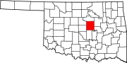 | |
| Towns | ||
| Unincorporated communities | ||
| Ghost towns | ||
| Footnotes | ‡This populated place also has portions in an adjacent county or counties | |