National Register of Historic Places listings in Ellis County, Oklahoma

This is a list of the National Register of Historic Places listings in Ellis County, Oklahoma.
This is intended to be a complete list of the properties on the National Register of Historic Places in Ellis County, Oklahoma, United States. The locations of National Register properties for which the latitude and longitude coordinates are included below, may be seen in a map.[1]
There are 10 properties listed on the National Register in the county.
This National Park Service list is complete through NPS recent listings posted April 12, 2024.[2]
Current listings
| [3] | Name on the Register[4] | Image | Date listed[5] | Location | City or town | Description |
|---|---|---|---|---|---|---|
| 1 | Bank of Gage | _interior_facing_SW_1.JPG/1280px-Bank_of_Gage_(Oklahoma)_interior_facing_SW_1.JPG) |
October 7, 1983 (#83004169) |
Corner of Main and Cedar[6] 36°19′14″N 99°45′26″W / 36.320516°N 99.757150°W / 36.320516; -99.757150 (Bank of Gage) | Gage | |
| 2 | George Carr Ranch House | April 10, 1985 (#85000788) |
Northwest of Camargo 36°02′31″N 99°23′06″W / 36.041944°N 99.385°W / 36.041944; -99.385 (George Carr Ranch House) | Camargo | ||
| 3 | Davison Silo | November 14, 1978 (#78002234) |
20 miles (32 km) southeast of Arnett 35°59′46″N 99°35′23″W / 35.996111°N 99.589722°W / 35.996111; -99.589722 (Davison Silo) | Arnett | Burned in 1993[7] | |
| 4 | Eggleston Springs | November 27, 1978 (#78002235) |
Address Restricted | Arnett | ||
| 5 | Ellis County Courthouse |  |
March 22, 1985 (#85000681) |
Town Square 36°08′04″N 99°46′14″W / 36.134348°N 99.770553°W / 36.134348; -99.770553 (Ellis County Courthouse) | Arnett | |
| 6 | Ingle Brothers Broomcorn Warehouse | December 3, 2009 (#09000975) |
320 NW 1st St. 36°16′36″N 99°53′03″W / 36.27667°N 99.88403°W / 36.27667; -99.88403 (Ingle Brothers Broomcorn Warehouse) | Shattuck | Brick warehouse with stepped gable. | |
| 7 | First State Bank |  |
October 7, 1983 (#83004170) |
239 S. Main St. 36°16′28″N 99°52′51″W / 36.274444°N 99.880833°W / 36.274444; -99.880833 (First State Bank) | Shattuck | Apparently no longer extant[8] |
| 8 | Grand Town Site | June 5, 1972 (#72001063) |
14 miles south of Arnett 35°58′56″N 99°47′43″W / 35.982222°N 99.795278°W / 35.982222; -99.795278 (Grand Town Site) | Arnett | ||
| 9 | Shattuck National Bank Building |  |
October 7, 1983 (#83004171) |
101 S. Main St.[9] 36°16′33″N 99°52′54″W / 36.275941°N 99.881775°W / 36.275941; -99.881775 (Shattuck National Bank Building) | Shattuck | |
| 10 | Stock Exchange Bank | _from_N_1.JPG/1280px-Stock_Exchange_Bank_bldg_(Fargo_OK)_from_N_1.JPG) |
October 7, 1983 (#83004173) |
Main St. 36°22′34″N 99°37′25″W / 36.376036°N 99.623734°W / 36.376036; -99.623734 (Stock Exchange Bank) | Fargo |
_interior_facing_SW_1.JPG)
_from_N_1.JPG)
Determined eligible
At least one property in Ellis County has been determined eligible but was not finally listed on the National Register.
| [3] | Name on the Register | Image | Date listed[5] | Location | City or town | Description |
|---|---|---|---|---|---|---|
| 1 | Harrel Bison Kill | n/a (#13000938) |
Address Restricted | Camargo | Determined eligible on December 18, 2013. |
See also
Wikimedia Commons has media related to National Register of Historic Places in Ellis County, Oklahoma.
- List of National Historic Landmarks in Oklahoma
- National Register of Historic Places listings in Oklahoma
References
- ^ The latitude and longitude information provided in this table was derived originally from the National Register Information System, which has been found to be fairly accurate for about 99% of listings. Some locations in this table may have been corrected to current GPS standards.
- ^ National Park Service, United States Department of the Interior, "National Register of Historic Places: Weekly List Actions", retrieved April 12, 2024.
- ^ a b Numbers represent an alphabetical ordering by significant words. Various colorings, defined here, differentiate National Historic Landmarks and historic districts from other NRHP buildings, structures, sites or objects.
- ^ "National Register Information System". National Register of Historic Places. National Park Service. March 13, 2009.
- ^ a b The eight-digit number below each date is the number assigned to each location in the National Register Information System database, which can be viewed by clicking the number.
- ^ See 2016 photo. Note the address "522", poorly visible on left side of doorframe.
- ^ http://nr_shpo.okstate.edu/shpopic.asp?id=78002234 [dead link]
- ^ See 2016 photo, showing northwest corner of 3rd and Main, occupied by a car-lot.
- ^ "Shattuck Public Library". Town of Shattuck. Retrieved 2016-03-29.
_location_1.JPG)
| Arnett |
| |
|---|---|---|
| Camargo |
| |
| Fargo |
| |
| Gage |
| |
| Shattuck |
| |
See also: National Register of Historic Places listings in Ellis County, Oklahoma and List of National Historic Landmarks in Oklahoma | ||
| Topics | |
|---|---|
| Lists by state |
|
| Lists by insular areas | |
| Lists by associated state | |
| Other areas | |
| Related | |
Municipalities and communities of Ellis County, Oklahoma, United States | ||
|---|---|---|
| Towns | 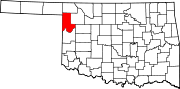 | |
| Unincorporated communities | ||
| Ghost town | ||