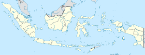
Salili
Salili | |
|---|---|
village | |
| Coordinates: 02°44′55″N 125°23′04″E / 2.74861°N 125.38444°E / 2.74861; 125.38444 | |
| Country | Indonesia |
| Province | North Sulawesi |
| Regency | Sitaro Islands Regency |
| Elevation | 831 m (2,726 ft) |
| Time zone | UTC+7 (WIB) |
Salili is a village on Siau Island in the Sitaro Islands Regency, North Sulawesi Province, Indonesia. The village is located on the slope of Mount Karangetang, south-west of the peak, beside the stream known as Salu Salili. 600 meters from the village is the site of an Indonesian government seismic and volcano observation post (Volcanological Survey of Indonesia).[1][2][3]
Karangetang is one of the most active volcanoes in Indonesia, having erupted 41 times since 1675.[4]
Notes
- ^ Rondonuwu, Yudith (25 March 2011). "Kisah Petugas Pemantau Gunung Api Karangetang (Story Karangetang Volcano Monitoring Officer)". Tribun Manado (in Indonesian). Manado, North Sulawesi, Indonesia. Archived from the original on 4 August 2013.
- ^ Staff (30 August 2011). "Soputan, Karangetang mountains still in alert status". Antara News. Archived from the original on 4 August 2013.
- ^ Raja, Supardi Bado (24 September 2012). "Awan Panas & Lava Pijar Masih Keluar dari Gunung Karangetang (Heat clouds & Lava Glow Still Out of Mount Karangetang)". Sindo TV (in Indonesian). Archived from the original on 27 September 2012.
- ^ "07/1997 (BGVN 22:07) Three people killed by a pyroclastic flow in June". Index of Monthly Reports (Karangetang [Api Siau]). www.volcano.si.edu. Retrieved 12 March 2011.
