East London Reef
| Disputed atoll | |
|---|---|
 East London Reef | |
| Other names | Đá Đông (Vietnamese) East Quezon Reef(Philippine English) Bahura ng Silangang Quezon (Filipino) 东礁 Dōng jiāo (Chinese) |
| Geography | |
| Location | South China Sea |
| Coordinates | 8°49′42″N 112°35′48″E / 8.82833°N 112.59667°E / 8.82833; 112.59667 (East London Reef) |
| Archipelago | Spratly Islands |
| Total islands | 3 (Da Dong A, B, C Islets) |
| Administration | |
| District | Trường Sa District |
| Township | Trường Sa Township |
| Claimed by | |
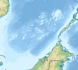
East London Reef (Filipino: Bahura ng Silangang Quezon); East Reef (Vietnamese: Đá Đông); Mandarin Chinese: 东礁; pinyin: Dōng jiāo, is a atoll on the eastern part of the London Reefs of the Spratly Islands in the South China Sea. The atoll has been occupied by Vietnam since 1987. It is also claimed by China (PRC), the Philippines, Vietnam, and Taiwan (ROC).[1][2][3]
Characteristic
The East Reef is located on an east-west axis with a length of about 14 km and a maximum width of about 4 km with a coral base area of about 25.1 km2. Because this rock slopes gradually from south to north, when the tide is 0.4 m low, the northern coral belt rises out of the water while the southern rim only rises 0.2 m low tide.[4] The lagoon of this atoll is from 7.3 to 14.6 m deep.[5]
The Vietnam Navy Engineers built three permanent houses on the west, north and east sides of the atoll, named Da Dong Islets (A, B, C). The specific geographical coordinates are (coordinates in brackets are the coordinates recorded on the sovereignty landmark):
- Da Dong A Islets: 8°49′21″N 112°39′33″E / 8.82250°N 112.65917°E / 8.82250; 112.65917 (8°49′21″N 112°39′33″E / 8.82250°N 112.65917°E / 8.82250; 112.65917), on the east side of East Reef, includes a permanent house connected to a multi-purpose cultural house (inaugurated April 2021).[6]
- Da Dong B Islets: 8°49′40″N 112°33′01″E / 8.82778°N 112.55028°E / 8.82778; 112.55028 (8°49′04″N 112°33′05″E / 8.81778°N 112.55139°E / 8.81778; 112.55139), on the west side of East Reef, consists of two permanent houses connected to each other.
- Da Dong C Islets: 8°50′24″N 112°35′40″E / 8.84000°N 112.59444°E / 8.84000; 112.59444 (8°50′00″N 112°34′30″E / 8.83333°N 112.57500°E / 8.83333; 112.57500), on the north side of East Reef, includes a permanent house. The multi-purpose cultural house will start construction in April 2022.[7]

History
In early 1988, after occupying Fiery Cross Reef (January 31, 1988) and Cuarteron Reef (February 18, 1988) in the Spratly Islands, China intended to occupy East London Reef.
On February 15, 1988, the transport ship HQ-614 of Navy Region 4 arrived at East London Reef, combined with ship HQ-851 to form a squadron because the forward command post of Region 4 was located on ship HQ-614 direct command. The forward command post of Region 4 includes Colonel, regional commander Lê Văn Thư, Lieutenant Colonel, Deputy Chief of Staff of the region Nguyễn Văn Dân and Lieutenant Colonel, Deputy Political Director of the Region Lê Xuân Bạ to organize guarding of East London Reef.[8]
On February 19, 1988, after an unsuccessful struggle around Cuarteron Reef with China, ships HQ-614 and HQ-851 brought forces from Brigade 146, Region 4 of the Vietnamese Navy and from the 83rd Infantry Regiment. Navy troops landed on East London Reef and organized to guard this rock.[9]
See also
References
- ^ (in Vietnamese)"Trường Sa và CQ-88 - Những tháng ngày lịch sử". March 14, 2017. Retrieved November 9, 2022.
- ^ D. J. Hancox; John Robert Victor Prescott (1995). A Geographical Description of the Spratly Islands and an Account of Hydrographic Surveys Amongst Those Islands. IBRU. pp. 14–. ISBN 978-1-897643-18-1.
- ^ "East Reef". cil.nus.edu.sg. Retrieved 27 November 2022.
- ^ Những điều cần biết về hai quần đảo Hoàng Sa, Trường Sa và khu vực thềm lục địa phía nam (DK1). Cục Chính trị, Bộ Tư lệnh Hải quân (Việt Nam). 2011.
- ^ Sailing Directions 161 (Enroute) - South China Sea and the Gulf of Thailand (13 ed.). Bethesda, Maryland: National Geospatial-Intelligence Agency. 2011. p. 13.
- ^ "Đoàn công tác thành phố Hà Nội thăm quân dân huyện đảo Trường Sa". quocphongthudo.vn (in Vietnamese). 2021-04-23. Retrieved 2022-11-02.
- ^ "Vnsea.net - Khởi công nhà văn hóa đa năng đảo Đá Đông C, huyện đảo Trường Sa". vnsea.net. Retrieved 2022-11-02.
- ^ "Trường Sa và CQ-88 - Những tháng ngày lịch sử". VietNamNet (in Vietnamese). Retrieved 2022-09-06.
- ^ "Trường Sa và CQ-88 - Những tháng ngày lịch sử". VietNamNet (in Vietnamese). Retrieved 2022-09-06.
External links
- Maritime Transparency Initiative Island Tracker
