Ashuradeh
 Ashuradeh Island at the LandSat-5 satellite image (01-Apr-1995, Caspian Sea waters high level) | |
| Geography | |
|---|---|
| Coordinates | 36°54′21″N 53°58′52″E / 36.90583°N 53.98111°E / 36.90583; 53.98111 |
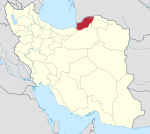
Ashūradeh (Persian: آشوراده), or Ashur Ada, besides Esmaeilsay and Akaz islands, is one of the islands off the Iranian coast on the Caspian Sea (Gorgan Bay).[1] Ashuradeh's surface area is 800 hectares (2,000 acres). It is located on the eastern end of the Miankaleh peninsula in the county of Behshahr of Māzandarān Province of Iran, 3 kilometers (1.9 mi) from Bandar Torkaman and 23 kilometers (14 mi) from Gorgan.[2]
The island can be reached via Bandar Torkaman. Over 40% of Iran's caviar is produced near Ashūradeh Island.[3]
History

Ashuradeh was inhabited by 300 families, but the village is now deserted. The island was occupied by Russian forces in 1837, despite protests from Persia.[4] Following the occupation, the Russian Army maintained a military post on the island for a few decades until 1921.[5]
References
- ^ "Akaz Island".
- ^ "Ashooradeh Island". Archived from the original on 2007-04-10. Retrieved 2007-03-20.
- ^ Caviar in Iran[permanent dead link]
- ^ Rezun, Miron (1981). The Soviet Union and Iran : Soviet policy in Iran from the beginnings of the Pahlavi Dynasty until the Soviet invasion in 1941. Alphen aan den Rijn: Sijthoff & Noordhoff International. p. 6. ISBN 90-286-2621-2. OCLC 7925812.
- ^ Colonel Stebnitzky's Report on His Journey in 1872
External links
- Memar, Parya, „New urban Settlements in the ecological context; Miānqāla and its new settlement in the south eastern coasts of Caspian Sea“. In: Sustainable Development of Emerging Settlement Patterns, Berlin 2006: pp. 88–102 (ISBN 978-3-7983-2022-2)
- Etymology of Ashuradeh Islands
- Ashuradeh Island Profile
- Pictures

