Amboseli Airport
Amboseli Airport | |||||||||||
|---|---|---|---|---|---|---|---|---|---|---|---|
 | |||||||||||
| Summary | |||||||||||
| Airport type | Public, Civilian | ||||||||||
| Owner | Kenya Civil Aviation Authority | ||||||||||
| Serves | Amboseli, Kenya | ||||||||||
| Location | Amboseli, | ||||||||||
| Elevation AMSL | 3,757 ft / 1,145 m | ||||||||||
| Coordinates | 02°38′32″S 037°15′00″E / 2.64222°S 37.25000°E / -2.64222; 37.25000 | ||||||||||
| Map | |||||||||||
 ASV Location of Amboseli Airport in Kenya (Placement on map is approximate) | |||||||||||
| Runways | |||||||||||
| |||||||||||
Amboseli Airport (IATA: ASV, ICAO: HKAM) is an airport in Kenya.
Location
Amboseli Airport is in Kajiado County, in Amboseli National Park, in south-central Kenya, close to the international border with the Republic of Tanzania.
It is approximately 156 kilometres (97 mi), by air, south of Jomo Kenyatta International Airport, the country's largest civilian airport.[1] The geographic coordinates of Amboseli Airport are 2° 38' 42.00"S, 37° 15' 0.00"E (Latitude: -2.64500; Longitude:37.25000).
Overview
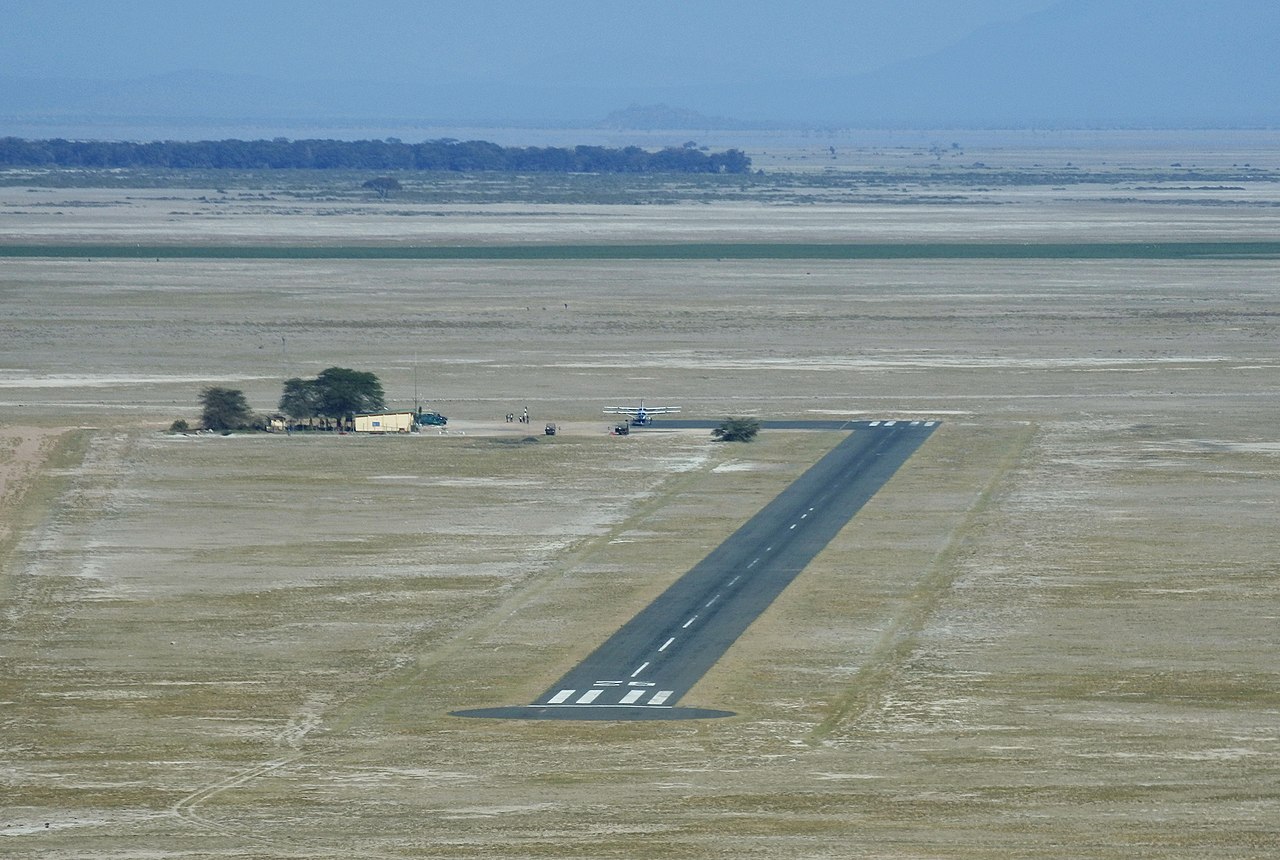
Amboseli Airport serves Amboseli National Park. The small airport receives regular scheduled service from Airkenya and unscheduled service from aircharter service providers.
At 1,145 metres (3,757 ft) above sea level the airport has a single asphalt runway that measures 1,180 metres (3,870 ft) in length.[2]
Airlines and destinations
| Airlines | Destinations |
|---|---|
| Airkenya Express | Nairobi–Wilson |
| Mombasa Air Safari | Mombasa |
| Safarilink | Nairobi–Wilson |
See also
- Amboseli National Park
- Kenya Airports Authority
- Kenya Civil Aviation Authority
- List of airports in Kenya
References
- ^ "Distance between Jomo Kenyatta Airport Nairobi (Nairobi Area) and Amboseli (Rift Valley) (Kenya)". distancecalculator.globefeed.com. Retrieved 21 August 2018.
- ^ "ASV - Amboseli, KE - Airport - Great Circle Mapper". www.gcmap.com. Retrieved 7 November 2018.
External links
- Location of Amboseli Airport At Google Maps
- Website of Kenya Airports Authority
- Airkenya Flight Routes