Wielen
Wielen | |
|---|---|
Location of Wielen within Grafschaft Bentheim district 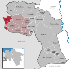 | |
 Wielen  Wielen | |
| Coordinates: 52°33′N 6°43′E / 52.550°N 6.717°E / 52.550; 6.717 | |
| Country | Germany |
| State | Lower Saxony |
| District | Grafschaft Bentheim |
| Municipal assoc. | Uelsen |
| Subdivisions | 4 Ortsteile |
| Government | |
| • Mayor | Gerold Stroeve |
| Area | |
| • Total | 23.06 km2 (8.90 sq mi) |
| Elevation | 20 m (70 ft) |
| Population (2022-12-31)[1] | |
| • Total | 498 |
| • Density | 22/km2 (56/sq mi) |
| Time zone | UTC+01:00 (CET) |
| • Summer (DST) | UTC+02:00 (CEST) |
| Postal codes | 49847 |
| Dialling codes | 0 59 48 |
| Vehicle registration | NOH |
| Website | www.uelsen.de |
Wielen is a small village in the district of Grafschaft Bentheim in Lower Saxony, Germany, and belongs to the Joint Community (Samtgemeinde) of Uelsen. Wielen has 614 inhabitants. Within the village is found the Lower County’s oldest maintained school, het Schöltien.
Constituent communities
Along with the namesake Ortsteil, there are outlying centres named Balderhaar, Striepe and Vennebrügge.
References
- ^ "LSN-Online Regionaldatenbank, Tabelle A100001G: Fortschreibung des Bevölkerungsstandes, Stand 31. Dezember 2022" (in German). Landesamt für Statistik Niedersachsen.
External links
- Wielen
- Joint Community’s webpage
Towns and municipalities in Grafschaft Bentheim (district) | ||
|---|---|---|
 | ||