Wano Township, Cheyenne County, Kansas
Wano Township | |
|---|---|
 Location in Cheyenne County | |
| Coordinates: 39°41′25″N 101°48′47″W / 39.69028°N 101.81306°W / 39.69028; -101.81306 | |
| Country | United States |
| State | Kansas |
| County | Cheyenne |
| Area | |
| • Total | 361.83 sq mi (937.12 km2) |
| • Land | 361.64 sq mi (936.64 km2) |
| • Water | 0.19 sq mi (0.48 km2) 0.05% |
| Elevation | 3,481 ft (1,061 m) |
| Population (2000) | |
| • Total | 2,104 |
| • Density | 5.8/sq mi (2.2/km2) |
| GNIS feature ID | 0485198 |
Wano Township is a township in Cheyenne County, Kansas, USA. As of the 2000 census, its population was 2,104.[needs update]
Geography
Wano Township covers an area of 361.83 square miles (937.1 km2) and contains one incorporated settlement, St. Francis (the county seat). According to the USGS, it contains eight cemeteries: Emanuel, Gar, Hope Valley, Lawn Ridge, Saint Francis, Saint Pauls, Salem and Salem Evangelical.
The streams of Cherry Creek, Drury Creek, Fish Creek, Sand Creek, Spring Creek and West Fork Sand Creek run through this township.
History
A post office was opened at Lawnridge in 1885. The post office was discontinued in 1896.[1]
Transportation
Wano Township contains two airports or landing strips: Cheyenne County Municipal Airport and Saint Francis Municipal Airport.
References
- ^ "Kansas Post Offices, 1828-1961". Kansas Historical Society. Retrieved January 5, 2018.[permanent dead link]
- USGS Geographic Names Information System (GNIS)
External links
- US-Counties.com
- City-Data.com
Municipalities and communities of Cheyenne County, Kansas, United States | ||
|---|---|---|
| Cities | 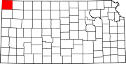 | |
| Unincorporated communities | ||
| Townships | ||
This article about a location in Cheyenne County, Kansas is a stub. You can help Wikipedia by expanding it. |