Vila Velha do Cassiporé
Vila Velha do Cassiporé | |
|---|---|
| Coordinates: 3°12′34″N 51°13′51″W / 3.2094°N 51.2308°W / 3.2094; -51.2308 | |
| Country | |
| Region | North |
| State | Amapá |
| Municipality | Oiapoque |
| Area | |
| • Total | 8,509 km2 (3,285 sq mi) |
| Population (2010)[1] | |
| • Total | 2,723 |
| • Density | 0.32/km2 (0.83/sq mi) |
| Time zone | UTC−3 (BRT) |
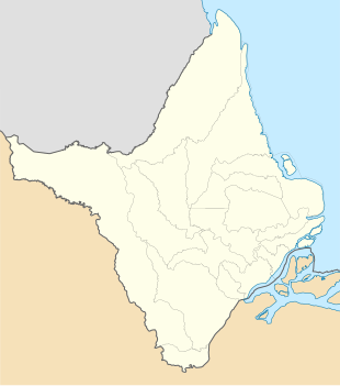
Vila Velha do Cassiporé (or Vila Velha[2]) is a village and district in the Brazilian municipality of Oiapoque, Amapá. It is located on the Cassiporé River.[3] Vila Velha is in a protected area near the Cabo Orange National Park.[4] In 2016, it was recognised as a Quilombo (escaped slaves) settlement.
Overview
Vila Velha do Cassiporé is located in a territory which was disputed between France and Brazil.[4] The region attracted escaped Brazilian slaves.[5] In the 19th century, gold was discovered in the Cassiporé River. In 1900, the territory was awarded to Brazil.[4]
In 1951, Vila Velha do Cassiporé became a district of the municipality of Oiapoque.[2] In 1957, the population of the village was estimated at about 250 people.[4] In 1999, INCRA established an agricultural community in Vila Velha.[6] In 2016, the village was recognised as a Quilombo settlement,[7] and has been allocated a territory comparable to the indigenous territories.[8]

Vila Velha do Cassiporé has a school and a clinic, however a 2018 investigation revealed that both were not meeting basic requirements.[9] The village used to accessible by boat only which amounted to a day's journey from Oiapoque. In 2015, a road opened connecting the village to the BR-156 highway.[3] The economy is mainly based on agriculture. The main export products are watermelons and cocoa.
Near the village, archaeological items such as ceramic burial jars, rock axes, and copper jingle bells were discovered dating from before 1500. In 2017, a plan was developed by National Institute of Historic and Artistic Heritage and the local community to investigate and protect the site.[5]
References
- ^ "Sinopse por setores". Instituto Brasileiro de Geografia e Estatística (in Portuguese). 16 November 2011. Retrieved 30 March 2021.
- ^ a b "Histórico". Municipality of Oiapoque (in Portuguese). Retrieved 30 March 2021.
- ^ a b "Cabo Orange: Comunidade agrícola no extremo Norte do AP sai do isolamento". Seles Nafes (in Portuguese). Retrieved 30 March 2021.
- ^ a b c d "Histórico sobre a região do rio Cassiporé". Diario do Amapá (in Portuguese). Retrieved 30 March 2021.
- ^ a b "Patrimônio arqueológico de Vila Velha do Cassiporé é foco de projeto de valorização". Itaú Cultural (in Portuguese). Retrieved 30 March 2021.
- ^ "IMPLANTAÇÃO DE SISTEMAS FOTOVOLTAICOS EM COMUNIDADES REMOTAS NO ESTADO DO AMAPÁ: A POLÍTICA PÚBLICA, DESAFIOS E POSSIBILIDADES" (PDF). Abens.org (in Portuguese). p. 3. Retrieved 30 March 2021.
- ^ "Mais seis comunidades são reconhecidas como remanescentes de quilombo no AP". Government of Amapá (in Portuguese). Retrieved 30 March 2021.
- ^ "Vila Velha do Cassiporé". omissão Pró-Índio de São Paulo (in Portuguese). 5 May 2017. Retrieved 30 March 2021.
- ^ "MP confirma situação de abandono em escolas e posto de saúde no norte do AP". Seles Nafes (in Portuguese). Retrieved 30 March 2021.

