Township 7, Rooks County, Kansas
Township 7 | |
|---|---|
 Location in Rooks County | |
| Coordinates: 39°21′02″N 99°32′54″W / 39.35056°N 99.54833°W / 39.35056; -99.54833 | |
| Country | United States |
| State | Kansas |
| County | Rooks |
| Richland | 1880 est. |
| Elevation | 1,972 ft (601 m) |
| Population (2010) | |
| • Total | 185 |
| Time zone | UTC-6 (CST) |
| GNIS feature ID | 472217[1] |
Township 7 is a township in Rooks County, Kansas, United States. Damar is the largest population center in Township 7.
History
Rooks County was established with four townships: Bow Creek, Lowell, Paradise and Stockton. That number increased to seven by 1878[2] and twenty three in 1925. The twenty three townships were in place until 1971 when the number was reduced to the current twelve townships.[3]
Township 7 was formed by renaming Richland Township[4] in 1971.[5] While other Rooks County townships were combined pursuant to Kansas Statute 80-1110,[6] Richland was just renamed using the new naming standard.
The South Fork Solomon River traverses the township.
Richland Township
Richland Township was formed in approximately 1880 from part of Stockton Township.[7]
References
- ^ "US Board on Geographic Names". United States Geological Survey. October 13, 1978. Retrieved January 7, 2018.
- ^ "MAP OF ROOKS COUNTY, KANSAS, 1878". KS Gen Web. Retrieved February 10, 2018.
- ^ "Rooks County Kansas". Kansas Historical Society. Retrieved February 10, 2018.
- ^ "Kansas Civil Townships and Independent Cities". Kansas Historical Society. Retrieved January 7, 2018.
- ^ BOARD OF COUNTY COMMISSIONERS, ROOKS COUNTY KANSAS (January 7, 1971). "LEGAL ADVERTISING". Plainville Times. p. 10.
- ^ "Chapter 80.:-TOWNSHIPS AND TOWNSHIP OFFICERS". Kansas Office of Revisor of Statutes. Retrieved February 10, 2018.
- ^ Vanduvall, Leonard C (November 23, 1961). "A History of Richland Township". Plainville Times. p. 3.
Municipalities and communities of Rooks County, Kansas, United States | ||
|---|---|---|
| Cities | 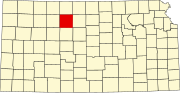 | |
| Unincorporated communities | ||
| Ghost towns | ||
| Townships | ||
| Footnotes | †This community is designated a Census-Designated Place (CDP) by the United States Census Bureau. | |
This article about a location in Rooks County, Kansas is a stub. You can help Wikipedia by expanding it. |