Template:Indian states and territories image map
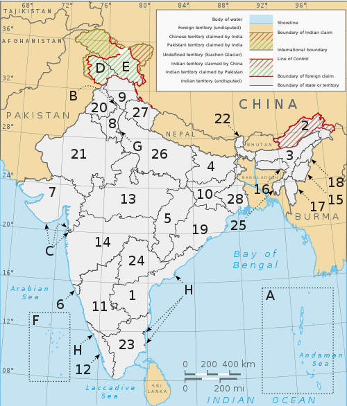
AfghanistanMyanmarChinaTajikistanIndian OceanBay of BengalAndaman SeaArabian SeaLaccadive SeaAndaman and Nicobar IslandsChandigarhDadra and Nagar Haveli and Daman and DiuDelhiLakshadweepPuducherryPuducherryGoaKeralaManipurMeghalayaMizoramNagalandSikkimTripuraPakistanNepalBhutanBangladeshSri LankaSri LankaSri LankaSri LankaSri LankaSri LankaSri LankaSri LankaSri LankaSiachen GlacierDisputed territory in Jammu and KashmirDisputed territory in Jammu and KashmirJammu and KashmirLadakhChandigarhDelhiDadra and Nagar Haveli and Daman and DiuDadra and Nagar Haveli and Daman and DiuPuducherryPuducherryPuducherryPuducherryGoaGujaratKarnatakaKeralaMadhya PradeshMaharashtraRajasthanTamil NaduAssamMeghalayaAndhra PradeshArunachal PradeshNagalandManipurMizoramTelanganaTripuraWest BengalSikkimBiharJharkhandOdishaChhattisgarhUttar PradeshUttarakhandHaryanaPunjabHimachal Pradesh
A clickable map of the 28 states and 8 union territories of India


Parameters

Parameter Description
image-width width for displayed template in pixels, defaults to 500

Example usage

{{Indian states and territories image map|image-width=250}}
Retrieved from "https://en.wikipedia.org/w/index.php?title=Template:Indian_states_and_territories_image_map&oldid=1182924148"