Snow Hill, Maryland
Snow Hill, Maryland | |
|---|---|
.jpg/1280px-Snow_Hill_business_center_(2008).jpg) | |
 Location in Worcester County and Maryland | |
 Snow Hill Location in Maryland  Snow Hill Snow Hill (the United States) | |
| Coordinates: 38°10′30″N 75°23′27″W / 38.17500°N 75.39083°W / 38.17500; -75.39083 | |
| Country | |
| State | |
| County | |
| Incorporated | 1812[1] |
| Government | |
| • Mayor | Mike Pruitt |
| • Town Council | Member List |
| Area [2] | |
| • Total | 1.56 sq mi (4.04 km2) |
| • Land | 1.48 sq mi (3.83 km2) |
| • Water | 0.08 sq mi (0.21 km2) |
| Elevation | 16 ft (5 m) |
| Population (2020) | |
| • Total | 2,156 |
| • Density | 1,456.76/sq mi (562.41/km2) |
| Time zone | UTC-5 (Eastern (EST)) |
| • Summer (DST) | UTC-4 (EDT) |
| ZIP code | 21863 |
| Area code(s) | 410, 443 |
| FIPS code | 24-73075 |
| GNIS feature ID | 0587416 |
| Website | www.snowhillmd.gov |
Snow Hill is a town and the county seat of Worcester County, Maryland, United States.[3] The population was 2,103 at the 2010 census. It is part of the Salisbury, Maryland-Delaware Metropolitan Statistical Area.
History
Snow Hill was founded in 1686 in Somerset County by English settlers, who may have named it after a street and neighborhood of the City of London called "Snow Hill" despite the location's elevation of just 16 feet (4.9 m) above sea level and the infrequency of snowfall. The town received its first charter on October 26, 1686, and was made a port of entry in 1694.[citation needed]
In 1742, Worcester County was carved out of the eastern half of old Somerset County and Snow Hill, centrally located in the new county and at the head of navigation on the Pocomoke River, was made the county seat.[citation needed]
Major fires in 1844 and 1893 destroyed the center of Snow Hill, including two successive court houses, but some 18th-century structures survived both fires. Following the second fire, much of the commercial area was rapidly rebuilt, so the downtown today contains many historic buildings of the late 19th and early 20th centuries. The Snow Hill Historic District, which includes approximately 80% of the town, was created in 2002.[citation needed]
In December 2010, a Snow Hill businessman started a petition to remove the town's incorporation and revert the area to county control. The reasons given were lower county taxes, better services provided to the town, and a need for revitalization. The push was abandoned in January 2011.[4]
The All Hallows Episcopal Church, Chanceford, Old Friendship United Methodist Church, Samuel Gunn House, Makemie Memorial Presbyterian Church, James Martin House, Nassawango Iron Furnace Site, Nun's Green, George Washington Purnell House, and Gov. John Walter Smith House are listed on the National Register of Historic Places.[5]
Geography
Snow Hill is located at 38°10′30″N 75°23′27″W / 38.17500°N 75.39083°W / 38.17500; -75.39083 (38.175024, -75.390738).[6]
According to the United States Census Bureau, the town has a total area of 3.12 square miles (8.08 km2), of which 3.01 square miles (7.80 km2) is land and 0.11 square miles (0.28 km2) is water.[7]
Demographics
| Census | Pop. | Note | %± |
|---|---|---|---|
| 1850 | 714 | — | |
| 1860 | 966 | 35.3% | |
| 1870 | 960 | −0.6% | |
| 1880 | 1,276 | 32.9% | |
| 1890 | 1,483 | 16.2% | |
| 1900 | 1,596 | 7.6% | |
| 1910 | 1,844 | 15.5% | |
| 1920 | 1,684 | −8.7% | |
| 1930 | 1,604 | −4.8% | |
| 1940 | 1,926 | 20.1% | |
| 1950 | 2,091 | 8.6% | |
| 1960 | 2,311 | 10.5% | |
| 1970 | 2,201 | −4.8% | |
| 1980 | 2,192 | −0.4% | |
| 1990 | 2,217 | 1.1% | |
| 2000 | 2,409 | 8.7% | |
| 2010 | 2,103 | −12.7% | |
| 2020 | 2,156 | 2.5% | |
| U.S. Decennial Census[8] | |||
2010 census
As of the census[9] of 2010, there were 2,103 people, 871 households, and 557 families residing in the town. The population density was 698.7 inhabitants per square mile (269.8/km2). There were 1,005 housing units at an average density of 333.9 per square mile (128.9/km2). The racial makeup of the town was 57.0% White, 39.0% African American, 0.2% Native American, 1.3% Asian, 0.3% from other races, and 2.2% from two or more races. Hispanic or Latino of any race were 1.6% of the population.
There were 871 households, of which 31.3% had children under the age of 18 living with them, 36.7% were married couples living together, 21.9% had a female householder with no husband present, 5.3% had a male householder with no wife present, and 36.1% were non-families. 32.0% of all households were made up of individuals, and 16% had someone living alone who was 65 years of age or older. The average household size was 2.32 and the average family size was 2.90.
The median age in the town was 44.7 years. 23.2% of residents were under the age of 18; 7.9% were between the ages of 18 and 24; 19.3% were from 25 to 44; 29.4% were from 45 to 64; and 20.2% were 65 years of age or older. The gender makeup of the town was 45.9% male and 54.1% female.
2000 census
As of the census[10] of 2000, there were 2,409 people, 862 households, and 555 families residing in the town. The population density was 1,806.2 inhabitants per square mile (697.4/km2). There were 964 housing units at an average density of 722.8 per square mile (279.1/km2). The racial makeup of the town was 56.00% White, 42.34% African American, 0.08% Native American, 0.58% Asian, 0.04% Pacific Islander, 0.37% from other races, and 0.58% from two or more races. Hispanic or Latino of any race were 1.08% of the population.
There were 862 households, out of which 28.3% had children under the age of 18 living with them, 40.6% were married couples living together, 20.2% had a female householder with no husband present, and 35.5% were non-families. 31.4% of all households were made up of individuals, and 15.7% had someone living alone who was 65 years of age or older. The average household size was 2.37 and the average family size was 2.94.
In the town, the population was spread out, with 21.0% under the age of 18, 9.3% from 18 to 24, 29.6% from 25 to 44, 20.5% from 45 to 64, and 19.5% who were 65 years of age or older. The median age was 39 years. For every 100 females, there were 99.4 males. For every 100 females age 18 and over, there were 95.5 males.
The median income for a household in the town was $29,730, and the median income for a family was $38,657. Males had a median income of $25,439 versus $20,625 for females. The per capita income for the town was $15,560. About 14.8% of families and 15.9% of the population were below the poverty line, including 19.5% of those under age 18 and 13.1% of those age 65 or over.
Education

Snow Hill is the location of:
- Snow Hill Elementary School
- Snow Hill Middle School
- Snow Hill High School
- Cedar Chapel Special School
Religion
This section needs expansion with: Other Religions. You can help by adding to it. (June 2017) |
A number of Protestant religious denominations have churches in Snow Hill; several are listed on the National Register of Historic Places:
- All Hallows Episcopal Church
- Makemie Memorial Presbyterian Church
- Bates Memorial United Methodist Church
- Whatcoat United Methodist Church
- Ebenezer United Methodist Church
- Snow Hill Christian Church
- Liberty Church on the Rock Ministries
- Old School Baptist Church
- Mt. Zion Baptist Church
- Hutt's Memorial United Methodist Church
Notable people
This section needs additional citations for verification. (June 2017) |
- Fannie Birckhead (1935–2022), interim mayor of Snow Hill in 1998[11]
- Janeen L. Birckhead, military official serving as the adjutant general of Maryland since 2023[12]
- Arch Johnson, stage, film, and television actor died in Snow Hill in 1997.
- Judy Johnson, was a player in the Negro Baseball Leagues and later a scout in the major leagues. In 1975, Johnson was inducted into the Baseball Hall of Fame. He was born William Julius "Judy" Johnson in Snow Hill on October 26, 1900.
- Sherron Mills, professional basketball player, 1971-2016
- John Walter Smith, Congressman for Maryland 1st District, 1899–1900; 44th Governor of Maryland, 1900–1904; U.S. Senator, 1907-1919. Born in Snow Hill on Feb 5, 1845.
- Ben Tate, NFL running back, who attended Snow Hill HS during his senior year in 2006; led team to the Maryland state championship game.
- R. V. Truitt, first lacrosse coach at the University of Maryland, 1919–1927. Founder of the Chesapeake Biological Laboratory in Solomons, Maryland (1925), now part of the University of Maryland Center for Environmental Science. World renowned marine ecologist who studied blue crab and oyster.
- Ephraim King Wilson II, U.S. Senator, 1885–1891; Congressman for Maryland 1st District, 1873-1874. Born in Snow Hill on December 22, 1821.
Snow Hill in popular culture
In 1999, some scenes of the film Runaway Bride (starring Julia Roberts and Richard Gere) were shot at the Snow Hill High School. The scenes at the baseball and football games were filmed behind the school.
At the end of each episode of Adult Swim's Children Hospital is an old advertisement for The Corddry Co Snow Hill, MD. The lead actor, writer, and producer is comedian Rob Corddry, whose father is from Snow Hill. He uses the advertisement as his production banner.
See also
References
- ^ "Snow Hill". Maryland Manual. Archived from the original on July 9, 2017. Retrieved June 28, 2017.
- ^ "2020 U.S. Gazetteer Files". United States Census Bureau. Retrieved April 26, 2022.
- ^ "Find a County". National Association of Counties. Archived from the original on May 9, 2015. Retrieved June 7, 2011.
- ^ "Effort to Disincorporate Snow Hill on Hold". Archived from the original on March 6, 2012. Retrieved January 31, 2011. The same "businessman" later was elected, and then abandoned his office, as the mayor.
- ^ "National Register Information System". National Register of Historic Places. National Park Service. July 9, 2010.
- ^ "US Gazetteer files: 2010, 2000, and 1990". United States Census Bureau. February 12, 2011. Archived from the original on July 13, 2020. Retrieved April 23, 2011.
- ^ "US Gazetteer files 2010". United States Census Bureau. Archived from the original on January 25, 2012. Retrieved January 25, 2013.
- ^ "Census of Population and Housing". Census.gov. Archived from the original on March 21, 2021. Retrieved June 4, 2015.
- ^ "U.S. Census website". United States Census Bureau. Archived from the original on December 27, 1996. Retrieved January 25, 2013.
- ^ "U.S. Census website". United States Census Bureau. Archived from the original on December 27, 1996. Retrieved January 31, 2008.
- ^ Lynch, Heather (February 11, 1998). "Johnson recalled in a landside". The Daily Times. p. 1. Retrieved July 15, 2023 – via Newspapers.com.
- ^ "Birckhead Appointed Adjutant General By Governor; Snow Hill Alumna Becomes Nation's First Black Woman To Lead State Military In Country". News Ocean City Maryland Coast Dispatch Newspaper. April 11, 2023. Retrieved July 2, 2023.
External links
 Snow Hill travel guide from Wikivoyage
- Town of Snow Hill website
Places adjacent to Snow Hill, Maryland | |
|---|---|
Municipalities and communities of Worcester County, Maryland, United States | ||
|---|---|---|
County seat: Snow Hill | ||
| City | 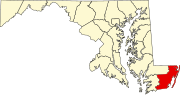 | |
| Towns |
| |
| CDPs | ||
| Other communities | ||
| Footnotes | ‡This populated place also has portions in an adjacent county or counties | |
| Counties | ||
|---|---|---|
| Principal city | ||
| Places 5k–20k | ||
| Places 1k–5k | ||

.jpg)