Sassanid Archaeological Landscape of Fars Region
| UNESCO World Heritage Site | |
|---|---|
| Location | Iran |
| Criteria | Cultural: (ii), (iii), (v) |
| Reference | 1568 |
| Inscription | 2018 (42nd Session) |
| Area | 639.3 ha (1,580 acres) |
| Buffer zone | 12,715 ha (31,420 acres) |
| Coordinates | 29°46′39″N 51°34′14″E / 29.77750°N 51.57056°E / 29.77750; 51.57056 |
Sassanid Archaeological Landscape of Fars Region (Persian: چشمانداز باستانشناسی ساسانی منطقه فارس) is the official denomination given by UNESCO to eight Sasanian-era archaeological sites situated in the southeast of Fars Province, Iran. It was recognized on 30 June 2018 as a UNESCO World Heritage Site.[1]
Sites
| Site | Image | Location |
|---|---|---|
| Qal'eh Dokhtar | 
|
Firuzabad 28°55′15″N 52°31′48″E / 28.92083°N 52.53000°E / 28.92083; 52.53000 |
| Ardashir Investiture Relief | _V1.JPG/1280px-Relief_Ardachir_Ist_(Firuzabad_II)_V1.JPG)
|
Firuzabad 28°55′00″N 52°32′15″E / 28.91667°N 52.53750°E / 28.91667; 52.53750 |
| Victory Relief of Ardashir | 
|
Firuzabad 28°54′36″N 52°32′27″E / 28.91000°N 52.54083°E / 28.91000; 52.54083 |
| Ardashir Khurreh | 
|
Firuzabad 28°51′08″N 52°31′57″E / 28.85222°N 52.53250°E / 28.85222; 52.53250 |
| Palace of Ardashir | 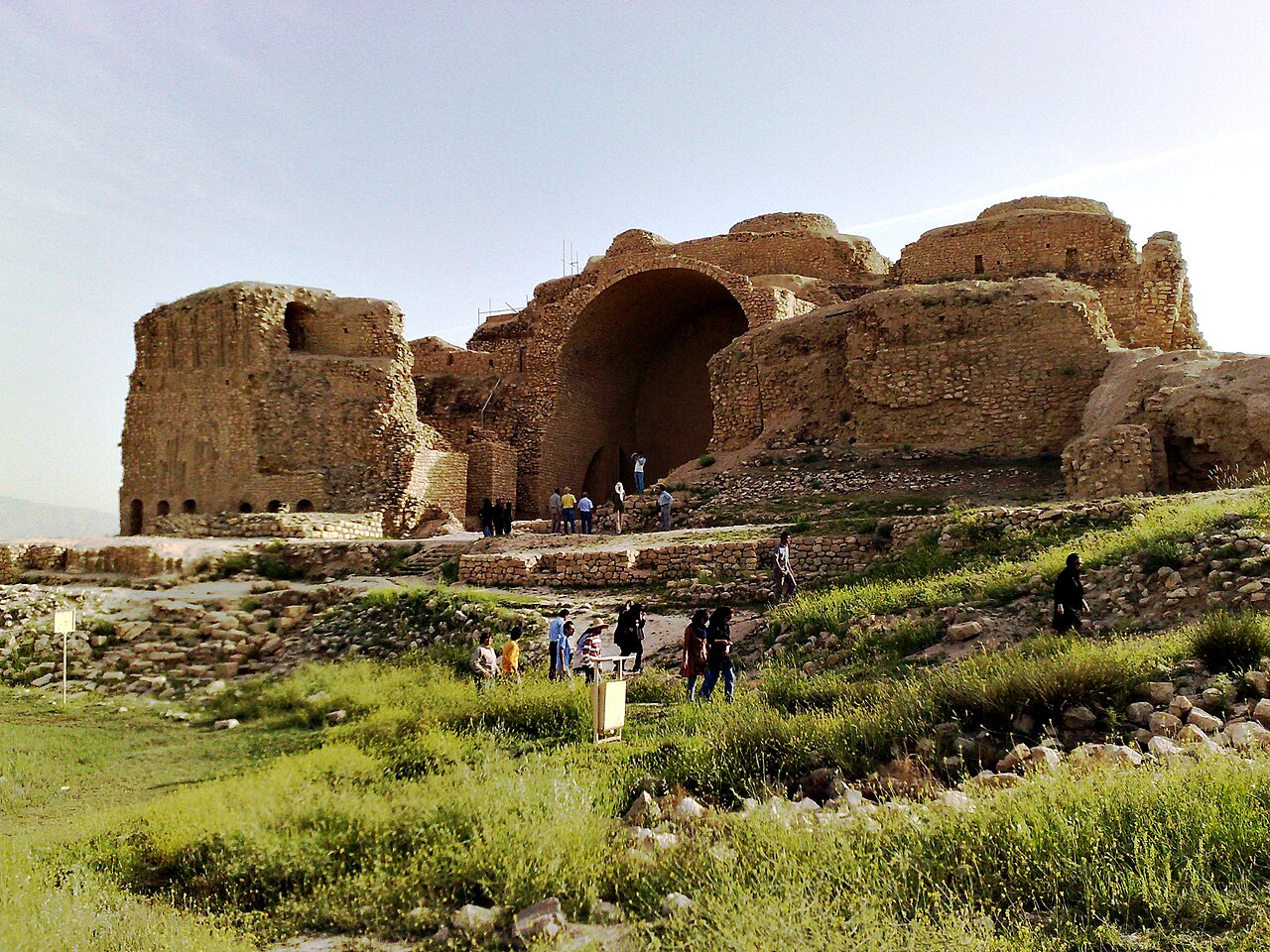
|
Firuzabad 28°53′53″N 52°32′21″E / 28.89806°N 52.53917°E / 28.89806; 52.53917 |
| City of Bishapur | _Sassanid_Period_2.jpg/1280px-Bishapur_(Iran)_Sassanid_Period_2.jpg)
|
Bishapur 29°46′39″N 51°34′14″E / 29.77750°N 51.57056°E / 29.77750; 51.57056 |
| Shapur cave | 
|
Bishapur 29°48′25″N 51°36′47″E / 29.80694°N 51.61306°E / 29.80694; 51.61306 |
| Sarvestan Palace | 
|
Sarvestan 29°11′44″N 53°13′52″E / 29.19556°N 53.23111°E / 29.19556; 53.23111 |
_V1.JPG)
_Sassanid_Period_2.jpg)
References
- ^ "Four sites added to UNESCO's World Heritage List". UNESCO. 30 June 2018. Retrieved 2 July 2018.
| Cultural |
|  |
|---|---|---|
| Natural | ||