Puka-Puka Airport
Puka Puka Airport | |||||||||||
|---|---|---|---|---|---|---|---|---|---|---|---|
| Summary | |||||||||||
| Serves | Puka-Puka | ||||||||||
| Elevation AMSL | 5 ft / 2 m | ||||||||||
| Coordinates | 14°48′33.5″S 138°48′39.2″W / 14.809306°S 138.810889°W / -14.809306; -138.810889 | ||||||||||
| Map | |||||||||||
| Runways | |||||||||||
| |||||||||||
[1] | |||||||||||
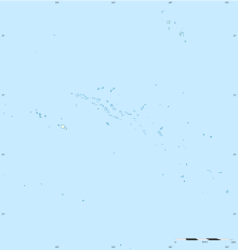
Puka-Puka Airport is an airport on Puka-Puka in French Polynesia (IATA: PKP, ICAO: NTGP). The airport is 3 km northeast of the village of Teonemahina. The airport is extremely vulnerable to climate change caused sea level rise. The airport only sits 1.5 meters in elevation above sea level, so even with low end climate model predictions, the airport is likely to be flooded.[2]
Airlines and destinations
Passenger
| Airlines | Destinations |
|---|---|
| Air Tahiti | Fakahina,[3] Fangatau,[3] Makemo, Papeete,[3] Raroia |
Statistics
References
- ^ "Puka Puka Airport". Airports Worldwide. Retrieved 13 November 2021.
- ^ Yesudian, Aaron N.; Dawson, Richard J. (2021-01-01). "Global analysis of sea level rise risk to airports". Climate Risk Management. 31: 100266. Bibcode:2021CliRM..3100266Y. doi:10.1016/j.crm.2020.100266. ISSN 2212-0963. S2CID 233747386.
- ^ a b c Liu, Jim. "Air Tahiti adds new domestic sectors in NS20". Routesonline. Retrieved 14 February 2020.
External links
- NTGP – PUKA-PUKA. AIP from French Service d'information aéronautique, effective 18 April 2024.
