Nevada is officially known as the "Silver State" because of the importance of silver to its history and economy. It is also known as the "Battle Born State" because it achieved statehood during the Civil War (the words "Battle Born" also appear on its state flag); due to the presidency of Abraham Lincoln, the Union benefited immensely from the support of newly awarded statehood by the infusion of the monetary support of nearly $400 million in silver ore generated at the time by the Comstock Lode. It is also known as the "Sagebrush State", for the native plant of the same name; and as the "Sage-hen State". The state's name means "snowy" in Spanish, referring to Nevada's small overlap with the Sierra Nevada mountain range; however, the rest of Nevada is largely desert and semi-arid, much of it within the Great Basin. Areas south of the Great Basin are within the Mojave Desert, while Lake Tahoe and the Sierra Nevada lie on the western edge. About 86% of the state's land is managed by various jurisdictions of the U.S. federal government, both civilian and military.
American Indians of the Paiute, Shoshone, and Washoe tribes inhabit what is now Nevada. The first Europeans to explore the region were Spanish. They called the region Nevada (snowy) because of the snow which covered the mountains in winter, similar to the Sierra Nevada in Spain. The area formed from mostly Alta California and part of Nuevo México's territory within the Viceroyalty of New Spain, which gained independence as Mexico in 1821. The United States annexed the area in 1848 after its victory in the Mexican–American War, and it was incorporated as part of the New Mexico and Utah Territory in 1850. The discovery of silver at the Comstock Lode in 1859 led to a population boom that became an impetus to the creation of Nevada Territory out of western Utah Territory in 1861. Nevada became the 36th state on October 31, 1864, as the second of two states added to the Union during the Civil War (the first being West Virginia). (Full article...)
PolesitterMatt Kenseth maintained his lead on the first lap to begin the race, as Greg Biffle, who started in the fourth position on the grid, remained behind him. On the 8th lap, the first caution was given because Robby Gordon spun sideways. Following the second caution, Stewart became the leader, and increased his lead to 6.5 seconds by lap 95. Late in the race, Stewart was given a penalty for speeding on pit road, giving the lead to Edwards. Edwards remained the leader to win for the second time at Las Vegas Motor Speedway. (Full article...)
Image 6Population density map of Nevada (from Nevada)
Image 7A burro-drawn wagon hauling lumber and supplies into Goldfield, Nevada, ca.1904. In 1903 only 36 people lived in the new town. By 1908 Goldfield was Nevada's largest city, with over 25,000 inhabitants. (from History of Nevada)
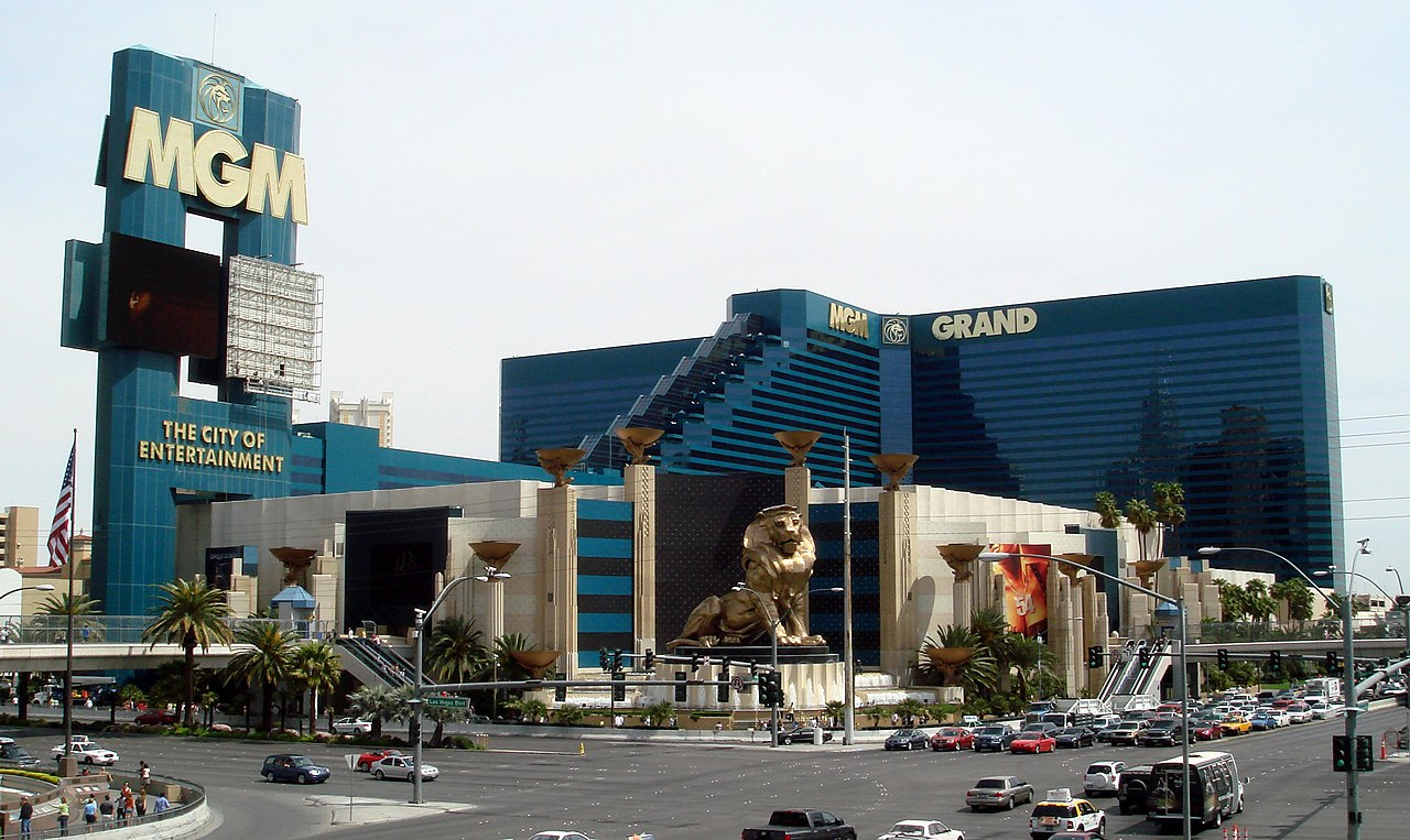
Image 8The 1931 gambling law helped enable the explosive growth of the Las Vegas area, where the population grew from five thousand in 1930 to over two million by 2013. (from History of Nevada)
Image 19Sculpture representing a steam locomotive, in Ely, Nevada. Early locomotives played an important part in Nevada's mining industry. (from Nevada)
Image 26Goldstrike (Post-Betze) Mine in the Carlin Trend, the largest Carlin-type deposit in the world, containing more than 35,000,000 troy ounces (1,100 t) gold (from Nevada)
Image 50Sculpture representing a steam locomotive, in Ely, Nevada. Early locomotives played an important part in Nevada's mining industry. (from Nevada)
Image 65The Nevada 1861 territory boundary (blue) changed three times: 1864 statehood shifted eastern border from 39th to 38th meridian, 1866 May 5; east border (pink) moved eastward 53.3 mi (85.8 km), from the 38th to 37th meridian, and 1867 January 18; south boundary (yellow) moved from the 37th parallel north southward to the current boundary (14 Stat. 43) (from History of Nevada)
Image 75U.S. Route50, also known as "The Loneliest Road in America" (from Nevada)
Image 76Goldstrike (Post-Betze) Mine in the Carlin Trend, the largest Carlin-type deposit in the world, containing more than 35,000,000 troy ounces (1,100 t) gold (from Nevada)
Image 77Majority/plurality party in each Nevada county (February 2023):
This list was generated from these rules. Questions and feedback are always welcome! The search is being run daily with the most recent ~14 days of results. Note: Some articles may not be relevant to this project.
KXZZ (edit | talk | history | links | watch | logs | tools) by Mlaffs (talk·contribs· new pages (7)) started on 2024-04-14, score: 20
The Celebration of Mimi (edit | talk | history | links | watch | logs | tools) by Daydream94 (talk ·contribs· new pages (1)) started on 2024-04-11, score: 34
Matthew Callister (edit | talk | history | links | watch | logs | tools) by Jmeservy (talk·contribs· new pages (1)) started on 2024-04-05, score: 30
UFC Fight Night 242 (edit | talk | history | links | watch | logs | tools) by AddedUpdatePoster (talk·contribs· new pages (5)) started on 2024-03-31, score: 34


.jpg/1280px-A_burro-drawn_wagon_hauling_lumber_and_supplies_into_Goldfield,_Nevada,_ca.1904_(CHS-5424).jpg)


.jpg/1280px-Downtown_Reno,_Nevada_(17573535294).jpg)


.jpg/1280px-The_Strip_from_Eiffel_Tower_(9176999807).jpg)


.jpg/1280px-Valley_of_Fire_State_Park_(6882627246).jpg)

.png)


_at_the_Bruneau_River,_about_38.6_miles_north_of_Deeth_in_Elko_County,_Nevada.jpg/1280px-2013-06-28_15_48_26_Cattle_along_Deeth-Charleston_Road_(Elko_County_Route_747)_at_the_Bruneau_River,_about_38.6_miles_north_of_Deeth_in_Elko_County,_Nevada.jpg)
.svg)


.svg)


.jpg)
.jpg)
.jpg)
.jpg)
_at_the_Bruneau_River,_about_38.6_miles_north_of_Deeth_in_Elko_County,_Nevada.jpg)
