National Register of Historic Places listings in York County, Pennsylvania

This is a list of the National Register of Historic Places listings in York County, Pennsylvania.
This is intended to be a complete list of the properties and districts on the National Register of Historic Places in York County, Pennsylvania, United States. The locations of National Register properties and districts for which the latitude and longitude coordinates are included below, may be seen in a map.[1]
There are 99 properties and districts listed on the National Register in the county.
This National Park Service list is complete through NPS recent listings posted April 12, 2024.[2]
Current listings
| [3] | Name on the Register | Image | Date listed[4] | Location | City or town | Description |
|---|---|---|---|---|---|---|
| 1 | Ashley and Bailey Company Silk Mill |  |
February 21, 1991 (#91000090) |
1237 West Princess Street 39°57′07″N 76°45′03″W / 39.951944°N 76.750833°W / 39.951944; -76.750833 (Ashley and Bailey Company Silk Mill) | West York | Mixed-income apartment building. Currently occupied and in serious need of exterior repair |
| 2 | Ashton-Hursh House |  |
November 15, 2003 (#03001155) |
204 Limekiln Road, south of New Cumberland 40°12′54″N 76°52′23″W / 40.215°N 76.873°W / 40.215; -76.873 (Ashton-Hursh House) | Fairview Township | |
| 3 | Henry and Elizabeth Berkheimer Farm |  |
November 15, 2000 (#00001382) |
240 Bentz Mill Road 40°02′26″N 77°00′50″W / 40.040556°N 77.013889°W / 40.040556; -77.013889 (Henry and Elizabeth Berkheimer Farm) | Washington Township | |
| 4 | Billmeyer House |  |
November 10, 1970 (#70000557) |
East Market Street 39°57′51″N 76°43′23″W / 39.964167°N 76.723056°W / 39.964167; -76.723056 (Billmeyer House) | York | |
| 5 | Michael and Magdealena Bixler Farmstead |  |
July 27, 2000 (#00000850) |
400 Mundis Race Road 40°01′15″N 76°42′16″W / 40.020833°N 76.704444°W / 40.020833; -76.704444 (Michael and Magdealena Bixler Farmstead) | East Manchester Township | |
| 6 | Barnett Bobb House |  |
October 29, 1975 (#75001682) |
Rear of 157 West Market Street 39°57′43″N 76°43′54″W / 39.961944°N 76.731667°W / 39.961944; -76.731667 (Barnett Bobb House) | York | |
| 7 | Bridge 182+42, Northern Central Railway |  |
May 4, 1995 (#95000542) |
Northern Central railroad tracks over Pennsylvania Route 616 and Codorus Creek, south of Glen Rock 39°46′39″N 76°43′25″W / 39.7775°N 76.723611°W / 39.7775; -76.723611 (Bridge 182+42, Northern Central Railway) | Shrewsbury Township | |
| 8 | Bridge 5+92, Northern Central Railway |  |
May 4, 1995 (#95000548) |
Northern Central railroad tracks over South Main Street, north of Pennsylvania Route 214 39°51′15″N 76°46′18″W / 39.854167°N 76.771667°W / 39.854167; -76.771667 (Bridge 5+92, Northern Central Railway) | Seven Valleys | |
| 9 | Bridge 634, Northern Central Railway |  |
May 4, 1995 (#95000543) |
Northern Central Railroad tracks over an Pleasent Valley Rd. and Codorus Creek, northwest of Railroad 39°46′23″N 76°43′14″W / 39.773056°N 76.720556°W / 39.773056; -76.720556 (Bridge 634, Northern Central Railway) | Shrewsbury Township | |
| 10 | Bridge between East Manchester and Newberry Townships |  |
June 22, 1988 (#88000795) |
York-Haven Rd. (State Route 181) over Conewago Creek 40°04′53″N 76°43′03″W / 40.081389°N 76.7175°W / 40.081389; -76.7175 (Bridge between East Manchester and Newberry Townships) | East Manchester and Newberry Townships | |
| 11 | Bridge in Washington Township |  |
June 22, 1988 (#88000817) |
Legislative Route 66150 over Bermudian Creek, south of Kralltown 40°00′31″N 76°58′29″W / 40.008611°N 76.974722°W / 40.008611; -76.974722 (Bridge in Washington Township) | Washington Township | Demolished c.2011 |
| 12 | S. B. Brodbeck Housing |  |
September 6, 1990 (#90001413) |
Main Street in Brodbecks 39°46′13″N 76°49′39″W / 39.770278°N 76.8275°W / 39.770278; -76.8275 (S. B. Brodbeck Housing) | Codorus Township | |
| 13 | Burgholtshouse |  |
June 22, 1979 (#79002369) |
South of East Prospect on Pennsylvania Route 124 39°57′57″N 76°30′54″W / 39.965833°N 76.515°W / 39.965833; -76.515 (Burgholtshouse) | Lower Windsor Township | |
| 14 | Chestnut Hill |  |
September 1, 2001 (#01000952) |
1105 Windsor Road 39°56′22″N 76°37′01″W / 39.939444°N 76.616944°W / 39.939444; -76.616944 (Chestnut Hill) | Windsor Township | |
| 15 | Clear Spring Mill |  |
November 4, 1996 (#96001199) |
Western corner of the junction of Capitol Hill and Clear Spring Roads, south of Dillsburg 40°03′25″N 77°03′53″W / 40.056944°N 77.064722°W / 40.056944; -77.064722 (Clear Spring Mill) | Franklin Township | |
| 16 | Codorus Forge and Furnace Historic District |  |
September 6, 1991 (#91001132) |
Junction of River Farm and Furnace Roads, southeast of Saginaw 40°03′05″N 76°39′26″W / 40.051389°N 76.657222°W / 40.051389; -76.657222 (Codorus Forge and Furnace Historic District) | Hellam Township | |
| 17 | Consumers Cigar Box Company |  |
September 24, 1999 (#99001196) |
121 First Avenue 39°53′48″N 76°36′21″W / 39.896667°N 76.605833°W / 39.896667; -76.605833 (Consumers Cigar Box Company) | Red Lion | Factory building converted to apartments |
| 18 | Cookes House |  |
October 5, 1972 (#72001182) |
438-440 Cookes House Lane 39°57′18″N 76°44′09″W / 39.955°N 76.73575°W / 39.955; -76.73575 (Cookes House) | York | |
| 19 | Coulsontown Cottages Historic District |  |
January 31, 1985 (#85000175) |
Ridge Road and Main, east of Delta 39°43′29″N 76°18′28″W / 39.724722°N 76.307667°W / 39.724722; -76.307667 (Coulsontown Cottages Historic District) | Peach Bottom Township | |
| 20 | Deer Creek Bridge, Stewartstown Railroad |  |
May 4, 1995 (#95000544) |
Stewartstown Railroad tracks over Deer Creek at Deer Creek Road, east of Shrewsbury 39°45′30″N 76°38′55″W / 39.758333°N 76.648611°W / 39.758333; -76.648611 (Deer Creek Bridge, Stewartstown Railroad) | Hopewell and Shrewsbury Townships | |
| 21 | Delta Historic District |  |
September 15, 1983 (#83002288) |
Main Street 39°43′27″N 76°19′53″W / 39.724167°N 76.331389°W / 39.724167; -76.331389 (Delta Historic District) | Delta | |
| 22 | Delta Trestle Bridge, Maryland and Pennsylvania Railroad |  |
May 4, 1995 (#95000550) |
Maryland and Pennsylvania Railroad tracks over an unnamed stream, east of Bunker Hill Road, north of Delta 39°43′44″N 76°19′49″W / 39.728889°N 76.330278°W / 39.728889; -76.330278 (Delta Trestle Bridge, Maryland and Pennsylvania Railroad) | Peach Bottom Township | |
| 23 | Diamond Silk Mill |  |
July 24, 1992 (#92000949) |
Junction of Ridge Avenue and Hay Street in East York 39°58′35″N 76°42′00″W / 39.976389°N 76.7°W / 39.976389; -76.7 (Diamond Silk Mill) | Springettsbury Township | |
| 24 | Dill's Tavern |  |
March 18, 2004 (#04000195) |
227 North Baltimore Street 40°06′55″N 77°02′14″W / 40.115278°N 77.037222°W / 40.115278; -77.037222 (Dill's Tavern) | Dillsburg | |
| 25 | Dritt Mansion |  |
August 16, 1977 (#77001206) |
3.5 miles (5.6 km) south of Wrightsville on Pennsylvania Route 624 39°58′39″N 76°29′48″W / 39.9775°N 76.496667°W / 39.9775; -76.496667 (Dritt Mansion) | Lower Windsor Township | |
| 26 | East York Historic District |  |
March 12, 1999 (#99000326) |
Bounded by Oxford Street, Wallace Street, Royal Street, and Eastern Boulevard 39°58′27″N 76°41′17″W / 39.974167°N 76.688056°W / 39.974167; -76.688056 (East York Historic District) | Springettsbury Township | |
| 27 | Eichelberger High School |  |
April 27, 1995 (#95000517) |
195 Stock Street 39°48′21″N 76°59′11″W / 39.805833°N 76.986389°W / 39.805833; -76.986389 (Eichelberger High School) | Hanover | |
| 28 | Emig Mansion | 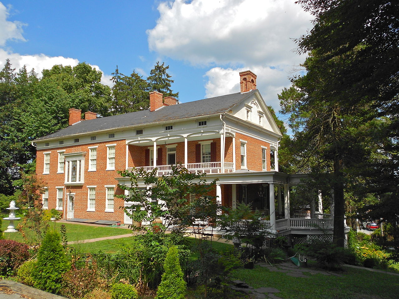 |
September 7, 1984 (#84003586) |
3342 North George Street in Emigsville 40°01′10″N 76°43′42″W / 40.019444°N 76.728472°W / 40.019444; -76.728472 (Emig Mansion) | Manchester Township | |
| 29 | Etters Bridge |  |
February 27, 1986 (#86000308) |
Green Lane Drive and Yellow Breeches Creek 40°13′26″N 76°53′51″W / 40.223889°N 76.8975°W / 40.223889; -76.8975 (Etters Bridge) | Fairview Township | Extends into Cumberland County |
| 30 | Fairmount Historic District |  |
November 30, 1999 (#99001428) |
Roughly bounded by Cherry Lane, Stevens Avenue, and Cottage Hill Road 39°58′03″N 76°43′59″W / 39.9675°N 76.733056°W / 39.9675; -76.733056 (Fairmount Historic District) | York | |
| 31 | Farmers Market |  |
November 25, 1977 (#77001207) |
380 West Market Street 39°57′33″N 76°44′13″W / 39.959167°N 76.736944°W / 39.959167; -76.736944 (Farmers Market) | York | |
| 32 | Fissel's School |  |
October 24, 1997 (#97001253) |
Junction of Fissel's Church Road and Country Club Road 39°46′05″N 76°44′00″W / 39.768056°N 76.733333°W / 39.768056; -76.733333 (Fissel's School) | Shrewsbury Township | |
| 33 | Forry House |  |
December 27, 1977 (#77001208) |
149 North Newberry Street 39°57′46″N 76°44′09″W / 39.962778°N 76.735833°W / 39.962778; -76.735833 (Forry House) | York | |
| 34 | Gen. Horatio Gates House |  |
December 6, 1971 (#71000737) |
157-159 West Market Street 39°57′43″N 76°43′47″W / 39.961944°N 76.729722°W / 39.961944; -76.729722 (Gen. Horatio Gates House) | York | |
| 35 | Gilbert Bridge |  |
May 5, 1989 (#89000355) |
Bishop Road / Gilbert Road over Yellow Breeches Creek, northwest of Siddonsburg 40°09′13″N 76°58′52″W / 40.153583°N 76.981111°W / 40.153583; -76.981111 (Gilbert Bridge) | Monaghan Township | Extends into Upper Allen Township in Cumberland County |
| 36 | Glen Rock Historic District |  |
May 30, 1997 (#97000518) |
Roughly bounded by Glenvue Road and Hanover, Manchester, Valley, Church, and Center Streets 39°47′34″N 76°43′58″W / 39.792778°N 76.732778°W / 39.792778; -76.732778 (Glen Rock Historic District) | Glen Rock | |
| 37 | Goldsboro Historic District |  |
June 14, 1984 (#84003589) |
Roughly bounded by North, 3rd, Fraser, and Railroad Streets 40°09′11″N 76°45′02″W / 40.153056°N 76.750556°W / 40.153056; -76.750556 (Goldsboro Historic District) | Goldsboro | |
| 38 | Guinston United Presbyterian Church |  |
January 11, 1976 (#76001682) |
East of Laurel off Pennsylvania Route 74 (14130 Guinston Forge Road) 39°50′04″N 76°29′30″W / 39.834444°N 76.491667°W / 39.834444; -76.491667 (Guinston United Presbyterian Church) | Chanceford Township | |
| 39 | Hammersly-Strominger House |  |
December 20, 1978 (#78002487) |
Northeast of Lewisberry on Pennsylvania Route 177 40°08′37″N 76°51′01″W / 40.143611°N 76.850278°W / 40.143611; -76.850278 (Hammersly-Strominger House) | Newberry Township | |
| 40 | Hanover Historic District |  |
January 2, 1997 (#96001552) |
Roughly bounded by Elm Avenue, Broadway, Eisenhower Drive, Hollywood Avenue, and the Hanover borough boundary line 39°48′23″N 76°58′58″W / 39.806389°N 76.982778°W / 39.806389; -76.982778 (Hanover Historic District) | Hanover | |
| 41 | Hanover Junction Railroad Station |  |
December 29, 1983 (#83004258) |
Pennsylvania Route 616 at Hanover Junction 39°50′37″N 76°46′38″W / 39.843611°N 76.777222°W / 39.843611; -76.777222 (Hanover Junction Railroad Station) | [[
This page is a redirect. The following categories are used to track and monitor this redirect: From a page move: This is a redirect from a page that has been moved (renamed). This page was kept as a redirect to avoid breaking links, both internal and external, that may have been made to the old page name. When appropriate, protection levels are automatically sensed, described and categorized. Categories (++): (+) Navigation menu Ebbedlila Alerts (0) Notices (6) Talk Sandbox Preferences Beta Light mode Watchlist Contributions Log out ArticleTalk Watch More TW Search Search Wikipedia Main page Contents Current events Random article About Wikipedia Contact us Donate Contribute Help Learn to edit Community portal Recent changes Upload file Tools What links here Related changes Special pages Permanent link Page information Cite this page Get shortened URL Print/export Download as PDF Printable version Languages Add links This page was last edited on 18 September 2023, at 10:28. Text is available under the Creative Commons Attribution-ShareAlike License 4.0; additional terms may apply. By using this site, you agree to the Terms of Use and Privacy Policy. Wikipedia® is a registered trademark of the Wikimedia Foundation, Inc., a non-profit organization. Privacy policyAbout WikipediaDisclaimersContact WikipediaCode of ConductDevelopersStatisticsCookie statementMobile viewWikimedia FoundationPowered by MediaWiki North Codorus Township is a township in York County, Pennsylvania, United States. The population was 9,149 at the 202|North Codorus Township]] |
|
| 42 | Howard Tunnel, Northern Central Railway |  |
May 19, 1995 (#95000541) |
Northern Central railroad tracks near the South Branch of Codorus Creek, southeast of New Salem 39°53′28″N 76°45′02″W / 39.891111°N 76.750556°W / 39.891111; -76.750556 (Howard Tunnel, Northern Central Railway) | [[
This page is a redirect. The following categories are used to track and monitor this redirect: From a page move: This is a redirect from a page that has been moved (renamed). This page was kept as a redirect to avoid breaking links, both internal and external, that may have been made to the old page name. When appropriate, protection levels are automatically sensed, described and categorized. Categories (++): (+) Navigation menu Ebbedlila Alerts (0) Notices (6) Talk Sandbox Preferences Beta Light mode Watchlist Contributions Log out ArticleTalk Watch More TW Search Search Wikipedia Main page Contents Current events Random article About Wikipedia Contact us Donate Contribute Help Learn to edit Community portal Recent changes Upload file Tools What links here Related changes Special pages Permanent link Page information Cite this page Get shortened URL Print/export Download as PDF Printable version Languages Add links This page was last edited on 18 September 2023, at 10:28. Text is available under the Creative Commons Attribution-ShareAlike License 4.0; additional terms may apply. By using this site, you agree to the Terms of Use and Privacy Policy. Wikipedia® is a registered trademark of the Wikimedia Foundation, Inc., a non-profit organization. Privacy policyAbout WikipediaDisclaimersContact WikipediaCode of ConductDevelopersStatisticsCookie statementMobile viewWikimedia FoundationPowered by MediaWiki North Codorus Township is a township in York County, Pennsylvania, United States. The population was 9,149 at the 202|North Codorus Township]] |
|
| 43 | Hyson Schools Historic District | January 30, 2023 (#100008595) |
Round Hill Church Rd., south of intersection with Hyson School Rd. 39°47′25″N 76°34′29″W / 39.7903°N 76.5748°W / 39.7903; -76.5748 (Hyson Schools Historic District) | East Hopewell Township | ||
| 44 | Indian Steps Cabin |  |
March 9, 1990 (#90000416) |
Indian Steps Road, north of Airville 39°51′48″N 76°22′33″W / 39.863333°N 76.375833°W / 39.863333; -76.375833 (Indian Steps Cabin) | Lower Chanceford Township | |
| 45 | Kise Mill Bridge |  |
June 22, 1988 (#88000799) |
Legislative Route 66003 over Bennett Run, east of Lewisberry 40°06′56″N 76°48′38″W / 40.115556°N 76.810556°W / 40.115556; -76.810556 (Kise Mill Bridge) | Newberry Township | |
| 46 | Kise Mill Bridge Historic District |  |
October 15, 1980 (#80003650) |
Junction of Kise Mill and Roxberry Roads, east of Lewisberry[5] 40°07′00″N 76°48′36″W / 40.116528°N 76.809972°W / 40.116528; -76.809972 (Kise Mill Bridge Historic District) | Newberry Township | |
| 47 | Laurel-Rex Fire Company House |  |
October 8, 1976 (#76001683) |
South Duke Street 39°57′42″N 76°43′31″W / 39.961667°N 76.725278°W / 39.961667; -76.725278 (Laurel-Rex Fire Company House) | York | |
| 48 | Byrd Leibhart Site (36YO170) |  |
January 14, 2009 (#84003955) |
Native Lands County Park[6] 39°58′41″N 76°29′54″W / 39.978167°N 76.498333°W / 39.978167; -76.498333 (Byrd Leibhart Site (36YO170)) | Lower Windsor Township | |
| 49 | Oscar Leibhart Site (36YO9) | May 24, 1984 (#84003597) |
Along the Susquehanna River, south of Trinity Church Road and west of Long Level Road[7] 39°59′20″N 76°30′01″W / 39.989000°N 76.500278°W / 39.989000; -76.500278 (Oscar Leibhart Site (36YO9)) | Lower Windsor Township | ||
| 50 | McCalls Ferry Farm |  |
November 8, 2000 (#00001344) |
447 McCalls Ferry Road 39°49′30″N 76°21′22″W / 39.825°N 76.356111°W / 39.825; -76.356111 (McCalls Ferry Farm) | Lower Chanceford Township | |
| 51 | Englehart Melchinger House | _Dover_PA.JPG/1280px-Englehart_Melchinger_House_from_SE_(rear)_Dover_PA.JPG) |
August 12, 1992 (#92000990) |
5 North Main Street 40°00′06″N 76°51′03″W / 40.001667°N 76.850833°W / 40.001667; -76.850833 (Englehart Melchinger House) | Dover | |
| 52 | Merchants Cigar Box Company | December 2, 2021 (#100007193) |
100 East Broad St. 39°54′07″N 76°38′15″W / 39.9019°N 76.6375°W / 39.9019; -76.6375 (Merchants Cigar Box Company) | Dallastown | ||
| 53 | Muddy Creek Bridge, Maryland and Pennsylvania Railroad | May 4, 1995 (#95000540) |
Maryland and Pennsylvania railroad tracks over Muddy Creek, east of Creek Ridge Road, south of Sunnyburn 39°45′37″N 76°21′05″W / 39.760278°N 76.351389°W / 39.760278; -76.351389 (Muddy Creek Bridge, Maryland and Pennsylvania Railroad) | Lower Chanceford and Peach Bottom Townships | ||
| 54 | Muddy Creek Forks Historic District |  |
April 29, 1994 (#94000397) |
Junction of Muddy Creek Forks and New Park Roads at Muddy Creek Forks 39°48′27″N 76°28′31″W / 39.8075°N 76.475278°W / 39.8075; -76.475278 (Muddy Creek Forks Historic District) | East Hopewell, Fawn, and Lower Chanceford Townships | |
| 55 | George Nace (Neas) House |  |
April 26, 1972 (#72001181) |
113-115 West Chestnut Street 39°48′03″N 76°59′10″W / 39.800833°N 76.986111°W / 39.800833; -76.986111 (George Nace (Neas) House) | Hanover | |
| 56 | New Freedom Railroad Station, Northern Central Railway |  |
May 4, 1995 (#95000539) |
Front Street 39°44′24″N 76°42′04″W / 39.74°N 76.701111°W / 39.74; -76.701111 (New Freedom Railroad Station, Northern Central Railway) | New Freedom | |
| 57 | The Nook |  |
March 1, 1982 (#82003821) |
1101 Farquhar Drive, south of York 39°56′44″N 76°43′27″W / 39.945556°N 76.724167°W / 39.945556; -76.724167 (The Nook) | Spring Garden Township | |
| 58 | Northwest York Historic District |  |
September 12, 1983 (#83002289) |
Roughly bounded by Carlisle, Texas, Pennsylvania, Newberry, Park, and Linden Avenues 39°57′42″N 76°44′54″W / 39.961667°N 76.748333°W / 39.961667; -76.748333 (Northwest York Historic District) | York | |
| 59 | Old Columbia-Wrightsville Bridge |  |
June 22, 1988 (#88000764) |
Legislative Route 128 over the Susquehanna River and a railroad line 40°01′50″N 76°30′41″W / 40.030556°N 76.511389°W / 40.030556; -76.511389 (Old Columbia-Wrightsville Bridge) | Wrightsville | Extends into Lancaster County |
| 60 | Payne's Folly |  |
March 6, 1986 (#86000422) |
Watters Road 39°43′32″N 76°30′06″W / 39.725556°N 76.501667°W / 39.725556; -76.501667 (Payne's Folly) | Fawn Township | |
| 61 | Pettit's Ford |  |
May 3, 1983 (#83002290) |
4400 Colonial Road, west of Dover 39°59′17″N 76°55′50″W / 39.988167°N 76.930639°W / 39.988167; -76.930639 (Pettit's Ford) | Dover Township | |
| 62 | Pierceville Run Agricultural Historic District |  |
February 1, 2013 (#12000902) |
Roughly bounded by Fair School, Myers, Meckley, Rockville, & Narrow Gauge Rds., & Pierceville Run 39°46′32″N 76°45′51″W / 39.775429°N 76.764078°W / 39.775429; -76.764078 (Pierceville Run Agricultural Historic District) | Codorus Township | |
| 63 | Pleasureville Historic District |  |
February 18, 2000 (#00000057) |
Roughly along North Sherman Street between Cherry Lane and Park View Road in Springettsbury 40°00′09″N 76°42′17″W / 40.0025°N 76.704722°W / 40.0025; -76.704722 (Pleasureville Historic District) | Springettsbury Township | |
| 64 | Rev. Anderson B. Quay House |  |
October 24, 1997 (#97001255) |
22 North Baltimore Street 40°06′41″N 77°02′09″W / 40.111389°N 77.035833°W / 40.111389; -77.035833 (Rev. Anderson B. Quay House) | Dillsburg | |
| 65 | Railroad Borough Historic District |  |
March 22, 1984 (#84003601) |
Shaub Road North, East, and South Main Street 39°45′37″N 76°41′54″W / 39.760278°N 76.698333°W / 39.760278; -76.698333 (Railroad Borough Historic District) | Railroad | |
| 66 | Red Lion Borough Historic District |  |
August 10, 2000 (#00000847) |
Roughly bounded by Edgewood Avenue, the Windsor Township line, a Maryland and Pennsylvania line, Chestnut Road, Country Club Road, and the York Township line 39°53′55″N 76°36′35″W / 39.898611°N 76.609722°W / 39.898611; -76.609722 (Red Lion Borough Historic District) | Red Lion | |
| 67 | Ridge Road Bridge, Stewartstown Railroad |  |
May 4, 1995 (#95000545) |
Stewartstown Railroad tracks over Ridge Road, west of Stewartstown 39°45′35″N 76°37′33″W / 39.759722°N 76.625833°W / 39.759722; -76.625833 (Ridge Road Bridge, Stewartstown Railroad) | Hopewell Township | |
| 68 | Martin Schultz House |  |
March 11, 1993 (#93000057) |
155 Emig Street 40°00′02″N 76°36′33″W / 40.000556°N 76.609167°W / 40.000556; -76.609167 (Martin Schultz House) | Hallam | |
| 69 | Scott Creek Bridge-North, Maryland and Pennsylvania Railroad |  |
May 4, 1995 (#95000551) |
Maryland and Pennsylvania railroad tracks over Scott Creek, west of Watson's Corner and south of Pennsylvania Route 851 39°44′46″N 76°20′29″W / 39.746111°N 76.341389°W / 39.746111; -76.341389 (Scott Creek Bridge-North, Maryland and Pennsylvania Railroad) | Peach Bottom Township | |
| 70 | William Shelly School and Annex |  |
May 2, 2001 (#01000464) |
201 North Adams Street 39°57′22″N 76°45′40″W / 39.9562°N 76.7610°W / 39.9562; -76.7610 (William Shelly School and Annex) | West York | |
| 71 | Shrewsbury Historic District |  |
March 22, 1984 (#84003605) |
Roughly bounded by Highland and Sunset Drives, Park Avenue, and Church and Pine Streets 39°46′03″N 76°40′49″W / 39.7675°N 76.680278°W / 39.7675; -76.680278 (Shrewsbury Historic District) | Shrewsbury | |
| 72 | Shrewsbury Railroad Station, Stewartstown Railroad |  |
May 4, 1995 (#95000546) |
South Main Street at the Stewartstown Railroad tracks 39°45′26″N 76°40′41″W / 39.757222°N 76.678056°W / 39.757222; -76.678056 (Shrewsbury Railroad Station, Stewartstown Railroad) | Shrewsbury | |
| 73 | Sinking Springs Farms |  |
July 27, 2000 (#00000848) |
Roughly bounded by Church Road, Sinking Springs Ln., North George Street, Locust Lane, the Susquehanna Trail, and Pennsylvania Route 238 40°00′37″N 76°44′33″W / 40.010278°N 76.7425°W / 40.010278; -76.7425 (Sinking Springs Farms) | Manchester Township | |
| 74 | South Road Bridge, Northern Central Railway |  |
May 4, 1995 (#95000549) |
Former Northern Central railroad tracks over an unnamed creek at the South Branch of the Codorus Creek, at Larue 39°49′14″N 76°45′39″W / 39.820556°N 76.760833°W / 39.820556; -76.760833 (South Road Bridge, Northern Central Railway) | Springfield Township | |
| 75 | Spring Grove Borough Historic District |  |
May 25, 1984 (#84003608) |
Roughly bounded by College Avenue and Jackson, Water, East, and Church Streets 39°52′25″N 76°51′55″W / 39.873611°N 76.865278°W / 39.873611; -76.865278 (Spring Grove Borough Historic District) | Spring Grove | |
| 76 | Springdale Historic District |  |
August 30, 2001 (#01000926) |
Bounded by South George Street, Lombardy Alley, South Queen Street, and Rathon Road 39°56′58″N 76°43′04″W / 39.949444°N 76.717778°W / 39.949444; -76.717778 (Springdale Historic District) | York | |
| 77 | Stevens School |  |
December 29, 1983 (#83004263) |
606 West Philadelphia Street 39°57′31″N 76°44′40″W / 39.958611°N 76.744444°W / 39.958611; -76.744444 (Stevens School) | York | |
| 78 | Stewartstown Engine House, Stewartstown Railroad |  |
May 4, 1995 (#95000554) |
North Hill Street 39°45′16″N 76°35′47″W / 39.754444°N 76.596389°W / 39.754444; -76.596389 (Stewartstown Engine House, Stewartstown Railroad) | Stewartstown | |
| 79 | Stewartstown Railroad Station |  |
May 18, 1995 (#95000553) |
Junction of West Pennsylvania Avenue and Hill Street 39°45′15″N 76°35′43″W / 39.754167°N 76.595278°W / 39.754167; -76.595278 (Stewartstown Railroad Station) | Stewartstown | |
| 80 | Stone Arch Road Bridge, Stewartstown Railroad |  |
May 4, 1995 (#95000547) |
Stewartstown Railroad tracks over Stone Arch Road, east of Railroad 39°45′01″N 76°41′14″W / 39.750278°N 76.687222°W / 39.750278; -76.687222 (Stone Arch Road Bridge, Stewartstown Railroad) | Shrewsbury Township | |
| 81 | Samuel Stoner Homestead |  |
January 30, 1976 (#76001684) |
South of York off Pennsylvania Route 182 39°55′25″N 76°45′48″W / 39.923611°N 76.763333°W / 39.923611; -76.763333 (Samuel Stoner Homestead) | West Manchester Township | |
| 82 | Strickler Family Farmhouse |  |
February 21, 1991 (#91000093) |
1205 Williams Road, east of York 39°59′16″N 76°39′33″W / 39.987778°N 76.659167°W / 39.987778; -76.659167 (Strickler Family Farmhouse) | Springettsbury Township | |
| 83 | Swigart's Mill |  |
July 23, 1980 (#80003649) |
North of Hanover on Berlin Road 39°56′04″N 76°58′18″W / 39.934583°N 76.971667°W / 39.934583; -76.971667 (Swigart's Mill) | Paradise Township | |
| 84 | United Cigar Manufacturing Company |  |
October 28, 1999 (#99001289) |
201 North Penn Street 39°57′45″N 76°44′19″W / 39.9625°N 76.738611°W / 39.9625; -76.738611 (United Cigar Manufacturing Company) | York | |
| 85 | US Post Office-Hanover |  |
December 24, 1992 (#92001719) |
141 Broadway 39°48′07″N 76°58′56″W / 39.801944°N 76.982222°W / 39.801944; -76.982222 (US Post Office-Hanover) | Hanover | |
| 86 | Valley Road Bridge, Stewartstown Railroad |  |
May 4, 1995 (#95000552) |
Stewartstown Railroad tracks over Valley Road, west of Stewartstown 39°45′19″N 76°36′35″W / 39.755278°N 76.609722°W / 39.755278; -76.609722 (Valley Road Bridge, Stewartstown Railroad) | Hopewell Township | |
| 87 | Wallace-Cross Mill |  |
December 22, 1977 (#77001204) |
South of Felton 39°47′58″N 76°32′27″W / 39.799444°N 76.540833°W / 39.799444; -76.540833 (Wallace-Cross Mill) | East Hopewell Township | |
| 88 | Warrington Meetinghouse |  |
February 20, 1975 (#75001681) |
Pennsylvania Route 74, east of Wellsville 40°03′11″N 76°55′49″W / 40.053056°N 76.930278°W / 40.053056; -76.930278 (Warrington Meetinghouse) | Warrington Township | |
| 89 | Wellsville Historic District |  |
December 6, 1977 (#77001205) |
Pennsylvania Route 74 40°03′04″N 76°56′26″W / 40.051111°N 76.940556°W / 40.051111; -76.940556 (Wellsville Historic District) | Wellsville | |
| 90 | West Side Sanitarium |  |
May 5, 2004 (#04000400) |
1253-1261 West Market Street 39°57′14″N 76°45′24″W / 39.953889°N 76.756667°W / 39.953889; -76.756667 (West Side Sanitarium) | West York | |
| 91 | Hugh and Elizabeth Ross Whiteford House |  |
September 21, 2018 (#100002988) |
306 Broad St. 39°43′51″N 76°19′21″W / 39.7307°N 76.3226°W / 39.7307; -76.3226 (Hugh and Elizabeth Ross Whiteford House) | Delta | |
| 92 | Willis House |  |
April 20, 1979 (#79002370) |
135 Willis Run Road, north of York 39°58′20″N 76°44′15″W / 39.972222°N 76.7375°W / 39.972222; -76.7375 (Willis House) | Manchester Township | |
| 93 | Wrightsville Historic District |  |
September 12, 1983 (#83002291) |
Roughly bounded by the Susquehanna River and Vine, 4th, and Willow Streets 40°01′26″N 76°31′41″W / 40.023889°N 76.528056°W / 40.023889; -76.528056 (Wrightsville Historic District) | Wrightsville | |
| 94 | York Armory |  |
April 18, 1990 (#90000421) |
369 North George Street 39°58′07″N 76°43′50″W / 39.968611°N 76.730556°W / 39.968611; -76.730556 (York Armory) | York | |
| 95 | York Central Market |  |
June 9, 1978 (#78002488) |
Philadelphia and Beaver Streets 39°57′46″N 76°43′47″W / 39.962778°N 76.729722°W / 39.962778; -76.729722 (York Central Market) | York | |
| 96 | York Dispatch Newspaper Offices |  |
March 8, 1978 (#78002489) |
15 and 17 East Philadelphia Street 39°57′50″N 76°43′41″W / 39.964°N 76.728167°W / 39.964; -76.728167 (York Dispatch Newspaper Offices) | York | |
| 97 | York Historic District |  |
August 29, 1979 (#79002371) |
Roughly bounded by railroad tracks, Hartley Street, Lilac Lane, and Cordorus Creek 39°57′30″N 76°43′34″W / 39.958333°N 76.726111°W / 39.958333; -76.726111 (York Historic District) | York | |
| 98 | York Iron Company Mine |  |
March 15, 1985 (#85000580) |
North of Green Valley Road, south of Spring Grove 39°50′29″N 76°48′35″W / 39.841389°N 76.809722°W / 39.841389; -76.809722 (York Iron Company Mine) | [[
This page is a redirect. The following categories are used to track and monitor this redirect: From a page move: This is a redirect from a page that has been moved (renamed). This page was kept as a redirect to avoid breaking links, both internal and external, that may have been made to the old page name. When appropriate, protection levels are automatically sensed, described and categorized. Categories (++): (+) Navigation menu Ebbedlila Alerts (0) Notices (6) Talk Sandbox Preferences Beta Light mode Watchlist Contributions Log out ArticleTalk Watch More TW Search Search Wikipedia Main page Contents Current events Random article About Wikipedia Contact us Donate Contribute Help Learn to edit Community portal Recent changes Upload file Tools What links here Related changes Special pages Permanent link Page information Cite this page Get shortened URL Print/export Download as PDF Printable version Languages Add links This page was last edited on 18 September 2023, at 10:28. Text is available under the Creative Commons Attribution-ShareAlike License 4.0; additional terms may apply. By using this site, you agree to the Terms of Use and Privacy Policy. Wikipedia® is a registered trademark of the Wikimedia Foundation, Inc., a non-profit organization. Privacy policyAbout WikipediaDisclaimersContact WikipediaCode of ConductDevelopersStatisticsCookie statementMobile viewWikimedia FoundationPowered by MediaWiki North Codorus Township is a township in York County, Pennsylvania, United States. The population was 9,149 at the 202|North Codorus Township]] |
|
| 99 | York Meetinghouse |  |
May 6, 1975 (#75001683) |
134 West Philadelphia Street 39°57′42″N 76°44′10″W / 39.961667°N 76.736111°W / 39.961667; -76.736111 (York Meetinghouse) | York |
See also
- List of National Historic Landmarks in Pennsylvania
- National Register of Historic Places listings in Pennsylvania
- List of Pennsylvania state historical markers in York County
References
- ^ The latitude and longitude information provided in this table was derived originally from the National Register Information System, which has been found to be fairly accurate for about 99% of listings. Some locations in this table may have been corrected to current GPS standards.
- ^ National Park Service, United States Department of the Interior, "National Register of Historic Places: Weekly List Actions", retrieved April 12, 2024.
- ^ Numbers represent an alphabetical ordering by significant words. Various colorings, defined here, differentiate National Historic Landmarks and historic districts from other NRHP buildings, structures, sites or objects.
- ^ The eight-digit number below each date is the number assigned to each location in the National Register Information System database, which can be viewed by clicking the number.
- ^ Location derived from its NRHP nomination form; the NRIS lists the site as "Address Restricted"
- ^ Location derived from this[permanent dead link] Lancaster-York Native Heritage Advisory Council document; the NRIS lists the site as "Address Restricted".
- ^ Location derived from page 13 of this[permanent dead link] Lower Windsor Township planning document and from York Daily Record. "Preserving the Oscar Leibhart site: Piece of history: $1.5M." 2007-09-21. Accessed 2009-12-19. The NRIS lists the site as "Address Restricted".


_Dover_PA.JPG)