National Register of Historic Places listings in the Central region of Texas: Bell, Coryell and Lampasas counties
This page is one of two listing the National Register of Historic Places listings in Texas's Central region.
The Central region is an area of 20 counties defined by the Texas Comptroller for economic reporting in 2022, as mapped here. The region included 2020 population of 1.3 million, or 4.3 percent of Texas's population, with Bell County having about 30 percent of Central's population.[1] Bell County, along with Coryell and Lampasas counties, is part of the Killeen–Temple–Fort Hood metropolitan area, a MSA.
This page covers Bell, Coryell, and Lampasas counties only, the three that make up the Killeen–Temple–Fort Hood metropolitan area. As of the 2020 census, the MSA had a population of 475,367. The area is sometimes called the "Centroplex", akin to the Dallas-Fort Worth metroplex.
For the other 17, please see this.
To see all locations together in a map, click on "Map all coordinates using OpenSourceMap" at right.
Bell County
1
| [2] | Name on the Register[3] | Image | Date listed[4] | Location | City or town | Description |
|---|---|---|---|---|---|---|
| 1 | Anderson House and Store |  |
April 5, 1983 (#83003076) |
Main St. 30°56′46″N 97°32′12″W / 30.946111°N 97.536667°W / 30.946111; -97.536667 (Anderson House and Store) | Salado | Recorded Texas Historic Landmark; Historic Resources of Salado MRA |
| 2 | Armstrong-Adams House |  |
April 5, 1983 (#83003077) |
Main St. and Thomas Arnold Rd. 30°56′49″N 97°32′14″W / 30.946944°N 97.537222°W / 30.946944; -97.537222 (Armstrong-Adams House) | Salado | Recorded Texas Historic Landmark; Historic Resources of Salado MRA |
| 3 | F. K. and Mary Austin House |  |
December 26, 1990 (#90001891) |
702 N. Penelope St. 31°03′44″N 97°27′35″W / 31.062222°N 97.459722°W / 31.062222; -97.459722 (F. K. and Mary Austin House) | Belton | Historic and Architectural Resources of Belton MPS |
| 4 | Ele Baggett House |  |
December 26, 1990 (#90001882) |
1019 N. Main St. 31°03′57″N 97°27′36″W / 31.065833°N 97.46°W / 31.065833; -97.46 (Ele Baggett House) | Belton | Recorded Texas Historic Landmark; Historic and Architectural Resources of Belton MPS |
| 5 | Silas and Ellen Baggett House |  |
December 26, 1990 (#90001881) |
1018 N. Main St. 31°03′58″N 97°27′38″W / 31.066111°N 97.460556°W / 31.066111; -97.460556 (Silas and Ellen Baggett House) | Belton | Historic and Architectural Resources of Belton MPS |
| 6 | George Washington Baines House |  |
April 5, 1983 (#83003078) |
316 Royal St. 30°56′31″N 97°31′59″W / 30.941944°N 97.533056°W / 30.941944; -97.533056 (George Washington Baines House) | Salado | Recorded Texas Historic Landmark; Historic Resources of Salado MRA |
| 7 | Barbee-Berry Mercantile Building |  |
August 22, 1984 (#84001571) |
Main and Royal St. 30°56′35″N 97°32′13″W / 30.943056°N 97.536944°W / 30.943056; -97.536944 (Barbee-Berry Mercantile Building) | Salado | Historic Resources of Salado MRA |
| 8 | Barclay-Bryan House |  |
May 10, 1984 (#84001572) |
804 S. 25th St. 31°05′32″N 97°21′28″W / 31.092222°N 97.357778°W / 31.092222; -97.357778 (Barclay-Bryan House) | Temple | |
| 9 | Bartlett Commercial Historic District |  |
September 30, 1980 (#80004076) |
E. Clark St. 30°47′42″N 97°25′37″W / 30.795°N 97.426944°W / 30.795; -97.426944 (Bartlett Commercial Historic District) | Bartlett | Extends into Williamson County |
| 10 | Barton House |  |
April 5, 1983 (#83003079) |
Main St. 30°56′51″N 97°32′07″W / 30.9475°N 97.535278°W / 30.9475; -97.535278 (Barton House) | Salado | Historic Resources of Salado MRA |
| 11 | Baylor Female College Historic District |  |
December 26, 1990 (#90001869) |
Bounded by King, College and W. Ninth Sts. 31°04′01″N 97°27′50″W / 31.066944°N 97.463889°W / 31.066944; -97.463889 (Baylor Female College Historic District) | Belton | Includes Recorded Texas Historic Landmark; Historic and Architectural Resources of Belton MPS |
| 12 | William Beamer House |  |
December 26, 1990 (#90001875) |
1202 S. Beal St. 31°02′41″N 97°27′52″W / 31.044722°N 97.464444°W / 31.044722; -97.464444 (William Beamer House) | Belton | Historic and Architectural Resources of Belton MPS |
| 13 | Bell County Courthouse | .jpg/1280px-BellCourthouse1_(1_of_1).jpg) |
December 12, 1976 (#76002004) |
Public Sq. 31°03′21″N 97°27′49″W / 31.055833°N 97.463611°W / 31.055833; -97.463611 (Bell County Courthouse) | Belton | State Antiquities Landmark, Recorded Texas Historic Landmark; part of Belton Commercial Historic District |
| 14 | Belton Academy | .jpg/1280px-Belton_Academy_(1_of_1).jpg) |
December 26, 1990 (#90001937) |
404 E. Ninth St. 31°03′49″N 97°27′28″W / 31.063611°N 97.457778°W / 31.063611; -97.457778 (Belton Academy) | Belton | Recorded Texas Historic Landmark; Historic and Architectural Resources of Belton MPS; also called Charles Wedemeyer House |
| 15 | Belton Commercial Historic District | .jpg/1280px-Belton_CommercialDistrict1_(1_of_1).jpg) |
December 26, 1990 (#90001868) |
Roughly bounded by Nolan Valley Rd., Penelope St. and Nolan Cr.. 31°03′23″N 97°27′45″W / 31.056389°N 97.4625°W / 31.056389; -97.4625 (Belton Commercial Historic District) | Belton | Includes State Antiquities Landmark, Recorded Texas Historic Landmarks; Historic and Architectural Resources of Belton MPS |
| 16 | Belton Farmers' Gin Coop |  |
December 26, 1990 (#90001870) |
219 S. East Ave., Building 4 31°03′18″N 97°27′45″W / 31.055°N 97.4625°W / 31.055; -97.4625 (Belton Farmers' Gin Coop) | Belton | Recorded Texas Historic Landmark; Historic and Architectural Resources of Belton MPS |
| 17 | Belton Standpipe |  |
December 26, 1990 (#90001900) |
NW of jct. of TX 317 & I-35 31°02′58″N 97°28′12″W / 31.049444°N 97.47°W / 31.049444; -97.47 (Belton Standpipe) | Belton | Historic and Architectural Resources of Belton MPS |
| 18 | Belton Yarn Mill |  |
December 26, 1990 (#90001899) |
805 E. Fourth St. 31°03′28″N 97°27′14″W / 31.0579°N 97.4539°W / 31.0579; -97.4539 (Belton Yarn Mill) | Belton | Historic and Architectural Resources of Belton MPS |
| 19 | T. Hamp and Beulah Birdwell House |  |
December 26, 1990 (#90001896) |
503 N. Wall 31°03′37″N 97°27′32″W / 31.060278°N 97.458889°W / 31.060278; -97.458889 (T. Hamp and Beulah Birdwell House) | Belton | Historic and Architectural Resources of Belton MPS |
| 20 | R. F. and Lena Burford House |  |
December 26, 1990 (#90001893) |
920 N. Penelope St. 31°03′01″N 97°27′33″W / 31.050278°N 97.459167°W / 31.050278; -97.459167 (R. F. and Lena Burford House) | Belton | Historic and Architectural Resources of Belton MPS |
| 21 | Carnegie Public Library |  |
March 4, 1985 (#85000473) |
201 N. Main St. 31°03′27″N 97°27′48″W / 31.0575°N 97.463333°W / 31.0575; -97.463333 (Carnegie Public Library) | Belton | Recorded Texas Historic Landmark; part of Belton Commercial Historic District |
| 22 | Cornelison House |  |
December 26, 1990 (#90001886) |
1102 N. Pearl St. 31°04′01″N 97°27′41″W / 31.066944°N 97.461389°W / 31.066944; -97.461389 (Cornelison House) | Belton | Historic and Architectural Resources of Belton MPS |
| 23 | Davis House | 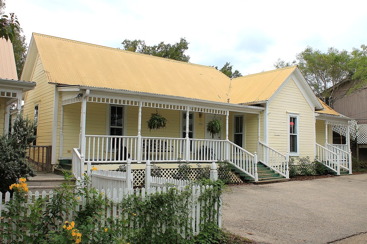 |
April 5, 1983 (#83003080) |
Main St. 30°56′41″N 97°32′11″W / 30.944722°N 97.536389°W / 30.944722; -97.536389 (Davis House) | Salado | Historic Resources of Salado MRA |
| 24 | Joel Elliott House |  |
December 26, 1990 (#90001876) |
716 N. College St. 31°03′50″N 97°27′51″W / 31.063889°N 97.464167°W / 31.063889; -97.464167 (Joel Elliott House) | Belton | Historic and Architectural Resources of Belton MPS |
| 25 | Ferguson House |  |
December 8, 1978 (#78002888) |
518 N. 7th St. 31°06′12″N 97°20′36″W / 31.103333°N 97.343472°W / 31.103333; -97.343472 (Ferguson House) | Temple | Recorded Texas Historic Landmark |
| 26 | James A. Ferguson House |  |
December 26, 1990 (#90001874) |
1123 N. Beal St. 31°03′57″N 97°27′19″W / 31.065833°N 97.455278°W / 31.065833; -97.455278 (James A. Ferguson House) | Belton | Historic and Architectural Resources of Belton MPS |
| 27 | James E. and Miriam Ferguson House |  |
December 26, 1990 (#90001889) |
604 N. Penelope St. 31°03′41″N 97°27′37″W / 31.061389°N 97.460139°W / 31.061389; -97.460139 (James E. and Miriam Ferguson House) | Belton | Historic and Architectural Resources of Belton MPS |
| 28 | First Christian Church Parsonage |  |
December 26, 1990 (#90001890) |
608 N. Penelope St. 31°03′43″N 97°27′36″W / 31.061944°N 97.46°W / 31.061944; -97.46 (First Christian Church Parsonage) | Belton | Historic and Architectural Resources of Belton MPS |
| 29 | Fowler House |  |
April 5, 1983 (#83003081) |
Main St. 30°57′30″N 97°31′58″W / 30.958333°N 97.532778°W / 30.958333; -97.532778 (Fowler House) | Salado | Recorded Texas Historic Landmark; Historic Resources of Salado MRA |
| 30 | Dr. Jacob Moore Frazier House |  |
December 26, 1990 (#90001897) |
618 N. Wall 31°03′42″N 97°27′32″W / 31.061667°N 97.458889°W / 31.061667; -97.458889 (Dr. Jacob Moore Frazier House) | Belton | Historic and Architectural Resources of Belton MPS |
| 31 | Gault Archaeological Site |  |
May 29, 2018 (#100002469) |
Address Restricted | Florence | |
| 32 | Gray Rental Houses |  |
December 26, 1990 (#90001934) |
702-708 N. Pearl St. 31°03′48″N 97°27′46″W / 31.063333°N 97.462778°W / 31.063333; -97.462778 (Gray Rental Houses) | Belton | Historic and Architectural Resources of Belton MPS |
| 33 | Capt. Robert Halley House |  |
April 5, 1983 (#83003082) |
Main St. 30°57′15″N 97°31′57″W / 30.954167°N 97.5325°W / 30.954167; -97.5325 (Capt. Robert Halley House) | Salado | Recorded Texas Historic Landmark; Historic Resources of Salado MRA |
| 34 | John P. Hammersmith House |  |
December 26, 1990 (#90001883) |
520 S. Main St. 31°03′10″N 97°27′56″W / 31.052778°N 97.465556°W / 31.052778; -97.465556 (John P. Hammersmith House) | Belton | Recorded Texas Historic Landmark; Historic and Architectural Resources of Belton MPS; also called Clark House |
| 35 | Capt. Andrew Jackson Harris House |  |
December 26, 1990 (#90001871) |
1001 W. Tenth Ave. 31°04′02″N 97°28′09″W / 31.067222°N 97.469167°W / 31.067222; -97.469167 (Capt. Andrew Jackson Harris House) | Belton | Recorded Texas Historic Landmark; Historic and Architectural Resources of Belton MPS |
| 36 | Hendrickson-Caskey House |  |
February 10, 1995 (#95000054) |
Center Circle 30°56′42″N 97°31′54″W / 30.945°N 97.531528°W / 30.945; -97.531528 (Hendrickson-Caskey House) | Salado | Historic Resources of Salado MRA |
| 37 | High View | December 29, 2020 (#100005990) |
731 Wolf St. 31°06′46″N 97°44′15″W / 31.1127°N 97.7376°W / 31.1127; -97.7376 (High View) | Killeen | ||
| 38 | House at 402 N. East St. | December 26, 1990 (#90001878) |
402 N. East St. 31°03′33″N 97°27′44″W / 31.059167°N 97.462222°W / 31.059167; -97.462222 (House at 402 N. East St.) | Belton | Historic and Architectural Resources of Belton MPS House demolished or moved | |
| 39 | House at 730 N. Beal St. |  |
December 26, 1990 (#90001936) |
730 N. Beal St. 31°03′45″N 97°27′26″W / 31.0625°N 97.457222°W / 31.0625; -97.457222 (House at 730 N. Beal St.) | Belton | Historic and Architectural Resources of Belton MPS |
| 40 | Dr. Taylor Hudson House |  |
December 26, 1990 (#90001879) |
324 N. Main St. 31°03′33″N 97°27′48″W / 31.059167°N 97.463333°W / 31.059167; -97.463333 (Dr. Taylor Hudson House) | Belton | Historic and Architectural Resources of Belton MPS |
| 41 | James House | December 26, 1990 (#90001873) |
805 N. Beal St. 31°03′48″N 97°27′22″W / 31.063333°N 97.456111°W / 31.063333; -97.456111 (James House) | Belton | Historic and Architectural Resources of Belton MPS | |
| 42 | Killeen Downtown Historic District |  |
March 31, 2014 (#14000098) |
Roughly bounded by Avenue A, Santa Fe Plaza, North 4th & North 8th Streets 31°07′19″N 97°43′38″W / 31.121839°N 97.727285°W / 31.121839; -97.727285 (Killeen Downtown Historic District) | Killeen | |
| 43 | Killeen High School |  |
May 18, 2015 (#15000244) |
101 North College Street 31°07′16″N 97°44′00″W / 31.121035°N 97.733281°W / 31.121035; -97.733281 (Killeen High School) | Killeen | Recorded Texas Historic Landmark |
| 44 | L. B. Kinchion House |  |
December 26, 1990 (#90001887) |
702 S. Pearl St. 31°03′04″N 97°27′58″W / 31.051111°N 97.466111°W / 31.051111; -97.466111 (L. B. Kinchion House) | Belton | Historic and Architectural Resources of Belton MPS |
| 45 | Kyle Hotel |  |
August 5, 1993 (#93000772) |
111 Main St. 31°05′54″N 97°20′26″W / 31.098333°N 97.340556°W / 31.098333; -97.340556 (Kyle Hotel) | Temple | Part of Temple Commercial Historic District |
| 46 | Walter J. Lee House | December 26, 1990 (#90001877) |
804 N. College St. 31°03′52″N 97°27′49″W / 31.064444°N 97.463611°W / 31.064444; -97.463611 (Walter J. Lee House) | Belton | Historic and Architectural Resources of Belton MPS House demolished or moved | |
| 47 | George and Martha McWhirter House |  |
December 26, 1990 (#90001884) |
400 N. Pearl St. 31°03′36″N 97°27′50″W / 31.06°N 97.463889°W / 31.06; -97.463889 (George and Martha McWhirter House) | Belton | Historic and Architectural Resources of Belton MPS |
| 48 | V. R. Means House |  |
December 26, 1990 (#90001938) |
609 E. 14th St. 31°04′04″N 97°27′05″W / 31.067778°N 97.451389°W / 31.067778; -97.451389 (V. R. Means House) | Belton | Historic and Architectural Resources of Belton MPS |
| 49 | J. Z. Miller House | December 26, 1990 (#90001892) |
804 N. Penelope St. 31°03′47″N 97°27′33″W / 31.063056°N 97.459167°W / 31.063056; -97.459167 (J. Z. Miller House) | Belton | Historic and Architectural Resources of Belton MPS | |
| 50 | Miller-Curtis House |  |
April 7, 1983 (#83003083) |
1004 N. Main St. 31°03′56″N 97°27′38″W / 31.065556°N 97.460694°W / 31.065556; -97.460694 (Miller-Curtis House) | Belton | Recorded Texas Historic Landmark; also called Curtis Mansion |
| 51 | Missouri, Kansas & Texas Railroad Bridge at the Leon River | December 26, 1990 (#90001898) |
Across the Leon R. at Taylor's Valley Rd. 31°03′44″N 97°26′35″W / 31.062222°N 97.443056°W / 31.062222; -97.443056 (Missouri, Kansas & Texas Railroad Bridge at the Leon River) | Belton | Historic and Architectural Resources of Belton MPS | |
| 52 | Missouri, Kansas and Texas (MK&T-Katy) Railway Passenger Depot |  |
December 26, 1990 (#100007401) |
620 Central Ave. 31°05′43″N 97°20′02″W / 31.0953°N 97.3340°W / 31.0953; -97.3340 (Missouri, Kansas and Texas (MK&T-Katy) Railway Passenger Depot) | Temple | |
| 53 | Morey House |  |
December 26, 1990 (#90001880) |
328 N. Main St. 31°03′33″N 97°27′47″W / 31.059167°N 97.463056°W / 31.059167; -97.463056 (Morey House) | Belton | Historic and Architectural Resources of Belton MPS |
| 54 | Mount Zion United Methodist Church |  |
December 26, 1990 (#90001872) |
218 Alexander St. 31°03′35″N 97°27′57″W / 31.05973°N 97.4658°W / 31.05973; -97.4658 (Mount Zion United Methodist Church) | Belton | Historic and Architectural Resources of Belton MPS |
| 55 | Robert Naismith House | December 26, 1990 (#90001888) |
440 N. Penelope St. 31°03′36″N 97°27′39″W / 31.06°N 97.460833°W / 31.06; -97.460833 (Robert Naismith House) | Belton | Historic and Architectural Resources of Belton MPS House demolished or moved | |
| 56 | Norton-Orgain House |  |
March 25, 1992 (#92000185) |
Main St. 30°56′50″N 97°32′11″W / 30.947222°N 97.536389°W / 30.947222; -97.536389 (Norton-Orgain House) | Salado | Recorded Texas Historic Landmark; Historic Resources of Salado MRA |
| 57 | Old St. Luke's Episcopal Church |  |
January 17, 1974 (#74002056) |
438 N. Wall St. 31°03′36″N 97°27′33″W / 31.06°N 97.4593°W / 31.06; -97.4593 (Old St. Luke's Episcopal Church) | Belton | |
| 58 | Arthur Potts House |  |
December 26, 1990 (#90001895) |
445 N. Wall 31°03′35″N 97°27′33″W / 31.059722°N 97.459167°W / 31.059722; -97.459167 (Arthur Potts House) | Belton | Historic and Architectural Resources of Belton MPS |
| 59 | Col. Elijah Sterling Clack Robertson Plantation |  |
April 5, 1983 (#83003084) |
I-35 30°56′32″N 97°32′34″W / 30.942222°N 97.542778°W / 30.942222; -97.542778 (Col. Elijah Sterling Clack Robertson Plantation) | Salado | Recorded Texas Historic Landmark; Historic Resources of Salado MRA |
| 60 | Maj. A. J. Rose House |  |
May 22, 1978 (#78002887) |
Wm. Rose Way and Royal St. 30°56′26″N 97°31′46″W / 30.940556°N 97.529444°W / 30.940556; -97.529444 (Maj. A. J. Rose House) | Salado | Recorded Texas Historic Landmark |
| 61 | Salado College Archeological Site |  |
March 1, 1985 (#85000403) |
Main St & College Hill 30°56′30″N 97°32′14″W / 30.941667°N 97.537222°W / 30.941667; -97.537222 (Salado College Archeological Site) | Salado | Historic Resources of Salado MRA; Smithsonian trinomial 41BL241 |
| 62 | Salado United Methodist Church |  |
August 22, 1984 (#84001573) |
Off Royal St. 30°56′30″N 97°31′44″W / 30.941667°N 97.528889°W / 30.941667; -97.528889 (Salado United Methodist Church) | Salado | Recorded Texas Historic Landmark; Historic Resources of Salado MRA; built in 1890; moved from its original location in 2005. |
| 63 | Stagecoach Inn |  |
April 5, 1983 (#83003085) October 10, 2017 boundary increase (#100001721) |
Main and Front Sts.; also 401 S. Stagecoach Rd. 30°56′31″N 97°32′15″W / 30.941944°N 97.5375°W / 30.941944; -97.5375 (Stagecoach Inn) | Salado | Recorded Texas Historic Landmark; Historic Resources of Salado MRA; second set of addresses represent a boundary increase approved October 10, 2017. |
| 64 | State Highway 53 Bridge at the Leon River |  |
October 10, 1996 (#96001119) |
FM 817, 2.5 mi (4.0 km). E of jct. with FM 93 31°03′59″N 97°26′33″W / 31.066389°N 97.4425°W / 31.066389; -97.4425 (State Highway 53 Bridge at the Leon River) | Belton | Historic Bridges of Texas, 1866-1945 MPS |
| 65 | Temple Commercial Historic District |  |
October 28, 2005 (#05001192) |
Roughly bounded by French Av., 3rd St., Av. D & 6th St. 31°05′53″N 97°20′28″W / 31.098056°N 97.341111°W / 31.098056; -97.341111 (Temple Commercial Historic District) | Temple | Includes Recorded Texas Historic Landmarks |
| 66 | Levi Tenney House |  |
April 5, 1983 (#83003086) |
Pace Park Dr. 30°56′49″N 97°32′08″W / 30.946944°N 97.535556°W / 30.946944; -97.535556 (Levi Tenney House) | Salado | Historic Resources of Salado MRA |
| 67 | Twelve Oaks | .jpg/1280px-Twelve_Oaks,_Salado,_Texas_(19_November_2008).jpg) |
April 5, 1983 (#83003088) |
Center Cirlce 30°56′45″N 97°31′55″W / 30.945833°N 97.531944°W / 30.945833; -97.531944 (Twelve Oaks) | Salado | Recorded Texas Historic Landmark; Historic Resources of Salado MRA |
| 68 | Tyler House |  |
April 5, 1983 (#83003087) |
Main St. 30°56′45″N 97°32′15″W / 30.945833°N 97.5375°W / 30.945833; -97.5375 (Tyler House) | Salado | Historic Resources of Salado MRA |
| 69 | W. J. Venable House | December 26, 1990 (#90001894) |
426 N. Wall 31°03′32″N 97°27′34″W / 31.058889°N 97.459444°W / 31.058889; -97.459444 (W. J. Venable House) | Belton | Historic and Architectural Resources of Belton MPS House demolished or moved | |
| 70 | Vickrey House |  |
April 5, 1983 (#83003089) |
Main St. 30°57′04″N 97°32′11″W / 30.951111°N 97.536389°W / 30.951111; -97.536389 (Vickrey House) | Salado | Recorded Texas Historic Landmark; Historic Resources of Salado MRA |
| 71 | H. A. and Helena Ware House | .jpg/1280px-WareHouse_(1_of_1).jpg) |
December 26, 1990 (#90001885) |
401 N. Pearl St. 31°03′35″N 97°27′48″W / 31.059722°N 97.463333°W / 31.059722; -97.463333 (H. A. and Helena Ware House) | Belton | Historic and Architectural Resources of Belton MPS |
| 72 | White-Aiken House |  |
April 5, 1983 (#83003090) |
I-35 30°57′36″N 97°31′58″W / 30.96°N 97.532778°W / 30.96; -97.532778 (White-Aiken House) | Salado | Historic Resources of Salado MRA |
| 73 | Ralph and Sunny Wilson Sr. House |  |
November 25, 1998 (#98001374) |
1714 S. 61st. St. 31°05′17″N 97°22′50″W / 31.088056°N 97.380556°W / 31.088056; -97.380556 (Ralph and Sunny Wilson Sr. House) | Temple |
.jpg)
.jpg)
.jpg)
.jpg)
.jpg)
==[[National Register of Historic Places listings in Bosque County, Texas|Bosque County]]== 2 {{:National Register of Historic Places listings in Bosque County, Texas}} ==[[National Register of Historic Places listings in Brazos County, Texas|Brazos County]]== 3 {{:National Register of Historic Places listings in Brazos County, Texas}} ==[[National Register of Historic Places listings in Burleson County, Texas|Burleson County]]== 4 {{:National Register of Historic Places listings in Burleson County, Texas}}
Coryell County
5
| [2] | Name on the Register | Image | Date listed[4] | Location | City or town | Description |
|---|---|---|---|---|---|---|
| 1 | Copperas Cove Stagestop and Post Office |  |
September 26, 1979 (#79002928) |
1.6 mi. SW of Copperas Cove off U.S. 190 31°06′15″N 97°55′44″W / 31.104167°N 97.928889°W / 31.104167; -97.928889 (Copperas Cove Stagestop and Post Office) | Copperas Cove | State Antiquities Landmark; known as Ogletree Stagestop and Post Office; built in 1878 |
| 2 | Coryell County Courthouse |  |
August 18, 1977 (#77001435) |
Bounded by 6th, 7th, Main and Leon Streets 31°26′04″N 97°45′01″W / 31.434444°N 97.750278°W / 31.434444; -97.750278 (Coryell County Courthouse) | Gatesville | State Antiquities Landmark; Italian Renaissance Revival style building completed in 1898 |
| 3 | Leon Street Bridge at the Leon River | .jpg/1280px-LeonBridge1_(1_of_1).jpg) |
February 28, 2017 (#100000694) |
Leon St. at Leon R. 31°25′58″N 97°45′42″W / 31.432842°N 97.761570°W / 31.432842; -97.761570 (Leon Street Bridge at the Leon River) | Gatesville | Recorded Texas Historic Landmark |
| 4 | Mother Neff State Park and F. A. S. 21-B(1) Historic District |  |
October 2, 1992 (#92001303) |
Jct. of TX 236 and the Leon R. 31°18′57″N 97°28′18″W / 31.315833°N 97.471667°W / 31.315833; -97.471667 (Mother Neff State Park and F. A. S. 21-B(1) Historic District) | Moody | First park in the Texas state park system; Many CCC structures in the park |
.jpg)
==[[National Register of Historic Places listings in Falls County, Texas|Falls County]]== 6 {{:National Register of Historic Places listings in Falls County, Texas}} ==[[National Register of Historic Places listings in Freestone County, Texas|Freestone County]]== 7 {{:National Register of Historic Places listings in Freestone County, Texas}} ==[[National Register of Historic Places listings in Grimes County, Texas|Grimes County]]== 8 {{:National Register of Historic Places listings in Grimes County, Texas}} ==[[National Register of Historic Places listings in Hamilton County, Texas|Hamilton County]]== 9 {{:National Register of Historic Places listings in Hamilton County, Texas}} ==[[National Register of Historic Places listings in Hill County, Texas|Hill County]]== 10 {{:National Register of Historic Places listings in Hill County, Texas}}
Lampasas County
| [2] | Name on the Register | Image | Date listed[4] | Location | City or town | Description |
|---|---|---|---|---|---|---|
| 1 | Lampasas Colored School |  |
April 24, 2002 (#02000404) |
514 College St. 31°03′53″N 98°10′23″W / 31.064796°N 98.172960°W / 31.064796; -98.172960 (Lampasas Colored School) | Lampasas | Recorded Texas Historic Landmark |
| 2 | Lampasas County Courthouse |  |
June 21, 1971 (#71000944) |
Bounded by S. Live Oak, E. 4th, S. Pecan, and E. 3rd Sts. 31°03′56″N 98°10′40″W / 31.065556°N 98.177778°W / 31.065556; -98.177778 (Lampasas County Courthouse) | Lampasas | State Antiquities Landmark, Recorded Texas Historic Landmark, part of Lampasas Downtown Historic District |
| 3 | Lampasas Downtown Historic District |  |
January 28, 2004 (#03001540) |
Roughly bounded by Second St., Pecan St., Fourth St. and Chestnut St. 31°04′03″N 98°10′45″W / 31.0675°N 98.179167°W / 31.0675; -98.179167 (Lampasas Downtown Historic District) | Lampasas | Includes State Antiquities Landmark, multiple Recorded Texas Historic Landmarks |
| 4 | Markward Homestead | .jpg/1280px-Markward_Homestead_(1_of_1).jpg) |
October 11, 2016 (#16000719) |
101 East FM 580 31°05′00″N 98°10′02″W / 31.083208°N 98.167153°W / 31.083208; -98.167153 (Markward Homestead) | Lampasas | |
| 5 | Phillips and Trosper Buildings |  |
April 30, 1987 (#87000676) |
408 and 410 E. Third St. 31°03′56″N 98°10′42″W / 31.065556°N 98.178333°W / 31.065556; -98.178333 (Phillips and Trosper Buildings) | Lampasas | Recorded Texas Historic Landmark, part of Lampasas Downtown Historic District |
| 6 | US 190 Bridge at the Colorado River |  |
October 10, 1996 (#96001125) |
US 190 at the Lampasas and San Saba Cnty. line 31°13′04″N 98°33′50″W / 31.217778°N 98.563889°W / 31.217778; -98.563889 (US 190 Bridge at the Colorado River) | Lometa |
.jpg)
== [[National Register of Historic Places listings in Leon County, Texas|Leon County]]== {{:National Register of Historic Places listings in Leon County, Texas}} ==[[National Register of Historic Places listings in Limestone County, Texas|Limestone County]]== {{:National Register of Historic Places listings in Limestone County, Texas}} ==[[National Register of Historic Places listings in Madison County, Texas|Madison County]]== {{:National Register of Historic Places listings in Madison County, Texas}} ==[[National Register of Historic Places listings in McLennan County, Texas|McLennan County]]== 15 {{:National Register of Historic Places listings in McLennan County, Texas}} ==[[National Register of Historic Places listings in Milam County, Texas|Milam County]]== {{:National Register of Historic Places listings in Milam County, Texas}} ==[[National Register of Historic Places listings in Mills County, Texas|Mills County]]== {{:National Register of Historic Places listings in Mills County, Texas}} ==[[National Register of Historic Places listings in Robertson County, Texas|Robertson County]]== {{:National Register of Historic Places listings in Robertson County, Texas}} ==[[National Register of Historic Places listings in San Saba County, Texas|San Saba County]]== {{:National Register of Historic Places listings in San Saba County, Texas}} ==[[National Register of Historic Places listings in Washington County, Texas|Washington County]]== 20 {{:National Register of Historic Places listings in Washington County, Texas}}
References
- ^ "The Central Region 2022 Regional Report". Texas Comptroller of Public Accounts. Retrieved April 5, 2023.
- ^ a b c Numbers represent an alphabetical ordering by significant words. Various colorings, defined here, differentiate National Historic Landmarks and historic districts from other NRHP buildings, structures, sites or objects.
- ^ "National Register Information System". National Register of Historic Places. National Park Service. July 9, 2010.
- ^ a b c The eight-digit number below each date is the number assigned to each location in the National Register Information System database, which can be viewed by clicking the number.