List of mountains in Broadwater County, Montana
This list is incomplete; you can help by adding missing items. (February 2011) |
There are at least 27 named mountains in Broadwater County, Montana.
- Avalanche Butte, 46°45′22″N 111°29′11″W / 46.75611°N 111.48639°W / 46.75611; -111.48639 (Avalanche Butte), el. 7,690 feet (2,340 m)[1]
- Big Mountain, 46°16′17″N 111°43′28″W / 46.27139°N 111.72444°W / 46.27139; -111.72444 (Big Mountain), el. 6,558 feet (1,999 m)[2]
- Bilk Mountain, 46°39′51″N 111°27′59″W / 46.66417°N 111.46639°W / 46.66417; -111.46639 (Bilk Mountain), el. 7,336 feet (2,236 m)[3]
- Black Butte, 46°17′39″N 111°12′14″W / 46.29417°N 111.20389°W / 46.29417; -111.20389 (Black Butte), el. 6,604 feet (2,013 m)[4]
- Black Butte, 46°27′53″N 111°22′38″W / 46.46472°N 111.37722°W / 46.46472; -111.37722 (Black Butte), el. 5,745 feet (1,751 m)[5]
- Boulder Baldy, 46°33′22″N 111°19′37″W / 46.55611°N 111.32694°W / 46.55611; -111.32694 (Boulder Baldy), el. 8,937 feet (2,724 m)[6]
- Boulder Mountain, 46°32′39″N 111°21′03″W / 46.54417°N 111.35083°W / 46.54417; -111.35083 (Boulder Mountain), el. 8,793 feet (2,680 m)[7]
- Cayuse Mountain, 46°40′28″N 111°27′06″W / 46.67444°N 111.45167°W / 46.67444; -111.45167 (Cayuse Mountain), el. 7,064 feet (2,153 m)[8]
- Cedar Hill, 46°05′38″N 111°24′21″W / 46.09389°N 111.40583°W / 46.09389; -111.40583 (Cedar Hill), el. 4,892 feet (1,491 m)[9]
- Chewh-toowh-too-peh Hill, 46°03′59″N 111°33′57″W / 46.06639°N 111.56583°W / 46.06639; -111.56583 (Chewh-toowh-too-peh Hill), el. 4,419 feet (1,347 m)[10]
- Dutchie Butte, 46°26′21″N 111°21′48″W / 46.43917°N 111.36333°W / 46.43917; -111.36333 (Dutchie Butte), el. 5,216 feet (1,590 m)[11]
- Frenchman Hill, 46°11′43″N 111°45′30″W / 46.19528°N 111.75833°W / 46.19528; -111.75833 (Frenchman Hill), el. 6,414 feet (1,955 m)[12]
- Giant Hill, 46°18′24″N 111°41′15″W / 46.30667°N 111.68750°W / 46.30667; -111.68750 (Giant Hill), el. 6,197 feet (1,889 m)[13]
- Glendale Butte, 46°15′24″N 111°42′05″W / 46.25667°N 111.70139°W / 46.25667; -111.70139 (Glendale Butte), el. 5,974 feet (1,821 m)[14]
- Grassy Mountain, 46°18′23″N 111°07′14″W / 46.30639°N 111.12056°W / 46.30639; -111.12056 (Grassy Mountain), el. 7,690 feet (2,340 m)[15]
- High Peak, 46°02′53″N 111°28′01″W / 46.04806°N 111.46694°W / 46.04806; -111.46694 (High Peak), el. 5,607 feet (1,709 m)[16]
- Hooligans Hill, 46°26′37″N 111°22′03″W / 46.44361°N 111.36750°W / 46.44361; -111.36750 (Hooligans Hill), el. 4,859 feet (1,481 m)[17]
- Lombard Hill, 46°06′24″N 111°23′47″W / 46.10667°N 111.39639°W / 46.10667; -111.39639 (Lombard Hill), el. 3,976 feet (1,212 m)[18]
- Lone Mountain, 46°07′32″N 111°38′13″W / 46.12556°N 111.63694°W / 46.12556; -111.63694 (Lone Mountain), el. 4,997 feet (1,523 m)[19]
- Mount Baldy, 46°26′25″N 111°14′51″W / 46.44028°N 111.24750°W / 46.44028; -111.24750 (Mount Baldy), el. 9,442 feet (2,878 m)[20]
- Mount Edith, 46°25′54″N 111°11′07″W / 46.43167°N 111.18528°W / 46.43167; -111.18528 (Mount Edith), el. 9,439 feet (2,877 m)[21]
- Needham Mountain, 46°41′58″N 111°28′24″W / 46.69944°N 111.47333°W / 46.69944; -111.47333 (Needham Mountain), el. 6,742 feet (2,055 m)[22]
- Pilot Knob, 46°25′27″N 111°20′13″W / 46.42417°N 111.33694°W / 46.42417; -111.33694 (Pilot Knob), el. 5,489 feet (1,673 m)[23]
- Sherlock Mountain, 46°11′53″N 111°05′13″W / 46.19806°N 111.08694°W / 46.19806; -111.08694 (Sherlock Mountain), el. 6,604 feet (2,013 m)[24]
- Sixmile Mountain, 46°11′41″N 111°13′28″W / 46.19472°N 111.22444°W / 46.19472; -111.22444 (Sixmile Mountain), el. 7,615 feet (2,321 m)[25]
- The Buttes, 46°06′40″N 111°29′27″W / 46.11111°N 111.49083°W / 46.11111; -111.49083 (The Buttes), el. 4,324 feet (1,318 m)[26]
- Wall Mountain, 46°13′02″N 111°03′47″W / 46.21722°N 111.06306°W / 46.21722; -111.06306 (Wall Mountain), el. 6,837 feet (2,084 m)[27]
See also
Notes
- ^ "Avalanche Butte". Geographic Names Information System. United States Geological Survey, United States Department of the Interior.
- ^ "Big Mountain". Geographic Names Information System. United States Geological Survey, United States Department of the Interior.
- ^ "Bilk Mountain". Geographic Names Information System. United States Geological Survey, United States Department of the Interior.
- ^ "Black Butte". Geographic Names Information System. United States Geological Survey, United States Department of the Interior.
- ^ "Black Butte". Geographic Names Information System. United States Geological Survey, United States Department of the Interior.
- ^ "Boulder Baldy". Geographic Names Information System. United States Geological Survey, United States Department of the Interior.
- ^ "Boulder Mountain". Geographic Names Information System. United States Geological Survey, United States Department of the Interior.
- ^ "Cayuse Mountain". Geographic Names Information System. United States Geological Survey, United States Department of the Interior.
- ^ "Cedar Hill". Geographic Names Information System. United States Geological Survey, United States Department of the Interior.
- ^ "Chewh-toowh-too-peh Hill". Geographic Names Information System. United States Geological Survey, United States Department of the Interior.
- ^ "Dutchie Butte". Geographic Names Information System. United States Geological Survey, United States Department of the Interior.
- ^ "Frenchman Hill". Geographic Names Information System. United States Geological Survey, United States Department of the Interior.
- ^ "Giant Hill". Geographic Names Information System. United States Geological Survey, United States Department of the Interior.
- ^ "Glendale Butte". Geographic Names Information System. United States Geological Survey, United States Department of the Interior.
- ^ "Grassy Mountain". Geographic Names Information System. United States Geological Survey, United States Department of the Interior.
- ^ "High Peak". Geographic Names Information System. United States Geological Survey, United States Department of the Interior.
- ^ "Hooligans Hill". Geographic Names Information System. United States Geological Survey, United States Department of the Interior.
- ^ "Lombard Hill". Geographic Names Information System. United States Geological Survey, United States Department of the Interior.
- ^ "Lone Mountain". Geographic Names Information System. United States Geological Survey, United States Department of the Interior.
- ^ "Mount Baldy". Geographic Names Information System. United States Geological Survey, United States Department of the Interior.
- ^ "Mount Edith". Geographic Names Information System. United States Geological Survey, United States Department of the Interior.
- ^ "Needham Mountain". Geographic Names Information System. United States Geological Survey, United States Department of the Interior.
- ^ "Pilot Knob". Geographic Names Information System. United States Geological Survey, United States Department of the Interior.
- ^ "Sherlock Mountain". Geographic Names Information System. United States Geological Survey, United States Department of the Interior.
- ^ "Sixmile Mountain". Geographic Names Information System. United States Geological Survey, United States Department of the Interior.
- ^ "The Buttes". Geographic Names Information System. United States Geological Survey, United States Department of the Interior.
- ^ "Wall Mountain". Geographic Names Information System. United States Geological Survey, United States Department of the Interior.
Municipalities and communities of Broadwater County, Montana, United States | ||
|---|---|---|
| City | 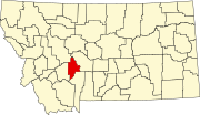 | |
| CDPs | ||
| Unincorporated community | ||