List of islands of Brunei

The following is a list of islands of Brunei.[1] The islands are either located in rivers, South China Sea, Serasa Bay or Brunei Bay.[1]
List of islands
Brunei-Muara District
Mukim Kota Batu
- Berambang Island – 4°51′31″N 114°58′53″E / 4.8586390°N 114.9813499°E / 4.8586390; 114.9813499
- Cermin Island – 4°55′47″N 115°01′30″E / 4.9298333°N 115.0249126°E / 4.9298333; 115.0249126
- Sibungor Island – 4°51′59″N 114°57′15″E / 4.866435°N 114.954211°E / 4.866435; 114.954211
- Baru-Baru Island – 4°54′10″N 115°02′21″E / 4.9026739°N 115.0391851°E / 4.9026739; 115.0391851
- Berbunut Island – 4°53′18″N 115°02′21″E / 4.8884198°N 115.0391851°E / 4.8884198; 115.0391851
- Keingaran Island – 4°56′51″N 115°01′40″E / 4.9474078°N 115.0276930°E / 4.9474078; 115.0276930
- Pepatan Island – 4°54′58″N 115°02′45″E / 4.9160717°N 115.0458577°E / 4.9160717; 115.0458577
- Lumut Lunting – 4°52′00″N 114°57′00″E / 4.8666667°N 114.9500000°E / 4.8666667; 114.9500000
- Silipan Island – 4°53′06″N 115°02′36″E / 4.884951°N 115.043466°E / 4.884951; 115.043466
- Silama Island – 4°52′56″N 115°02′45″E / 4.882182°N 115.045816°E / 4.882182; 115.045816
Mukim Serasa

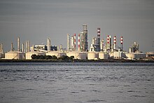
Muara Besar Island - Pelumpong Spit – 5°02′25″N 115°06′37″E / 5.0403205°N 115.1104073°E / 5.0403205; 115.1104073
- Bedukang Island – 4°58′42″N 115°03′44″E / 4.9784298°N 115.0621680°E / 4.9784298; 115.0621680
Mukim Kilanas
- Ranggu Island – 4°51′49″N 114°54′47″E / 4.8636947°N 114.9131212°E / 4.8636947; 114.9131212
- Luba Island – 4°50′46″N 114°53′21″E / 4.8462113°N 114.8890724°E / 4.8462113; 114.8890724
Mukim Mentiri
- Si Mangga Besar Island – 4°58′48″N 115°02′41″E / 4.979955°N 115.044700°E / 4.979955; 115.044700

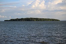
Bedukang Island - Si Mangga Damit Island – 4°58′52″N 115°02′27″E / 4.980997°N 115.040907°E / 4.980997; 115.040907
- Salar Island – 4°59′58″N 115°02′29″E / 4.999377°N 115.041498°E / 4.999377; 115.041498[2]
- Pasir Tengah Island – 4°59′49″N 115°02′32″E / 4.997068°N 115.042268°E / 4.997068; 115.042268[2]
Other islands
- Pelong Rocks – 5°04′44″N 115°03′10″E / 5.0789126°N 115.0528082°E / 5.0789126; 115.0528082
- Punyit – 4°59′00″N 114°49′59″E / 4.983333°N 114.833056°E / 4.983333; 114.833056
Temburong District
Mukim Labu
- Selirong Island – 4°52′55″N 115°07′47″E / 4.8818999°N 115.1298164°E / 4.8818999; 115.1298164
- Siarau Island – 4°48′35″N 115°02′39″E / 4.809725°N 115.044236°E / 4.809725; 115.044236
- Kitang Island – 4°52′37″N 115°05′55″E / 4.876858°N 115.098646°E / 4.876858; 115.098646
- Selanjak Island – 4°49′27″N 115°03′58″E / 4.824113°N 115.066191°E / 4.824113; 115.066191
- Tarap Island – 4°49′56″N 115°04′14″E / 4.832289°N 115.070588°E / 4.832289; 115.070588
- Pituat Island – 4°46′31″N 115°04′27″E / 4.775267°N 115.074091°E / 4.775267; 115.074091
Mukim Bangar
- Kibi Island – 4°45′40″N 115°02′21″E / 4.761221°N 115.039218°E / 4.761221; 115.039218
Mukim Amo
- Batu Mas Island – 4°37′13″N 115°06′30″E / 4.620348°N 115.108267°E / 4.620348; 115.108267
- Langsat Island – 4°37′12″N 115°06′25″E / 4.619994°N 115.106958°E / 4.619994; 115.106958
- Amo Island
Tutong District
Mukim Pekan Tutong
- Setawat Island – 4°46′26″N 114°36′23″E / 4.774002°N 114.606441°E / 4.774002; 114.606441
- Bakuku Island – 4°47′12″N 114°37′34″E / 4.786662°N 114.626073°E / 4.786662; 114.626073
Mukim Tanjong Maya
- Tanjong Maya Island – 4°45′26″N 114°39′49″E / 4.757298°N 114.663657°E / 4.757298; 114.663657
See also
References
- ^ a b Silvestre, Geronimo (1992). The Coastal Resources of Brunei Darussalam: Status, Utilization and Management. WorldFish. p. 151. ISBN 978-971-8709-11-5.
- ^ a b c Thiessen, Tamara (2012). Borneo: Sabah, Brunei, Sarawak. Bradt Travel Guides. p. 153. ISBN 978-1-84162-390-0.

