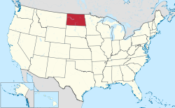
List of census-designated places in North Dakota

Census-designated places (CDPs) are unincorporated communities lacking elected municipal officers and boundaries with legal status.[1] North Dakota has 44 census designated places.
Census-designated place
Population data based on 2010 census.
| 2019 Rank | City | 2019 Estimate[2] | 2010 Census[3] | Change | County |
|---|---|---|---|---|---|
| 1 | Minot Air Force Base | 5,384 | 5,521 | −2.48% | Ward |
| 2 | Grand Forks Air Force Base | 2,685 | 2,367 | +13.43% | Grand Forks |
| 3 | Belcourt | 2,038 | 2,078 | −1.92% | Rolette |
| 4 | Fort Totten | 1,311 | 1,243 | +5.47% | Benson |
| 5 | Shell Valley | 1,300 | 1,197 | +8.60% | Rolette |
| 6 | Cannon Ball | 945 | 875 | +8.00% | Sioux |
| 7 | Mandaree | 606 | 596 | +1.68% | McKenzie |
| 8 | Green Acres | 529 | 575 | −8.00% | Rolette |
| 9 | East Dunseith | 528 | 500 | +5.60% | Rolette |
| 10 | Four Bears Village | 426 | 517 | −17.60% | McKenzie |
| 11 | Porcupine | 263 | 146 | +80.14% | Sioux |
| 12 | Harmon | 257 | 145 | +77.24% | Morton |
| 13 | White Shield | 243 | 336 | −27.68% | McLean |
| 14 | Logan | 239 | 194 | +23.20% | Ward |
| 15 | Englevale | 198 | 40 | +395.00% | Ransom |
| 16 | Ruthville | 147 | 191 | −23.04% | Ward |
| 17 | Brooktree Park | 106 | 80 | +32.50% | Cass |
| 18 | Manning | 85 | 74 | +14.86% | Dunn |
| 19 | Driscoll | 78 | 82 | −4.88% | Burleigh |
| 20 | Menoken | 70 | 70 | 0.00% | Burleigh |
| 21 | Ypsilanti | 58 | 104 | −44.23% | Stutsman |
| 22 | East Fairview | 52 | 76 | −31.58% | McKenzie |
| 23 | Erie | 49 | 50 | −2.00% | Cass |
| 24 | Nash | 47 | 32 | +46.88% | Walsh |
| 25 | Dahlen | 46 | 18 | +155.56% | Nelson |
| 26 | Jessie | 39 | 25 | +56.00% | Griggs |
| 27 | Wheatland | 37 | 68 | −45.59% | Cass |
| 28 | Caledonia | 33 | 39 | −15.38% | Traill |
| 29-(T) | De Lamere | 27 | 30 | −10.00% | Sargent |
| 29-(T) | Embden | 27 | 59 | −54.24% | Cass |
| 31-(T) | Denhoff | 25 | 20 | +25.00% | Sheridan |
| 31-(T) | Selz | 25 | 46 | −45.65% | Pierce |
| 33 | Foxholm | 22 | 75 | −70.67% | Ward |
| 34 | Orrin | 21 | 22 | −4.55% | Pierce |
| 35-(T) | Auburn | 19 | 48 | −60.42% | Walsh |
| 35-(T) | Barton | 19 | 20 | −5.00% | Pierce |
| 37 | Heil | 16 | 15 | +6.67% | Grant |
| 38-(T) | Larson | 12 | 12 | 0.00% | Burke |
| 38-(T) | Raleigh | 12 | 12 | 0.00% | Grant |
| 40-(T) | Spiritwood | 7 | 18 | −61.11% | Stutsman |
| 40-(T) | Heimdal | 7 | 27 | −74.07% | Wells |
| 42-(T) | Blanchard | 6 | 26 | −76.92% | Traill |
| 42-(T) | Sutton | 6 | 17 | −64.71% | Griggs |
| 44 | McLeod | 5 | 27 | −81.48% | Ransom |
References
- ^ "Geographic Terms and Concepts– Place". United States Census Bureau. United States Department of Commerce. Retrieved February 24, 2014.
- ^ "North Dakota Cities by Population". Cubit. Retrieved November 4, 2020.
- ^ "2010 Census Redistricting Data (Public Law 94-171) Summary File". American FactFinder2. U.S. Census Bureau, 2010 Census. Retrieved October 8, 2019.[dead link]