Outline of Hungary


The following outline is provided as an overview of and topical guide to Hungary:
Hungary – landlocked sovereign country located in the Carpathian Basin of Central Europe, bordering Austria, Slovakia, Ukraine, Romania, Serbia, Croatia, and Slovenia.[1] Its capital is Budapest. Hungary is a member of OECD, NATO, EU and a Schengen state. The official language is Hungarian (also known as Magyar), which forms part of the Uralic family. It is one of the four official languages of the European Union that is not of Indo-European origin.
Following a Celtic (after c. 450 BC) and a Roman (9 BC - c. 4th century) period, the foundation of Hungary was laid in the late Ninth Century by the Magyar chieftain Árpád, whose great-grandson István ascended to the throne with a crown sent from Rome in 1000. The Kingdom of Hungary existed with minor interruptions for more than 900 years, and at various points was regarded as one of the cultural centers of the Western world. It was succeeded by a Communist era (1947–1989) during which Hungary gained widespread international attention regarding the Revolution of 1956 and the seminal move of opening its border with Austria in 1989, thus accelerating the collapse of the Eastern Bloc. The present form of government is a parliamentary republic (since 1989). Hungary's current goal is to become a developed country by International Monetary Fund standards, having become already developed by most traditional measures, including GDP and HDI[2] (world ranking 36th and rising). The country's first ever term of EU presidency is due in 2011.[3]
Hungary was one of the 15 most popular tourist destinations in the world in the past decade,[4][5] with a capital regarded as one of the most beautiful in the world.[6][7] Despite its relatively small size, the country is home to numerous World Heritage Sites, UNESCO Biosphere reserves, the second largest thermal lake in the world (Lake Hévíz), the largest lake in Central Europe (Lake Balaton), and the largest natural grassland in Europe (Hortobágy National Park).
General reference

- Pronunciation: /ˈhʌŋɡəri/
- Common English country name: Hungary
- Official English country name: Hungary
- Common endonym: Magyarország
- Official endonym: Magyarország
- Adjectives & demonymic: Hungarian, Magyar
- Etymology: Name of Hungary
- International rankings of Hungary
- ISO country codes: HU, HUN, 348
- ISO region codes: See ISO 3166-2:HU
- Internet country code top-level domain: .hu
Geography of Hungary

- Hungary is: a landlocked country
- Location:
- Northern Hemisphere and Eastern Hemisphere
- Eurasia
- Time zone: Central European Time (UTC+01), Central European Summer Time (UTC+02)
- Extreme points of Hungary
- Land boundaries: 2,185 km
 Slovakia 676 km
 Romania 443 km
 Austria 366 km
 Croatia 329 km
 Serbia 166 km
 Ukraine 103 km
 Slovenia 102 km
- Coastline: none
- Population of Hungary: 10,035,000 (June 30, 2008) - 80th most populous country
- Area of Hungary: 93,030 km2
- Atlas of Hungary
Environment of Hungary

- Climate of Hungary
- Renewable energy in Hungary
- Geology of Hungary
- Protected areas of Hungary
- Wildlife of Hungary
Natural geographic features of Hungary
- Glaciers of Hungary
- Islands of Hungary
- Lakes of Hungary
- Mountains of Hungary
- Volcanoes in Hungary
- Rivers of Hungary
- Waterfalls of Hungary
- Valleys of Hungary
- World Heritage Sites in Hungary
Regions of Hungary
Ecoregions of Hungary
Administrative divisions of Hungary
Counties of Hungary
Subregions of Hungary
Municipalities of Hungary
- Capital of Hungary: Budapest
- Cities of Hungary
Demography of Hungary
Government and politics of Hungary
- Form of government: parliamentary representative democratic republic
- Capital of Hungary: Budapest
- Elections in Hungary
| Parliamentary elections |
|
|---|---|
| European elections | |
| Local elections | |
| Referendums | |
| |
Branches of the government of Hungary
Executive branch of the government of Hungary
- Head of state: President of Hungary, János Áder
- Head of government: Prime Minister of Hungary, Viktor Orbán
- Cabinet of Hungary
Legislative branch of the government of Hungary
Judicial branch of the government of Hungary
Foreign relations of Hungary
| Africa |  | |
|---|---|---|
| Americas | ||
| Asia | ||
| Europe | ||
| Multilateral | ||
| Former | ||
| Diplomatic missions | ||
International organization membership
International organization membership of Hungary The Republic of Hungary is a member of:[1]
Law and order in Hungary

- Capital punishment in Hungary
- Constitution of Hungary
- Crime in Hungary
- Human rights in Hungary
- Law enforcement in Hungary
- 2006 protests in Hungary
Military of Hungary
- Command
- Forces
- Army of Hungary
- Navy of Hungary: None (the country is landlocked)
- Air Force of Hungary
- Military history of Hungary
- Military ranks of Hungary
Local government in Hungary
| Name of county | County seat | Area (km2) |
Population | Population density |
Towns/ villages |
|---|---|---|---|---|---|
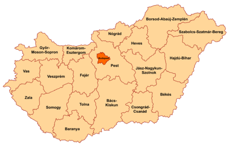 | |||||
| Bács-Kiskun | Kecskemét | 8,445 | 541,584 | 64 | 119 |
| Baranya | Pécs | 4,430 | 402,260 | 91 | 301 |
| Békés | Békéscsaba | 5,631 | 392,845 | 70 | 75 |
| Borsod-Abaúj-Zemplén | Miskolc | 7,247 | 739,143 | 102 | 355 |
| Csongrád-Csanád | Szeged | 4,263 | 425,785 | 100 | 60 |
| Fejér | Székesfehérvár | 4,359 | 428,579 | 98 | 108 |
| Győr-Moson-Sopron | Győr | 4,208 | 440,138 | 105 | 182 |
| Hajdú-Bihar | Debrecen | 6,211 | 550,265 | 89 | 82 |
| Heves | Eger | 3,637 | 323,769 | 89 | 119 |
| Jász-Nagykun-Szolnok | Szolnok | 5,582 | 413,174 | 74 | 75 |
| Komárom-Esztergom | Tatabánya | 2,265 | 315,886 | 139 | 76 |
| Nógrád | Salgótarján | 2,546 | 218,218 | 86 | 129 |
| Pest | Budapest | 6,393 | 1,124,395 | 176 | 186 |
| Somogy | Kaposvár | 6,036 | 334,065 | 55 | 244 |
| Szabolcs-Szatmár-Bereg | Nyíregyháza | 5,936 | 583,564 | 98 | 228 |
| Tolna | Szekszárd | 3,703 | 247,287 | 67 | 108 |
| Vas | Szombathely | 3,336 | 266,342 | 80 | 216 |
| Veszprém | Veszprém | 4,493 | 368,519 | 82 | 217 |
| Zala | Zalaegerszeg | 3,784 | 269,705 | 78 | 257 |
History of Hungary
- Timeline of the history of Hungary
- Current events of Hungary
- Military history of Hungary
Culture of Hungary
- Architecture of Hungary
- Cuisine of Hungary
- Festivals in Hungary
- Languages of Hungary
- Media in Hungary
- Museums in Hungary
- National symbols of Hungary
- People of Hungary
- Prostitution in Hungary
- Public holidays in Hungary
- Records of Hungary
- Religion in Hungary
- Christianity in Hungary
- Hinduism in Hungary
- Islam in Hungary
- History of the Jews in Hungary
- Sikhism in Hungary
- World Heritage Sites in Hungary
Art in Hungary
- Art in Hungary
- Architecture of Hungary
- Cinema of Hungary
- Literature of Hungary
- Music of Hungary
- Television in Hungary
- Theatre in Hungary
Sports in Hungary
Sports in Hungary
Economy and infrastructure of Hungary
- Economic rank, by nominal GDP (2007): 49th (forty-ninth)
- Agriculture in Hungary
- Banking in Hungary
- Communications in Hungary
- Companies of Hungary
- Currency of Hungary: Forint
- ISO 4217: HUF
- Energy in Hungary
- Energy policy of Hungary
- Oil industry in Hungary
- Health care in Hungary
- Mining in Hungary
- Hungary Stock Exchange
- Tourism in Hungary
- Transport in Hungary
Education in Hungary
See also
- Index of Hungary-related articles
- List of Hungary-related topics
- List of international rankings
- Member state of the European Union
- Member state of the North Atlantic Treaty Organization
- Member state of the United Nations
- Outline of Europe
- Outline of geography
References
- ^ a b "Hungary". The World Factbook. United States Central Intelligence Agency. July 2, 2009. Retrieved July 23, 2009.
- ^ Microsoft Word - NHDP_HU_NSRF_en_r1.doc
- ^ The Budapest Times - Hungary‘s leading English Language source for daily news - Parties discuss preparations for Hungary's EU presidency in 2011
- ^ Index - Miért menjünk Magyarországra? Miért menjünk Szlovákiába?
- ^ "Archived copy". Archived from the original on 2007-04-23. Retrieved 2008-07-11.
{{cite web}}: CS1 maint: archived copy as title (link) - ^ https://whc.unesco.org/archive/advisory_body_evaluation/400bis.pdf [bare URL PDF]
- ^ Budapest, including the Banks of the Danube, the Buda Castle Quarter and Andrássy Avenue - World Heritage Site - Pictures, info and travel reports
External links
![]() Wikimedia Atlas of Hungary
Wikimedia Atlas of Hungary
- Official site of the National Assembly
- hungary.hu
- History of Hungary: Primary Documents
- History of Hungary – The Corvinus Library
- The Jewish Community of Budapest, Hungary – The Museum of the Jewish People at Beit Hatfutsot
- Translation of Hungarian literary works - a database
- Hungary at Curlie
- Agricultural land use profile