Kamouh el Hermel
 Kamouh el Hermel (Pyramid of Hermel), 2008 | |
| Alternative name | Qamouh el Hermel, Pyramid of Hermel, Hermel Pyramid |
|---|---|
| Location | Beqaa Valley, Lebanon |
| Coordinates | 34°21′51.6″N 36°24′57.0″E / 34.364333°N 36.415833°E / 34.364333; 36.415833 |
| History | |
| Periods | Shepherd Neolithic, Ancient Greece |
| Site notes | |
| Archaeologists | Frank Skeels, Lorraine Copeland, René Dussaud |
| Condition | restored in 1931, faces somewhat damaged |
| Public access | Not fenced off |
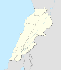
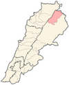
Kamouh el Hermel, the Pyramid of Hermel (also known as God's Pyramid, House of El, the Funnel of Hermel or Needle of Hermel) is an ancient pyramid located 6 kilometres (3.7 mi) south of Hermel in Baalbek-Hermel Governorate, Lebanon.[1][2][3]
Location, description
The pyramid sits on top of a hill that is clearly visible from a distance and has been fenced off to prevent damage.[4] Despite this, the monument was heavily vandalised by locals in 2000–2018, all the four faces of the base being covered with graffiti and no serious measures being taken by the authorities for its conservation. It is between 19.6 metres (64 ft) and 27 metres (89 ft) high and sits on a base measuring around 1.1 metres (3.6 ft) with three steps made from black basalt.[2] On the base site two massive limestone blocks weighing between 40 tonnes (40,000 kg) and 50 tonnes (50,000 kg).[4] The blocks are around 7 metres (23 ft) high and 9 metres (30 ft) wide and are crowned by a pyramid measuring some 4.5 metres (15 ft) high.[5] Some sections of the monument were restored in 1931. A relief on the north side depicts two deer, possibly caught in a hunting trap. On the east side is a carved image of a boar being attacked by dogs and speared. The south side is badly damaged but shows an image considered possibly to be a bear. The relief on the west side shows two wolves attacking a bull.[6][7]
Shepherd Neolithic archaeological site

Evidence was found of a Shepherd Neolithic archaeological site in the area around the monument, on the south and west of the hill. The site was discovered and a collection of flint tools used during the Neolithic Revolution was made by Lorraine Copeland and Frank Skeels in 1965.[8] Materials recovered included blade-butts with scraping edges or notches, borers, cores (one with a twin edge) and small flakes. Some pieces were vaguely bifacial. The flints found were in a grey or chocolate-brown colour with some having a shiny patina.[9]
Modern identification
The pyramid has been suggested to date to the first or second century BC due to similarities with architecture of tower tombs of the late Seleucid era at Palmyra in Syria.[2] It was considered by William McClure Thomson to possibly have been of Ancient Greek construction; however, the lack of inscriptions puzzled him as he thought the ancient Greeks to be a "scribbling generation".[10][11] Thomson also entertained the notion, along with Charles William Meredith van de Velde that the construction may have been Assyrian.[12] René Dussaud later suggested that although the reliefs resembled the Ishtar Gate, the edifice was likely a monument to the hunting prowess of a member of Syrian royalty from the first century BC.[13]
Gallery
-
Kamouh el Hermel described in the early 1850s, by van de Velde
-
Kamouh el Hermel described in the early 1850s, by van de Velde
-
Kamouh el Hermel, between 1898 and 1946
-
Kamuat el Hirmil showing restoration work in progress, 1920
-
Kamuat el-Hirmel, 1925
References
- ^ Perdrizet, Paul., Le monument de Herme, Syria, Volume 19, Issue 19-1, pp. 47-71, 1938.
- ^ a b c Paul Doyle (1 March 2012). Lebanon. Bradt Travel Guides. pp. 215–. ISBN 978-1-84162-370-2. Retrieved 26 September 2012.
- ^ Jūrj Marʻī Ḥaddād (1956). Baalbak, North & South Lebanon: Description, history and touristic guide. Printed by el-Hashimieh Press. Retrieved 27 September 2012.
- ^ a b Anus, F., La protection des Monuments historiques en Syrie et au Liban, Syria, Volume 13, Issue 13-3, pp. 293-299, 1932.
- ^ Mīkhāʾīl Mūsá Allūf (1914). History of Baalbek ... Catholic Printing Press. Retrieved 27 September 2012.
- ^ Terry Carter; Lara Dunston; Amelia Thomas (1 July 2008). Syria and Lebanon. Lonely Planet. pp. 361–. ISBN 978-1-74104-609-0. Retrieved 26 September 2012.
- ^ William McClure Thomson (1859). The Land and the Book: or, Biblical illustrations drawn from the manners and customs, the scenes and scenery, of the Holy Land. Harper & brothers. pp. 362–. Retrieved 27 September 2012.
- ^ Francis Hours (1994). Atlas des sites du proche orient (14000-5700 BP). Maison de l'Orient méditerranéen. ISBN 978-2-903264-53-6. Retrieved 27 September 2012.
- ^ L. Copeland; P. Wescombe (1966). Inventory of Stone-Age Sites in Lebanon: North, South and East-Central Lebanon, p. 37. Impr. Catholique. Retrieved 3 March 2011.
- ^ Bibliotheca sacra and theological review. Allen, Morrill, and Wardwell. 1848. pp. 695–. Retrieved 26 September 2012.
- ^ James Stevens Curl (18 November 2005). The Egyptian Revival. Taylor & Francis. pp. 39–. ISBN 978-0-415-36119-4. Retrieved 26 September 2012.
- ^ Charles William Meredith van de Velde; Carel Willem Meredith Velde (van de) (1854). Narrative of a journey through Syria and Palestine in 1851 and 1852. W. Blackwood and sons. pp. 469–. Retrieved 27 September 2012.
- ^ Dussaud, René., Mémoire de M. Paul Perdrizet sur le monument d'Hermel (Syrie), Comptes-rendus des séances de l'Académie des Inscriptions et Belles-Lettres, Volume 81, Issue 4, pp. 342-343, 1937.
External links
- Hermel Pyramid on Wikimapia.org
- Kamouh Hermel video on YouTube
- al-hermel.org (in Arabic)
- Hermel Pyramid on discoverlebanon.com
- Qâmoûaa el Hermel on travelingluck.com
- Qâmoûaa el Hermel on geographic.org
- Images of Qâmou el Hermel on Lebanoneguide.com

.jpg/440px-93.Kamoa_el-Hermel_(profils_et_details).jpg)
_.jpg/440px-92.Kamoa_el-Hermel_(monument_dans_la_plaine_de_Riblah.)_.jpg)


