Jōmon Prehistoric Sites in Northern Japan
| UNESCO World Heritage Site | |
|---|---|
 | |
| Location | Japan |
| Criteria | Cultural: (iii)(v) |
| Reference | 1632 |
| Inscription | 2021 (44th Session) |
| Area | 141.9 ha (0.548 sq mi) |
| Buffer zone | 984.8 ha (3.802 sq mi) |
Jōmon Prehistoric Sites in Northern Japan (北海道・北東北の縄文遺跡群) is a serial UNESCO World Heritage Site consisting of 17 Jōmon-period archaeological sites in Hokkaidō and northern Tōhoku, Japan. The Jōmon period lasted more than 10,000 years, representing "sedentary pre-agricultural lifeways and a complex spiritual culture of prehistoric people".[2]
It was first placed on the World Heritage Tentative List in 2009.[3] In 2021, ICOMOS recommended the inscription in July of the revised serial nomination of seventeen sites under criteria iii and v.[4] It was then officially inscribed on the World Heritage List on 27 July 2021.[2]
Sites
All component sites have been designated for protection under the Law for the Protection of Cultural Properties, as Historic Sites or *Special Historic Sites ("ACA" column below).[4]
| UNESCO ID[5] | Site | Municipality | Prefecture | Comments | Image | Coordinates | ACA |
|---|---|---|---|---|---|---|---|
| 1632-001 | Ōdai Yamamoto I Site 大平山元遺跡 Ōdai Yamamoto iseki |
Sotogahama | Aomori | excavated earthenware has been dated as early as 16500 BP[6] |  |
41°04′02″N 140°33′18″E / 41.067288°N 140.554973°E / 41.067288; 140.554973 (Ōdai Yamamoto Site) | [1] |
| 1632-002 | Kakinoshima site 垣ノ島遺跡 Kakinoshima iseki |
Hakodate | Hokkaidō | cf. nearby Hakodate Jōmon Culture Center and Hollow Dogū (National Treasure) | 41°55′44″N 140°56′51″E / 41.928861°N 140.9475°E / 41.928861; 140.9475 (Kakinoshima site) | [2] | |
| 1632-003 | Kitakogane site 北黄金貝塚 Kitakogane kaizuka |
Date | Hokkaidō |  |
42°24′07″N 140°54′38″E / 42.40203392°N 140.91064837°E / 42.40203392; 140.91064837 (Kitakogane Site) | [3] | |
| 1632-004 | Tagoyano site 田小屋野貝塚 Tagoyano kaizuka |
Tsugaru | Aomori |  |
40°53′17″N 140°20′21″E / 40.888176°N 140.339233°E / 40.888176; 140.339233 (Tagoyano Site) | [4] | |
| 1632-005 | Kamegaoka Burial Site 亀ヶ岡石器時代遺跡 Kamegaoka sekki-jidai iseki |
Tsugaru | Aomori |  |
40°53′06″N 140°20′22″E / 40.884895°N 140.339569°E / 40.884895; 140.339569 (Kamegaoka Burial Site) | [5] | |
| 1632-006 | Futatsumori Site 二ツ森貝塚 Futatsumori kaizuka |
Shichinohe | Aomori |  |
40°44′54″N 141°13′47″E / 40.74845883°N 141.22984087°E / 40.74845883; 141.22984087 (Futatsumori Site) | [6] | |
| 1632-007 | *Sannai Maruyama Site 三内丸山遺跡 Sannai-Maruyama iseki |
Aomori | Aomori | Special Historic Site with associated ICP excavated artefacts[7] | 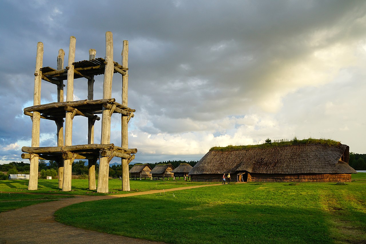 |
40°48′40″N 140°41′55″E / 40.81103046°N 140.69849073°E / 40.81103046; 140.69849073 (Sannai Maruyama Site Site) | [7] |
| 1632-008 | Ōfune Site 大船遺跡 Ōfune iseki |
Hakodate | Hokkaidō |  |
41°57′29″N 140°55′27″E / 41.95794955°N 140.9243044°E / 41.95794955; 140.9243044 (Ōfune Site) | [8] | |
| 1632-009 | Goshono site 御所野遺跡 Goshono iseki |
Ichinohe | Iwate |  |
40°11′53″N 141°18′23″E / 40.19815136°N 141.30645834°E / 40.19815136; 141.30645834 (Goshono site) | [9] | |
| 1632-010 | Irie site 入江貝塚 Irie kaizuka |
Tōyako | Hokkaidō |  |
42°32′50″N 140°46′13″E / 42.54710056°N 140.77019889°E / 42.54710056; 140.77019889 (Irie site) | [10] | |
| 1632-011 | Takasago Burial Site 高砂貝塚 Takasago kaizuka |
Tōyako | Hokkaidō |  |
42°32′50″N 140°46′13″E / 42.54710056°N 140.77019889°E / 42.54710056; 140.77019889 (Takasago Burial Site) | [11] | |
| 1632-012 | Komakino Stone Circle 小牧野遺跡 Komakino iseki |
Aomori | Aomori |  |
40°44′19″N 140°43′43″E / 40.7385616°N 140.72862813°E / 40.7385616; 140.72862813 (Komakino Stone Circle) | [12] | |
| 1632-013 | Isedōtai Stone Circles 伊勢堂岱遺跡 Isedōtai iseki |
Kita-Akita | Akita |  |
40°12′05″N 140°20′54″E / 40.20140097°N 140.34830948°E / 40.20140097; 140.34830948 (Isedōtai Stone Circles) | [13] | |
| 1632-014 | *Ōyu Stone Circles 大湯環状列石 Ōyu kanjōresseki |
Kazuno | Akita | Special Historic Site |  |
40°16′17″N 140°48′16″E / 40.27133697°N 140.80431892°E / 40.27133697; 140.80431892 (Ōyu Stone Circles) | [14] |
| 1632-015 | Kiusu Earthwork Burial Circles キウス周堤墓群 Kiusu shūteibo-gun |
Chitose | Hokkaidō |  |
42°53′09″N 141°42′59″E / 42.88578385°N 141.71640587°E / 42.88578385; 141.71640587 (Kiusu Earthwork Burial Circles) | [15] | |
| 1632-016 | Ōmori Katsuyama Stone Circle 大森勝山遺跡 Ōmori Katsuyama iseki |
Hirosaki | Aomori |  |
40°41′56″N 140°21′30″E / 40.69889°N 140.35833°E / 40.69889; 140.35833 (Ōmori Katsuyama Stone Circle) | [16] | |
| 1632-017 | Korekawa Site 是川石器時代遺跡 Korekawa sekki-jidai iseki |
Hachinohe | Aomori | ICP excavated artefacts at Korekawa Jōmon Kan[8] |  |
40°28′25″N 141°29′28″E / 40.473722°N 141.491032°E / 40.473722; 141.491032 (Korekawa Site) | [17] |
See also
- List of National Treasures of Japan (archaeological materials)
- List of Historic Sites of Japan (Hokkaidō)
- List of Historic Sites of Japan (Aomori)
- List of Historic Sites of Japan (Iwate)
- List of Historic Sites of Japan (Akita)
- World Heritage Sites in Japan
References
- ^ 土偶 [Dogū] (in Japanese). Agency for Cultural Affairs. Retrieved 28 July 2021.
- ^ a b "Jomon ruins added to UNESCO World Heritage List". The Japan Times. 27 July 2021. Retrieved 28 July 2021.
- ^ "Jômon Archaeological Sites in Hokkaidô, Northern Tôhoku, and other regions". UNESCO. Retrieved 12 June 2012.
- ^ a b ICOMOS, ed. (2021). "Evaluations of Nominations of Cultural and Mixed Properties (WHC-21/44.COM/INF.8B1)" (PDF). UNESCO. pp. 339–349. Retrieved 24 July 2021.
- ^ "Jōmon Prehistoric Sites in Northern Japan : Multiple locations". UNESCO World Heritage Centre. Retrieved 28 July 2021.
- ^ "大平山元I遺跡 -日本最古の土器出土-" [Ōdaiyamamoto Ichi Site - Excavation of Japan's Earliest Earthenware] (in Japanese). Aomori Prefecture. Retrieved 12 June 2012.
- ^ "青森県三内丸山遺跡出土品" [Excavated Artefacts from the Sannai-Maruyama Site] (in Japanese). Agency for Cultural Affairs. Retrieved 12 June 2012.
- ^ "陸奥国是川遺跡出土品" [Excavated Artefacts from the Korekawa Site] (in Japanese). Agency for Cultural Affairs. Retrieved 12 June 2012.
External links
- Jōmon Prehistoric Sites in Northern Japan

_02.jpg)