Hazlehurst, Georgia
Hazlehurst, Georgia | |
|---|---|
 Hazlehurst City Hall | |
 Flag  Seal | |
| Motto: "Come linger' longer" | |
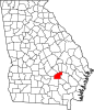
 Location in Jeff Davis County and the state of Georgia | |
| Coordinates: 31°51′58″N 82°35′58″W / 31.86611°N 82.59944°W / 31.86611; -82.59944 | |
| Country | United States |
| State | Georgia |
| County | Jeff Davis |
| Named for | George Hazlehurst |
| Government | |
| • Mayor | John Ramay |
| Area [1] | |
| • Total | 4.81 sq mi (12.45 km2) |
| • Land | 4.73 sq mi (12.26 km2) |
| • Water | 0.08 sq mi (0.20 km2) |
| Elevation | 249 ft (76 m) |
| Population (2020) | |
| • Total | 4,088 |
| • Density | 863.72/sq mi (333.48/km2) |
| Time zone | UTC-5 (Eastern (EST)) |
| • Summer (DST) | UTC-4 (EDT) |
| ZIP code | 31539 |
| Area code | 912 |
| FIPS code | 13-37564[2] |
| GNIS feature ID | 0315266[3] |
| Website | http://www.hazlehurstga.gov |
Hazlehurst is a city in and the county seat of Jeff Davis County, Georgia, United States.[4] The population was 4,088 in 2020.
History
Hazlehurst was founded circa 1880 as a depot on the Macon and Brunswick Railroad.[5] The community was named for railroad surveyor Col. George Hazlehurst.[6]
Geography
Hazlehurst is located in southeast Georgia, and is served by U.S. routes 23, 221 and 341.
Climate
| Climate data for Hazlehurst, Georgia, 1991–2020 normals, extremes 1918–2015 | |||||||||||||
|---|---|---|---|---|---|---|---|---|---|---|---|---|---|
| Month | Jan | Feb | Mar | Apr | May | Jun | Jul | Aug | Sep | Oct | Nov | Dec | Year |
| Record high °F (°C) | 85 (29) |
84 (29) |
93 (34) |
95 (35) |
102 (39) |
105 (41) |
107 (42) |
104 (40) |
106 (41) |
97 (36) |
88 (31) |
85 (29) |
107 (42) |
| Mean daily maximum °F (°C) | 60.3 (15.7) |
64.1 (17.8) |
70.9 (21.6) |
77.8 (25.4) |
85.1 (29.5) |
89.7 (32.1) |
92.4 (33.6) |
91.4 (33.0) |
86.6 (30.3) |
78.7 (25.9) |
69.8 (21.0) |
62.5 (16.9) |
77.4 (25.2) |
| Daily mean °F (°C) | 49.1 (9.5) |
52.4 (11.3) |
58.8 (14.9) |
65.5 (18.6) |
73.3 (22.9) |
79.2 (26.2) |
82.1 (27.8) |
81.2 (27.3) |
76.3 (24.6) |
66.9 (19.4) |
57.5 (14.2) |
51.4 (10.8) |
66.1 (19.0) |
| Mean daily minimum °F (°C) | 37.9 (3.3) |
40.7 (4.8) |
46.7 (8.2) |
53.2 (11.8) |
61.5 (16.4) |
68.8 (20.4) |
71.7 (22.1) |
71.0 (21.7) |
66.0 (18.9) |
55.2 (12.9) |
45.2 (7.3) |
40.3 (4.6) |
54.9 (12.7) |
| Record low °F (°C) | 10 (−12) |
18 (−8) |
20 (−7) |
29 (−2) |
40 (4) |
47 (8) |
58 (14) |
56 (13) |
45 (7) |
28 (−2) |
19 (−7) |
15 (−9) |
10 (−12) |
| Average precipitation inches (mm) | 4.15 (105) |
4.21 (107) |
4.41 (112) |
3.65 (93) |
3.30 (84) |
5.28 (134) |
4.50 (114) |
6.87 (174) |
4.47 (114) |
2.95 (75) |
2.98 (76) |
4.09 (104) |
50.86 (1,292) |
| Average snowfall inches (cm) | 0.0 (0.0) |
0.1 (0.25) |
0.0 (0.0) |
0.0 (0.0) |
0.0 (0.0) |
0.0 (0.0) |
0.0 (0.0) |
0.0 (0.0) |
0.0 (0.0) |
0.0 (0.0) |
0.0 (0.0) |
0.0 (0.0) |
0.1 (0.25) |
| Average precipitation days (≥ 0.01 in) | 10.4 | 10.2 | 9.1 | 7.6 | 7.1 | 12.5 | 12.4 | 13.3 | 11.4 | 8.6 | 7.1 | 9.7 | 119.4 |
| Average snowy days (≥ 0.1 in) | 0.0 | 0.1 | 0.0 | 0.0 | 0.0 | 0.0 | 0.0 | 0.0 | 0.0 | 0.0 | 0.0 | 0.0 | 0.1 |
| Source 1: NOAA[7] | |||||||||||||
| Source 2: XMACIS2[8] | |||||||||||||
Demographics
| Census | Pop. | Note | %± |
|---|---|---|---|
| 1890 | 290 | — | |
| 1900 | 793 | 173.4% | |
| 1910 | 1,181 | 48.9% | |
| 1920 | 1,383 | 17.1% | |
| 1930 | 1,378 | −0.4% | |
| 1940 | 1,732 | 25.7% | |
| 1950 | 2,687 | 55.1% | |
| 1960 | 3,699 | 37.7% | |
| 1970 | 4,065 | 9.9% | |
| 1980 | 4,298 | 5.7% | |
| 1990 | 4,202 | −2.2% | |
| 2000 | 3,787 | −9.9% | |
| 2010 | 4,226 | 11.6% | |
| 2020 | 4,088 | −3.3% | |
| U.S. Decennial Census[9] | |||
| Race | Num. | Perc. |
|---|---|---|
| White (non-Hispanic) | 2,078 | 50.83% |
| Black or African American (non-Hispanic) | 1,359 | 33.24% |
| Native American | 9 | 0.22% |
| Asian | 22 | 0.54% |
| Pacific Islander | 3 | 0.07% |
| Other/Mixed | 123 | 3.01% |
| Hispanic or Latino | 494 | 12.08% |
As of the 2020 United States census, there were 4,088 people, 1,494 households, and 894 families residing in the city.
Education
Jeff Davis County School District
The Jeff Davis County School District consists of two elementary schools, a middle school, and a high school.[11] The district has 210 classroom teachers and 3,075 students. [12]
- Jeff Davis Elementary School
- Jeff Davis Primary School
- Jeff Davis Middle School
- Jeff Davis High School
References
- ^ "2020 U.S. Gazetteer Files". United States Census Bureau. Retrieved December 18, 2021.
- ^ "U.S. Census website". United States Census Bureau. Retrieved January 31, 2008.
- ^ "US Board on Geographic Names". United States Geological Survey. October 25, 2007. Retrieved January 31, 2008.
- ^ "Find a County". National Association of Counties. Retrieved June 7, 2011.
- ^ Hellmann, Paul T. (May 13, 2013). Historical Gazetteer of the United States. Routledge. p. 233. ISBN 978-1135948597. Retrieved November 30, 2013.
- ^ Krakow, Kenneth K. (1975). Georgia Place-Names: Their History and Origins (PDF). Macon, GA: Winship Press. p. 106. ISBN 0-915430-00-2.
- ^ "U.S. Climate Normals Quick Access – Station: Hazlehurst, GA". National Oceanic and Atmospheric Administration. Retrieved February 27, 2023.
- ^ "xmACIS2". National Oceanic and Atmospheric Administration. Retrieved February 27, 2023.
- ^ "Census of Population and Housing". Census.gov. Retrieved June 4, 2015.
- ^ "Explore Census Data". data.census.gov. Retrieved December 18, 2021.
- ^ Georgia Board of Education[permanent dead link], Retrieved June 20, 2010.
- ^ National Center for Educational Statistics, Retrieved April 1, 2024
Municipalities and communities of Jeff Davis County, Georgia, United States | ||
|---|---|---|
County seat: Hazlehurst | ||
| Cities |
|  |
| CDP | ||
| Unincorporated community | ||
| Ghost town | ||