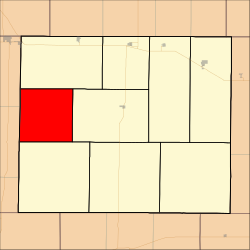
Gaeland Township, Gove County, Kansas
Gaeland Township | |
|---|---|
 Location in Gove County | |
| Coordinates: 38°56′21″N 100°43′55″W / 38.93917°N 100.73194°W / 38.93917; -100.73194 | |
| Country | United States |
| State | Kansas |
| County | Gove |
| Area | |
| • Total | 80.37 sq mi (208.15 km2) |
| • Land | 80.37 sq mi (208.15 km2) |
| • Water | 0 sq mi (0 km2) 0% |
| Elevation | 2,943 ft (897 m) |
| Population (2000) | |
| • Total | 46 |
| • Density | 0.6/sq mi (0.2/km2) |
| GNIS feature ID | 0471376 |
Gaeland Township is a township in Gove County, Kansas, USA. As of the 2000 census, its population was 46.
Geography
Gaeland Township covers an area of 80.37 square miles (208.2 km2) and contains no incorporated settlements.
Transportation
Gaeland Township contains two airports or landing strips: Evans Airport and Stevenson Airport.
References
- USGS Geographic Names Information System (GNIS)
External links
- US-Counties.com
- City-Data.com
