Ein al-Asad
Ein al-Asad
עין אל אסד عين الأسد | |
|---|---|
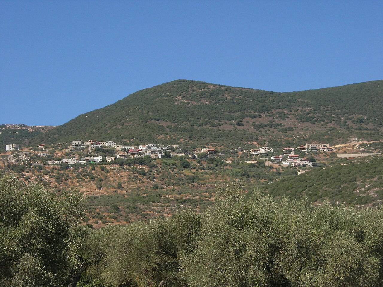 | |
 Ein al-Asad  Ein al-Asad | |
| Coordinates: 32°56′28″N 35°23′47″E / 32.94111°N 35.39639°E / 32.94111; 35.39639 | |
| Country | |
| District | Northern |
| Council | Merom HaGalil |
| Founded | 1899 |
| Founded by | Beit Jann residents |
| Population (2022)[1] | 920 |
Ein al-Asad (Arabic: عين الأسد "the lion's spring", Hebrew: עין אל-אסד) is a Druze village in northern Israel. Located near Maghar in the Galilee, it falls under the jurisdiction of Merom HaGalil Regional Council. As of 2022 it had a population of 920.[1]
History
The community was founded in the mid to late 19th century by Druze from nearby Beit Jann, who were later joined by Druze migrants from Lebanon and Jabal al-Druze in Syria.[2] It was named after an eponymous wellspring outside the village.[3]
British Mandate era
In the 1922 census of Palestine conducted by the British Mandate authorities, Ein al-Asad had a population of 48, of whom 47 were Druze and one a Christian,[4] increasing in the 1931 census to 81; 80 Druze and one Christian and a total of 18 houses.[5] In the 1945 statistics, the population of Ein al-Asad together with Beit Jann was 1,640, all classified as "others" (meaning Druze, 120 of which were indicated as being in Ein al-Asad),[6] who owned 43,550 dunams of land according to an official land and population survey.[7] 2,530 dunams were plantations and irrigable land, while 7,406 dunams were used for cereals[8] and 67 dunams were built-up (urban) land.[9]
See also
References
- ^ a b "Regional Statistics". Israel Central Bureau of Statistics. Retrieved 21 March 2024.
- ^ Falah 1975, p. 44.
- ^ The spring of Ibadiyeh, according to Palmer, 1881, p. 61
- ^ Barron, 1923, p. 36
- ^ Mills, 1932, p. 100
- ^ Government of Palestine, Department of Statistics, 1945, p. 4 Archived 2018-09-28 at the Wayback Machine
- ^ Government of Palestine, Department of Statistics. Village Statistics, April, 1945. Quoted in Hadawi, 1970, p. 40 Archived 2018-09-15 at the Wayback Machine
- ^ Government of Palestine, Department of Statistics. Village Statistics, April, 1945. Quoted in Hadawi, 1970, p. 80 Archived 2018-09-15 at the Wayback Machine
- ^ Government of Palestine, Department of Statistics. Village Statistics, April, 1945. Quoted in Hadawi, 1970, p. 130 Archived 2018-09-15 at the Wayback Machine
Bibliography
- Barron, J.B., ed. (1923). Palestine: Report and General Abstracts of the Census of 1922. Government of Palestine.
- Falah, Salman (1975). "A History of the Druze Settlements in Palestine during the Ottoman Period". In Maoz, Moshe (ed.). Studies on Palestine during the Ottoman Period. Jerusalem: Magnes Press. Archived from the original on 2023-03-31. Retrieved 2023-03-31.
- Government of Palestine, Department of Statistics (1945). Village Statistics, April, 1945. Archived from the original on 2019-04-02. Retrieved 2023-03-31.
- Hadawi, S. (1970). Village Statistics of 1945: A Classification of Land and Area ownership in Palestine. Palestine Liberation Organization Research Center. Archived from the original on 2018-12-08. Retrieved 2013-10-28.
- Mills, E., ed. (1932). Census of Palestine 1931. Population of Villages, Towns and Administrative Areas (PDF). Jerusalem: Government of Palestine.
- Palmer, E. H. (1881). The Survey of Western Palestine: Arabic and English Name Lists Collected During the Survey by Lieutenants Conder and Kitchener, R. E. Transliterated and Explained by E.H. Palmer. Committee of the Palestine Exploration Fund.
External links
- Welcome To 'Ayn al-'Asad
- Survey of Western Palestine, Map 4: IAA, Wikimedia commons