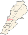
Bmahray
Bmahray
بمهريه | |
|---|---|
Village | |
| Coordinates: 33°45′25″N 35°43′8″E / 33.75694°N 35.71889°E / 33.75694; 35.71889 | |
| Country | |
| Governorate | Mount Lebanon Governorate |
| District | Aley District |
| Area | |
| • Total | 23.6 km2 (9.1 sq mi) |
| Lowest elevation | 1,215 m (3,986 ft) |
| Time zone | UTC+2 (EET) |
| • Summer (DST) | UTC+3 (EEST) |
| Dialing code | +961 |
Bmahray (Arabic: بمهريه), is a village in the Aley District in Lebanon. It lies 41 km south-East of Beirut at an altitude of 1215m above sea level.[1]
Demography
Bmahray's residents are Maronite, Druze and Greek Catholic communities. The 2010 municipal elections census counted 1018 registered voters,[2] The village's religious buildings are Saint George Maronite church and a Druze Khalwa.
Bmahray's main families are:
- Abou Zakhem
- Bou Malhab / Bou Malham
- Al Abanni
- Saab
- Abou Chahine
- Abou Ghanem
- Moukamer
- Daou
- Jreidy
- Nakhle
- Rabah
- Malkoun
Geography
Bmahray is located on the western face of Mount Lebanon. According to the national local development resource Center (Localiban), the village has a total municipal area of 23.6 square kilometres (9.11 sq mi).[1]
Archaeology
Bmahray contains the remains of Roman monuments and rock sarcophagi.[3]
Economy
Bmahray has no schools, no hospitals or medical institutions and no institutions counting more than 5 employees.[1]
Before the Lebanese civil war, the main source of income for the villagers was horticulture, especially apples; the lack of water for irrigation failed attempts to revitalize this economic activity.[3]
Government and politics
Some residents are affiliated with March 14 Movement with others affiliated to the Free Patriotic Movement, and the Progressive Socialist Party. The mayor is Joseph Malkoun since 1998.
Environment
Bmahray was one of the first villages to become part of the Shouf Cedar Biosphere Reserve. It has one million square meters of cedar trees, as well as at least three million square meters of pine trees.[3]
References
- ^ a b c Centre de ressources sur le développement local au Liban. "Bmohray". Centre de ressources sur le développement local au Liban. Archived from the original on January 16, 2015. Retrieved October 17, 2013.
- ^ الإنتخابات البلدية والاختيارية 2010 (PDF) (in Arabic). information-international. Archived from the original (PDF) on 16 June 2015. Retrieved 17 October 2013.
- ^ a b c "Bmohray". shoufcedar. Archived from the original on 17 October 2013. Retrieved 17 October 2013.

