A Line (Los Angeles Metro)
| A Line | |
|---|---|
 | |
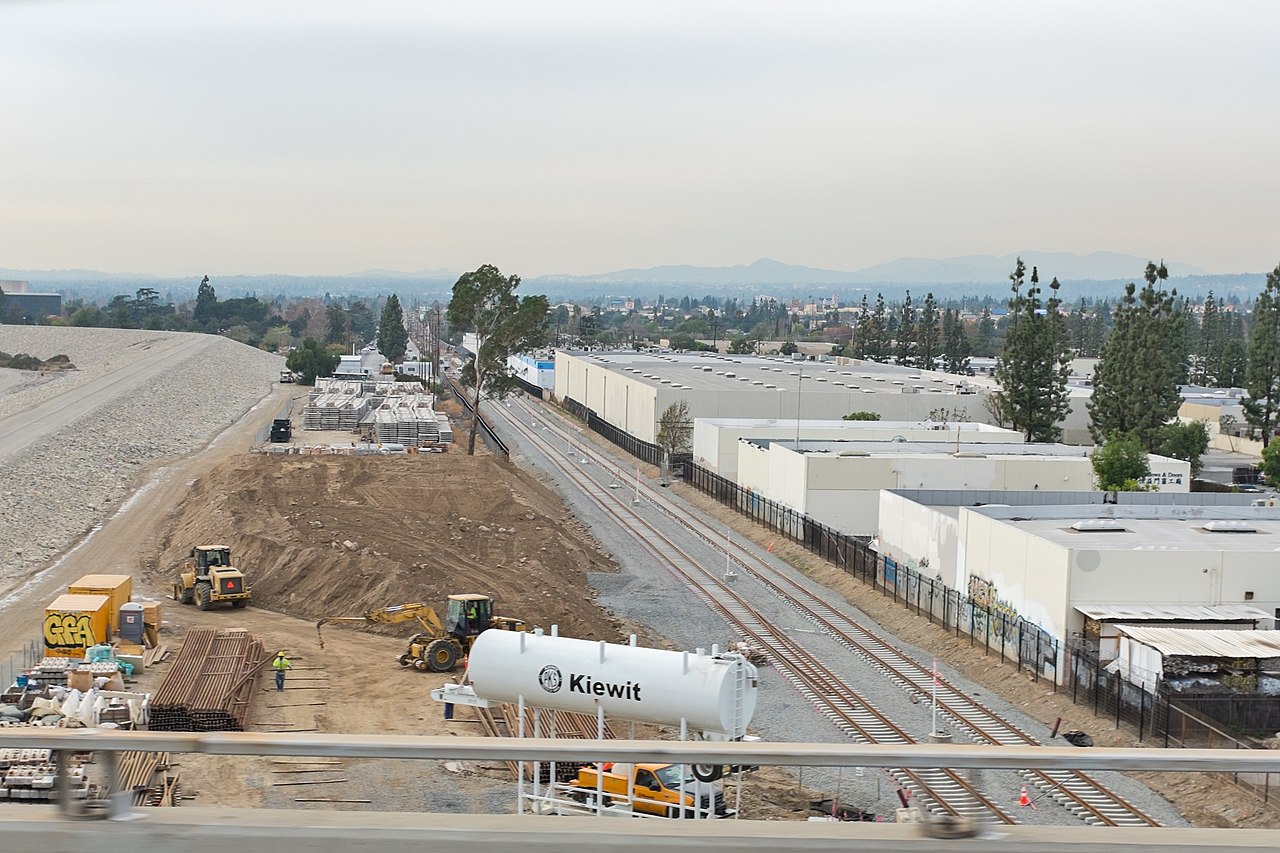
 Foothill Freeway overpass east of Sierra Madre Villa station | |
| Overview | |
| Other name(s) | Blue Line (1990–2019) Gold Line/L Line (north of Little Tokyo/Arts District) |
| Owner | Los Angeles County Metropolitan Transportation Authority |
| Line number | 801 |
| Termini | |
| Stations | 44 (4 more under construction) |
| Website | metro.net/riding/guide/a-line |
| Service | |
| Type | Light rail |
| System | Los Angeles Metro Rail |
| Depot(s) | Division 11 (Long Beach) Division 24 (Monrovia) |
| Rolling stock | Kinki Sharyo P3010 or AnsaldoBreda P2550 running in 2- or 3-car consists |
| Daily ridership | 60,423 (weekday, October 2023) |
| Ridership | 15,069,823 (2023) |
| History | |
| Opened | July 14, 1990 |
| Technical | |
| Line length | 48.5 mi (78.1 km)[2] |
| Number of tracks | 2 (except single track Long Beach loop) |
| Character | Mostly at-grade in private right-of-way, with some street-running, elevated and underground sections |
| Track gauge | 4 ft 8+1⁄2 in (1,435 mm) standard gauge |
| Electrification | Overhead line, 750 V DC |
| Operating speed | 55 mph (89 km/h) (max.) 24 mph (39 km/h) (avg.) |
The A Line (formerly, from 1990 to 2019, and colloquially known as the Blue Line)[3][4] is a 48.5-mile (78.1 km) light rail line in Los Angeles County, California. It is one of the six lines of the Los Angeles Metro Rail system, operated by the Los Angeles County Metropolitan Transportation Authority (Metro). The A Line serves 44 stations and runs east-west between Azusa and Pasadena, then north-south between Pasadena and Long Beach. It interlines and shares five stations with the E Line in Downtown Los Angeles. Service operates for approximately 19 hours with headways of up to 8 minutes during peak hours. The A Line is currently the longest light rail line in the world.
The A Line is the oldest and busiest light rail line in the Los Angeles Metro Rail system, carrying an average of 60,423 riders on weekdays in October 2023. Its initial segment from Long Beach to Downtown Los Angeles opened in 1990, using much of the original right-of-way of the Long Beach Line, a former Pacific Electric interurban line. The line became heavily used, prompting the implementation of capacity and reliability improvements throughout its alignment. A plan to extend the line north to Pasadena in the San Gabriel Valley surfaced in the 1980s but was canceled due to funding constraints. The Gold Line (renamed the L Line in 2020) light rail line opened in 2003, completing part of the planned extension from Union Station to Pasadena. It was extended east to Azusa in 2016.
The northern extension was revived as part of the Regional Connector project in the early 2000s, and construction began in 2014. The project enabled A Line trains to run to the San Gabriel Valley via a new downtown tunnel connecting the A Line tracks to the L Line tracks. The A Line's current Azusa–Long Beach service was introduced in June 2023 with the opening of the Regional Connector, incorporating the Union Station–Pasadena–Azusa portion of the former L Line. Construction is underway to extend the A Line further east to Pomona and Montclair.
Service description

Route description
The A Line runs 48.5 miles (78.1 km)[2] between Azusa and Downtown Long Beach, serving 44 stations. It is the longest light rail line in the world, surpassing the Coast Tram in Belgium.[5]
The line's northern terminus is at APU/Citrus College station just west of Citrus Avenue and north of the two universities. The line runs west through Azusa before stopping at Azusa Downtown station at Azusa Avenue, north of Foothill Boulevard. Continuing west, the line crosses over the I-210 freeway and runs parallel to it, entering Irwindale before stopping at Irwindale station at Irwindale Avenue. After this station, the line continues west, crossing over the San Gabriel River and underneath the I-605 freeway, diverging from I-210 and entering Duarte, before stopping at Duarte/City of Hope station located on the north side of Duarte Road, across from the City of Hope National Medical Center.
Continuing west, the line parallels Duarte Road, entering Monrovia, before diverging northwest just before arriving at Monrovia station. Entering Arcadia, the line crosses all street crossings on bridges except for First Avenue at the at-grade Arcadia station. Continuing west, the line reconverges with and enters the median of I-210 and continues west to Sierra Madre Villa station in Pasadena. Six stations serve different parts of Pasadena, with three of them in the freeway's median. In Old Pasadena, the line travels underground for almost half a mile, passing under Pasadena's main thoroughfare, Colorado Boulevard, which makes the Memorial Park station below grade. The station serves most of Pasadena's fine dining, shops, malls, and civic center. The line continues south through downtown Pasadena and South Pasadena, primarily at grade. North of Highland Park, the line crosses over the Arroyo Seco Parkway (State Route 110) via the Santa Fe Arroyo Seco Railroad Bridge towards Highland Park.
After Highland Park station, the line runs in the median of Marmion Way, where trains go at only 20 miles per hour (32 km/h). After 50th Avenue, the line runs primarily at grade in its own right-of-way, except for a short tunnel underneath the intersection of Figueroa Street and Pasadena Avenue. From here, the line continues, with a handful of stations serving the hillside areas north of downtown, including Lincoln Heights, Mount Washington, and the Southwest Museum of the American Indian. Northeast of Chinatown, the line crosses over the Los Angeles River on an elevated viaduct. Continuing on the elevated viaduct, the line stops at Chinatown station before arriving at Union Station. This entire section of the line north of Union Station follows the current and former right-of-way of the Pasadena Subdivision.
At Union Station, riders can transfer to other trains and modes.
Transfers include:
- The B and D rapid transit lines.
- The J bus rapid transit line.
- Other bus services.
- Metrolink commuter rail.
- Amtrak inter-city services.
South of Union Station, trains use the Regional Connector through Downtown Los Angeles. In Little Tokyo, the line enters the new tunnel north of Temple Street to serve the replacement underground Little Tokyo/Arts District station, where the line merges with the E Line. The two lines turn west to run under 2nd Street and the 2nd Street Tunnel, as well as the B and D lines, with clearances as low as 7 feet (2.1 m). The Regional Connector tunnel connects to the north end of 7th Street/Metro Center station, the former northern terminal of the A Line. The line continues south along Flower Street, transitioning from underground to street level at 11th St. Passengers can connect to the bus rapid transit J Line at 7th Street/Metro Center, Pico, and Grand/LATTC stations.
The A and E Lines diverge at Flower Street and Washington Boulevard. E Line trains continue south along Flower Street, and the A Line turns east onto Washington Boulevard before turning south into the former Pacific Electric right-of-way at Long Beach Avenue. This historic rail corridor has four tracks, two for A Line trains and two for freight trains. Along the corridor, there are some flyovers to either eliminate grade crossings in more densely populated areas or pass over diverging freight tracks. Passengers can connect with the C Line at the Willowbrook/Rosa Parks station. Just south of Willow station, A Line trains exit the rail corridor and begin street running in the median of Long Beach Boulevard into the city of Long Beach, where trains travel through the Long Beach Transit Mall while making a loop using 1st Street, Pacific Avenue, and 8th Street.
Hours and frequency
A Line service hours are from approximately 4:30 a.m. and 11:45 p.m daily. Trains operate every 8 minutes during peak hours, Monday through Friday. During weekday midday and weekends from 9:00 a.m. to 7:00 p.m., trains run every 10 minutes. Night and early morning service is approximately every 20 minutes every day.[6]
| Time | 4A | 5A | 6-7A | 8A-1P | 2-6P | 7P | 8P-12A |
|---|---|---|---|---|---|---|---|
| Weekdays | 20 | 8-20 | 8 | 10 | 8 | 10-20 | 20 |
| Weekends/Holidays | 20 | 8-20 | 10 | 10-20 | 20 | ||
Speed
The full travel time of the 48.5-mile (78.1 km)[2] line is approximately two hours, including a brief layover at Union Station to change train crews. Southbound trips over the full line are scheduled at 1 hour and 55 minutes, with northbound trips scheduled at 1 hour and 55 minutes.[7]
The line's scheduled average speed is approximately 25–26 miles per hour (40–42 km/h). Top speeds on the line vary, from below 10 miles per hour (16 km/h) at surface level in Downtown Los Angeles, to 55 miles per hour (89 km/h) on grade-separated infrastructure.[8]
Station listing
The following is the complete list of stations, from north to south.
| Station | Date Opened | City/Neighborhood | Major connections and notes[9][10] |
|---|---|---|---|
| APU/Citrus College | March 5, 2016 | Azusa | Park and ride: 200 spaces |
| Azusa Downtown | Park and ride: 521 spaces | ||
| Irwindale | Irwindale | Park and ride: 350 spaces | |
| Duarte/City of Hope | Duarte | Park and ride: 125 spaces | |
| Monrovia | Monrovia | Park and ride: 350 spaces | |
| Arcadia | Arcadia | Park and ride: 300 spaces | |
| Sierra Madre Villa | July 26, 2003 | Pasadena | Park and ride: 965 spaces |
| Allen | |||
| Lake | Park and ride: 22 spaces | ||
| Memorial Park | |||
| Del Mar | Park and ride: 610 spaces | ||
| Fillmore | Park and ride: 155 spaces | ||
| South Pasadena | South Pasadena | Park and ride: 142 spaces | |
| Highland Park | Los Angeles (Highland Park) | ||
| Southwest Museum | Los Angeles (Mount Washington) | ||
| Heritage Square | Los Angeles (Montecito Heights) | Park and ride: 129 spaces | |
| Lincoln/Cypress | Los Angeles (Lincoln Heights/Cypress Park) | Park and ride: 94 spaces | |
| Chinatown | Los Angeles (Chinatown) | ||
| Union Station | Los Angeles (Downtown) | Paid parking: 3,000 spaces | |
| Little Tokyo/Arts District | November 15, 2009 | Los Angeles (Little Tokyo/Arts District) | |
| Historic Broadway | June 16, 2023 | Los Angeles (Downtown) | |
| Grand Avenue Arts/Bunker Hill | |||
| 7th Street/Metro Center | February 15, 1991 | ||
| Pico | July 14, 1990 | ||
| Grand/LATTC | |||
| San Pedro Street | South Los Angeles | ||
| Washington | |||
| Vernon | |||
| Slauson | |||
| Florence | Florence-Graham | Park and ride: 116 spaces | |
| Firestone | |||
| 103rd Street/Watts Towers | Watts | Park and ride: 64 spaces | |
| Willowbrook/Rosa Parks station | Willowbrook | Park and ride: 234 spaces | |
| Compton | Compton | ||
| Artesia | Park and ride: 288 spaces | ||
| Del Amo | Carson | Park and ride: 362 spaces | |
| Wardlow | Long Beach | Park and ride: 139 spaces | |
| Willow Street | Park and ride: 927 spaces | ||
| Pacific Coast Highway | |||
| Anaheim Street | |||
| 5th Street (southbound only) |
September 1, 1990 | ||
| 1st Street (southbound only) |
|||
| Downtown Long Beach (northbound only) |
|||
| Pacific Avenue (northbound only) |
Ridership
| Year | Ridership | %± |
|---|---|---|
| 2009 | 25,735,979 | — |
| 2010 | 25,119,753 | −2.4% |
| 2011 | 26,053,645 | +3.7% |
| 2012 | 28,959,483 | +11.2% |
| 2013 | 28,185,745 | −2.7% |
| 2014 | 27,276,468 | −3.2% |
| 2015 | 24,457,253 | −10.3% |
| 2016 | 24,988,825 | +2.2% |
| 2017 | 22,383,828 | −10.4% |
| 2018 | 19,836,016 | −11.4% |
| 2019 | 8,905,140 | −55.1% |
| 2020 | 9,290,318 | +4.3% |
| 2021 | 9,099,416 | −2.1% |
| 2022 | 10,663,617 | +17.2% |
| 2023 | 15,069,823 | +41.3% |
| Source: Metro[11] | ||
Graphs are unavailable due to technical issues. There is more info on Phabricator and on MediaWiki.org. |
History


Long Beach Line
Much of the initial segment of the A Line from Downtown Los Angeles to Long Beach follows the route of the Pacific Electric's Long Beach Line, which ended service in 1961. The old route gave the new light rail trains a private right-of-way between Washington and Willow Street stations allowing them to reach higher speeds between stops.[12]
The line initially opened as the Blue Line on Saturday, July 14, 1990, and ran from Pico to Anaheim Street. The Long Beach Loop section to Long Beach opened in September 1990,[13] followed by the tunnel into 7th Street/Metro Center in February 1991.[14] The initial light rail segment cost US$877 million ($2.05 billion in 2023 adjusted for inflation).[15]
The route reached full capacity after one decade of service, and from 1999 to 2001, the Blue Line underwent a US$11 million project to lengthen 19 of its platforms to accommodate three-car trains.[16] There were also plans since the 1980s to extend the Blue Line north to Pasadena but the connection through downtown was postponed due to funding constraints from the voter-approved 1998 Proposition A. That new law restricted local county subway funding, halting the process of Blue Line and other rail transit projects from advancing.[17]
The Blue Line was renovated in 2019, with the southern half of the line being closed for the first five months and the northern half closing for the following five months (10 months total). Metro provided a bus shuttle service to compensate for the lack of rail service. Metro officially reopened the line on November 2, 2019, rebranding it as the A Line.[3][4][18] The renovation helped improve the line's speed and reliability by replacing and modernizing old tracks, signals, train control systems, and bridges.[19]
Pasadena Blue Line

Much of the A Line's right-of-way north of Union Station through the San Gabriel Valley was built by the Los Angeles and San Gabriel Valley Railroad in 1885. It was eventually taken over by the Atchison, Topeka and Santa Fe Railway, as part of the Pasadena Subdivision, which saw Amtrak service until 1994, when construction began on the conversion to light rail.[20] The light rail project was initially called the "Pasadena Metro Blue Line."[21]
Planners envisioned extending the existing Blue Line (A Line) north of 7th Street/Metro Center, but it was canceled due to funding shortages. However, the mostly above-ground segment of the extension from Union Station to Pasadena advanced and began construction in 1994 as a separate line but was suspended again by 1998 due to the Proposition A ban.[22][23] Later that year, a bill was authorized to create a new independent construction authority to finish the line. The agency, now known as the Foothill Gold Line Construction Authority, resumed light rail construction in 2000 and completed the line three years later.[21]
The now-renamed Gold Line, between Union Station and Sierra Madre Villa station in East Pasadena, opened on July 26, 2003.[24]
Foothill Extension
In 2016, the Gold Line was extended east from Pasadena as part of Phase 2A (Phase 1 was the initial Los Angeles to Pasadena segment) of the Foothill Extension, running between Sierra Madre Villa and APU/Citrus College stations in Azusa. The extension was constructed by the Foothill Gold Line Construction Authority and added six new stations to the Gold Line serving the cities of Arcadia, Monrovia, Duarte, Irwindale, and Azusa. A groundbreaking ceremony for Phase 2A was held on June 26, 2010; construction began the following summer and was completed in September 2015, with the extension entering service on March 5, 2016.[25][26]
Like other lines in the Los Angeles Metro system, the Gold Line's designation became a letter in 2020. This was the beginning of a process where all Metro Rail and Busway lines would be identified by a letter name rather than a system of colors. The Gold Line was renamed to the L Line.[27]
Regional Connector

The Regional Connector Transit Project constructed a 1.9-mile (3.1 km) light rail tunnel across Downtown Los Angeles that connected A and E lines to the L Line, with the purpose of reducing transfers and travel times through downtown. The project completed the late 1990’s vision of the "Pasadena Blue Line," connecting the northern (Union Station–Azusa) segment of the L Line to the A Line. This enabled A Line trains to run from Long Beach to Azusa through the new tunnel. The southern (Pico/Aliso–East LA) segment was combined with the existing E Line between Downtown Los Angeles and Santa Monica. The new east-west line kept the E Line name but uses the L Line's gold color.[28] Two new stations were also constructed in the tunnel, providing more service to destinations and communities in Downtown Los Angeles.[29]
Formal studies and planning for the Regional Connector began in 2004 and was approved in 2012. A groundbreaking ceremony was held on September 30, 2014, marking the start of major construction.[30] To accommodate the new tunnel, the existing at-grade L Line Little Tokyo/Arts District station was demolished in 2020 and rebuilt as a subway station approximately 500 feet (150 m) south and on the opposite side of Alameda Street from its former location. Starting on April 9, 2023, the A, E, and L Line trains ran through the Regional Connector tunnel for final testing.[31] The project officially opened for revenue service on June 16, 2023.[32]
Once the Regional Connector was completed, the alignment of the L Line was split into two parts at Little Tokyo/Arts District station, with the portion north of the station joined to the A Line, extending it to connect Long Beach with Azusa. The alignment east of Little Tokyo/Arts District station was assigned to the E Line, extending it to connect Santa Monica and East Los Angeles directly. At this time, the L Line ceased to exist as a separate line.[33]
Future developments
Foothill Extension
Phase 2B of the Foothill Extension, running between APU/Citrus College station in Azusa and the Pomona–North Metrolink station in Pomona, is currently under construction, with a current estimated completion in 2025.[34] This extension, like the original Gold Line to Pasadena, and the first phase of the Foothill Extension is being built by the Foothill Gold Line Construction Authority. The original plan called for the extension to end at Montclair in San Bernardino County, but budget challenges forced the construction authority to cut the line back to Pomona.
It is served by the A Line due to the completion of the Regional Connector project on June 16, 2023.[32]
Southeast Gateway Line
The Southeast Gateway Line is a planned light rail line, mostly following the Pacific Electric's historic West Santa Ana Branch, connecting Downtown Los Angeles to the city of Artesia, along with other cities in southeastern Los Angeles County. It will link the southeast/Gateway cities with the A Line at Slauson station (A Line) station. Construction is planned to begin in 2025 with service starting in 2035. Metro estimates it will take 10 years to build.[35]
Current issues
Capacity limits

The A Line often operates at capacity, and various options to increase capacity have been considered, such as four-car or more frequent trains. Both have problems: it would be difficult or impossible to lengthen some of the station platforms, and the number of trains already causes delays for other vehicles at level crossings. Since the opening of the Regional Connector, ridership on the A Line continues to increase, potentially resulting in even more capacity problems.[36]
Safety at level crossings

Over 120 motorists and pedestrians have been killed at A Line level crossings since 1990. There have been more than 800 collisions,[37][38] making the line easily the country's deadliest and most collision-prone rail line.[39]

In 1998, the MTA commissioned Booz Allen Hamilton, Inc. to evaluate the cause of Blue Line collisions and recommend affordable solutions. The study reported the high ridership (over 70,000 per day) was a contributor:
The MBL has one of the highest ridership counts for light rail lines in the Country. This factor is perhaps the most important contributor to the grade-crossing accident rate. The high ridership results in increased pedestrian traffic near stations compared to other light rail systems. In addition, although MTA Operations does not allow high passenger loads to dictate safe operations, there is pressure to maintain travel times and headway schedule requirements (e.g., a passenger trip from Los Angeles to Long Beach in less than one hour).
Other contributing factors identified were the high population density leading to more pedestrian and vehicular traffic around the tracks, the diverse, varied socio-economic community around the line that creates literacy and language difficulties for public education campaigns, driver frustration due to the slow traffic speeds around the line that leads to more risk-taking behavior, and the shared right-of-way with freight traffic in the fastest running section from Washington station to Willow station, where trains operate at a maximum of 55 mph (89 km/h) between stations.[40]
Due to this, Metro started in the early 2000s to install four-quadrant gates at crossings where the A Line shares the right-of-way with freight rail between Willowbrook station and Artesia station. The gates prevent drivers from going around lowered gates.[41] Metro also improved the safety of the A Line's pedestrian crossings in 2015.[42]
Operations
On Metro Rail's internal timetables, the A Line is called line 801.
Because of the length of the line, operators do not take trains from end to end, swapping out at Union Station. Trains are operated between APU/Citrus College and Union Station by employees based at Division 24 in Monrovia. Between Long Beach and Union Station, operators are based out of Division 11 in Rancho Dominguez.[43]
Maintenance facilities
The A Line is operated out of two divisions, Metro’s term for train maintenance and storage facilities.[43]
Division 11 is located at 4350 East 208th Street in Cota, North Long Beach between Del Amo and Wardlow stations. The facility can house and maintain 86 light rail vehicles and can perform heavy maintenance including repainting. Trains get to this yard via a wye junction on the southbound tracks. Northbound trains can enter and exit the yard via the cross tracks on the north and south sides of the junction.
Division 24 is located south of the I-210 freeway in Monrovia between Monrovia and Duarte/City of Hope stations. Just like Division 11, trains access the yard via the westbound/southbound tracks from either direction of its wye junction. Crossovers from the eastbound track to the yard junction are located near the California Avenue and Mountain Avenue railroad crossings.[44]
Rolling stock

.jpg)
.jpg/1280px-19951007_03_LRT_Long_Beach_Blvd._@_20th_(5378831405).jpg)
The A Line operates trains with three light rail vehicles on weekdays and two on weekends.[43] The line currently uses two different types of light rail vehicles: the Kinki Sharyo P3010 and the AnsaldoBreda P2550, but has seen every type of light rail rolling stock on Metro's roster throughout its history of operation.
When the A Line, then known as the Blue Line, first opened in 1990, the line had 54 Nippon Sharyo P865 light rail vehicles, numbered 100–153. These cars wore a unique livery of several blue stripes and a single red stripe, reflecting the Blue Line's color designation and its Pacific Electric Red Car heritage.
In 2000, Metro transferred all 15 Nippon Sharyo P2020 (numbered 154-168) light rail vehicles from the Green Line (now the C Line) to the Blue Line fleet. These light rail vehicles were nearly identical to the older P865 model but were about five years newer and originally had equipment for automatic train operation.[45]
In 2012, Metro transferred some Siemens P2000 light rail vehicles from the Gold Line to the A (then Blue) Line fleet. These vehicles were used before their refurbishment. As of 2023, some are currently being tested on the A Line.
In 2017, the Blue Line received 78 Kinki Sharyo P3010 light rail vehicles, the first new cars for the line since it opened in 1990. As the P3010 fleet was introduced, Metro gradually retired all of the remaining P865 light rail vehicles, followed by the P2020 fleet.
In 2023, the AnsaldoBreda P2550 light rail vehicles began service on the A Line. The P2550 trains were tested on the Blue Line in 2009, but were instead assigned to the Gold Line due to weight restrictions.[46]
References
- ^ "Interactive Estimated Ridership Stats". Los Angeles County Metropolitan Transportation Authority. Archived from the original on December 8, 2023. Retrieved December 30, 2023.
- ^ a b c "Facts At A Glance". Los Angeles County Metropolitan Transportation Authority. June 2023. Archived from the original on March 19, 2023. Retrieved June 22, 2023.
- ^ a b Fonseca, Ryan (September 25, 2019). "Ignore Those 'Line A' Signs. Metro's Blue Line Will Reopen As The 'A Line'". laist.com. Southern California Public Radio. Archived from the original on September 26, 2019. Retrieved September 26, 2019.
- ^ a b Nelson, Laura J. (October 17, 2019). "Light rail to Long Beach will reopen soon — but it won't be called the Blue Line". Los Angeles Times. Archived from the original on October 18, 2019. Retrieved October 18, 2019.
- ^ Morino, Douglas (June 23, 2023). "L.A. Opens Its New Light-Rail Link". The New York Times. Retrieved July 26, 2023.
- ^ "Metro A Line schedule". Los Angeles County Metropolitan Transportation Authority. December 10, 2023. Retrieved December 25, 2023.
- ^ "Metro A Line Timetable" (PDF). Los Angeles County Metropolitan Transportation Authority. December 10, 2023.
- ^ Sharp, Steven (February 23, 2021). "Metro staff provides update on effort to speed up street-running light rail". Urbanize LA. Retrieved March 2, 2024.
- ^ "Metro A Line (Blue)". www.metro.net. Archived from the original on September 28, 2020. Retrieved July 23, 2020.
- ^ "Metro Parking Lots by Line". www.metro.net. Archived from the original on August 10, 2020. Retrieved July 23, 2020.
- ^ "Metro Ridership". Metro.net. Los Angeles County Metropolitan Transportation Authority. March 2023. Archived from the original on April 10, 2021. Retrieved March 10, 2023.
- ^ Reft, Ryan (February 26, 2015). "A Clear Blue Vision: L.A. Light Rail Transit and Twenty-Five Years of the Blue Line". KCET. Archived from the original on February 8, 2021. Retrieved February 8, 2021.
- ^ "New Long Beach Loop". The Los Angeles Times. September 1, 1990. p. B10. Archived from the original on March 23, 2023. Retrieved December 14, 2022 – via Newspapers.com.

- ^ Curiel, Socorro C. (1991). "Los Angeles County Transportation Commission Joins SHPE Strategic Technical Employment Program (STEP)". Society of Hispanic Professional Engineers. Hispanic Engineer (Fall 1991). Career Communications Group, Inc.: 20. Archived from the original on March 23, 2023. Retrieved November 19, 2013.
- ^ "Facts at a Glance". Los Angeles County Metropolitan Transit Authority. November 18, 2013. Archived from the original on August 20, 2019. Retrieved November 16, 2013.
- ^ "MTA Starts 3-Car Train Service on Busy Metro Blue Line". www.metro.net. Archived from the original on June 3, 2021. Retrieved January 22, 2020.
- ^ Rabin, Jeffrey L. (October 18, 1998). "SPECIAL REPORT * As critics move to cut subway funding, supporters deride the measure as shortsighted. The MTA awaits voters' decision because . . . : Approval of Prop. A Would Chart a New Course for Transportation". Los Angeles Times. Retrieved April 14, 2024.
- ^ "A Line". www.metro.net. Archived from the original on October 18, 2019. Retrieved November 18, 2019.
- ^ Hymon, Steve (October 17, 2019). "Metro reopens the A Line (Blue) on Saturday, Nov. 2, with three days of free rides on refurbished line". The Source. Retrieved April 13, 2024.
- ^ "The Last Train Out". Pasadena Star-News. January 15, 1994. p. 1. Retrieved April 13, 2024 – via Newspapers.com.
- ^ a b "Construction Authority". Foothill Gold Line. Retrieved April 13, 2024.
- ^ "MTA Breaks ground on Pasadena Blue Line - Third Light Rail System In Metro Rail Network" (PDF). Los Angeles County Metropolitan Transportation Authority. April 8, 1994. Retrieved April 13, 2024.
- ^ Claiborne, William (June 10, 1998). "L.A. SUBWAY TESTS MASS TRANSIT'S LIMITS". Washington Post. ISSN 0190-8286. Retrieved April 14, 2024.
- ^ Streeter, Kurt (June 19, 2003). "Gold Line Is Set to Open July 26". Los Angeles Times. Archived from the original on March 14, 2016. Retrieved March 14, 2016.
- ^ "Pasadena to Azusa". Foothill Gold Line. Retrieved April 12, 2024.
- ^ Scauzillo, Steve (February 17, 2015). "Gold Line authority makes push for next extension from Azusa to Montclair". San Gabriel Valley Tribune. Archived from the original on March 13, 2016. Retrieved March 13, 2016.
- ^ "LA, meet our new lineup". www.metro.net. Retrieved December 23, 2023.
- ^ "LA Metro celebrates opening three new stations connecting the mountains to the beaches". CBS News. June 16, 2023. Retrieved July 27, 2023.
- ^ "The Regional Connector and three new downtown L.A. stations to open Friday, June 16, with a weekend of free rides!". The Source. May 23, 2023. Retrieved April 14, 2024.
- ^ Sotero, Dave (April 26, 2012). "Metro Board certifies final environmental study for Regional Connector". The Source. Retrieved December 22, 2023.
- ^ Metro, L. A. (March 29, 2023). "Heads up: Regional Connector train testing is underway — and you may see and hear some changes to trains on the A, E and L Lines". The Source. Retrieved June 20, 2023.
- ^ a b Von Quednow, Cindy (June 16, 2023). "Metro Regional Connector opens in Los Angeles, bringing more direct access to downtown". KTLA. Nexstar Media Group. Retrieved June 16, 2023.
- ^ Von Quednow, Cindy (June 16, 2023). "Metro Regional Connector opens in Los Angeles, bringing more direct access to downtown". KTLA. Nexstar Media Group. Retrieved June 16, 2023.
- ^ "Background". Foothill Gold Line. Retrieved April 14, 2024.
- ^ "Southeast Gateway Line (previously West Santa Ana Branch Transit Corridor)". LA Metro. Retrieved March 2, 2024.
- ^ Plummer, Caitlin (December 10, 2023). "Metro Light Rail Lines Are Running More Often To Serve More Riders. Here Are The Details". LAist. Retrieved April 14, 2024.
- ^ Nelson, Laura (March 28, 2015). "Metro light rail crash near USC renews debate on rail safety". Los Angeles Times. Archived from the original on October 19, 2015. Retrieved October 20, 2015.
- ^ "Summary of Blue Line Train/Vehicle and Train/Pedestrian Accidents". Los Angeles County Metropolitan Transportation Authority. June 2007.
- ^ "Light rail fatalities, 1990–2002". American Public Transportation Association. May 20, 2005. Archived from the original on September 26, 2010. Retrieved May 12, 2010.
- ^ "Evaluation of the Current Grade Crossing Safety Improvement Program of the Metro Blue Line" (PDF). Los Angeles County Metropolitan Transportation Authority. November 2, 1998. p. 32. Retrieved April 14, 2024.
- ^ Rabin, Jeffry L. (April 25, 2000). "New Gates Approved for Blue Line Crossings". Los Angeles Times. Retrieved April 14, 2024.
- ^ Hymon, Steve (April 23, 2018). "Project to upgrade pedestrian safety at 27 Blue Line crossings is now complete". The Source. Retrieved April 14, 2024.
- ^ a b c "Regional Connector Slides for Customer Service Briefings". Los Angeles County Metropolitan Transportation Authority. Retrieved June 21, 2023.
- ^ "Operating Divisions and Major Facilities" (PDF). Los Angeles County Metropolitan Transportation Authority. 2016. Retrieved April 14, 2024.
- ^ "Archived copy". Archived from the original on October 25, 2007. Retrieved October 22, 2007.
{{cite web}}: CS1 maint: archived copy as title (link) - ^ Blake, Tagan; Isaac, Lauren; Rose, David (September 2013). Managing Railcar Maintenance: A Primer on Practices and Improvement Opportunities for the U.S. Transit Industry (PDF) (Report). Federal Transit Administration. p. 72.
External links
- Los Angeles County Metropolitan Transportation Authority
- Blue Line homepage Archived January 16, 2010, at the Wayback Machine
- Blue Line schedule Archived June 25, 2013, at the Wayback Machine
- Blue Line connections overview
- A History of the Blue Line: A Light Rail Success Story Archived July 29, 2007, at the Wayback Machine by the Transit Coalition
- Killing Time on the Ghetto Blue from the LA Weekly
- Delivery of The First Metro Blue Line Vehicle
| |
| |
| |
| Services |
|  | ||||||||||||
|---|---|---|---|---|---|---|---|---|---|---|---|---|---|---|
| Stations | ||||||||||||||
| Bus lanes | ||||||||||||||
| Capital projects |
| |||||||||||||
| Fleet | ||||||||||||||
| Other information | ||||||||||||||