1902 Turkestan earthquake
| UTC time | 1902-08-22 03:00:22 |
|---|---|
| ISC event | 16957769 |
| Local date | August 22, 1902 |
| Local time | 09:00:22 |
| Magnitude | 7.7 Mw |
| Depth | 18.0 km (11.2 mi) |
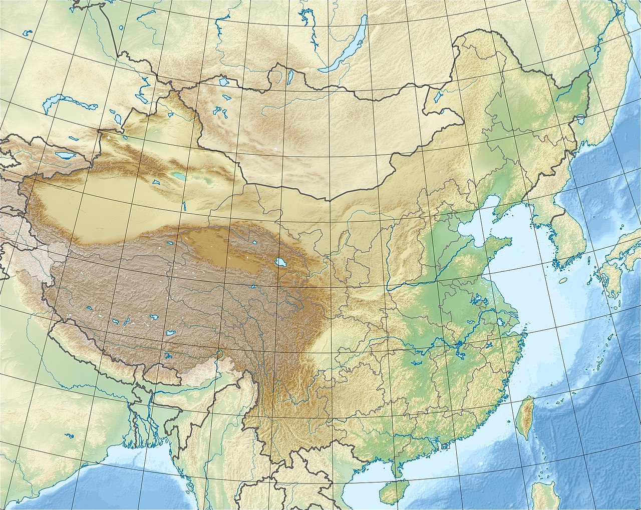
| Epicenter | 39°52′N 76°25′E / 39.87°N 76.42°E / 39.87; 76.42 |
| Type | Thrust |
| Areas affected | China & Kyrgyzstan |
| Max. intensity | RFS X (Extremely high intensity tremor) |
| Aftershocks | Many. Largest was a Ms 6.8–7.3 |
| Casualties | 5,650–10,000 dead |

The 1902 Turkestan earthquake (also known as the Artush or Kashgar earthquake) devastated Xinjiang, China, near the Kyrgyzstan border. It occurred on August 22, 1902, at 03:00:22 (09:00:22 local time) with an epicenter in the Tien Shan mountains.[1] The thrust earthquake measured 7.7 on the moment magnitude scale (Mw ) and had a depth of 18 km (11 mi).
The Tien Shan mountains is situated in a zone of complex convergence caused by the Indian–Eurasian plate interaction. This zone is actively deforming—accommodated by active thrust faults responsible for seismic activity. The mainshock was preceded by an intense series of foreshocks in the years prior. Many aftershocks followed, several were larger than magnitude 6.0 and the largest measured 6.8–7.3. Aftershocks were recorded for three years. Additional shocks were recorded over a decade after the mainshock.
An estimated 5,650–10,000 people were killed in the mainshock. Widespread destruction occurred—at least 30,000 homes were destroyed. Shaking was felt across an area of 927,000 km2 (358,000 sq mi). The effects of the earthquake led government officials to relieve victims of taxes and provide compensation.
Tectonic setting
The Pamir–Tien Shan region is situated in a broad deformation zone caused by the ongoing collision of the Indian Plate with the Eurasian Plate. This deformation led to the formation of the Tien Shan mountains.[2] Its formation began in two stages during the Paleozoic era—first (southern Tien Shan) in the Late Devonian–early Carboniferous and later (northern Tien Shan) in the late Carboniferous–early Permian. [3] Before the Indian subcontinent collided with Eurasia, there were island arcs and microcontinents (terranes) between the two landmasses. These terranes were later accreted to Eurasia as the northward-moving Indian subcontinent collided, and are now in present-day Central Asia. The collision of terranes and island arcs as well as the collision with Eurasia eventually formed the Tien Shan mountains. Ancient suture zones mark the boundary where these collisions took place.[3][4] The region is dominated by large, north and south dipping thrust faults along the southern edge of the Tien Shan mountains, and the northern boundary of the Tarim Basin.[2] The Tien Shan actively accommodates crustal shortening by underthrusting of the Tarim Basin in the south and overthrusting of the Pamirs in the west southwest. Most of the 20 ± 2 mm (0.787 ± 0.079 in)/year shortening is accommodated along its southern boundary. The northwestern Tien Shan is seismically active—earthquakes are caused by thrust faulting and usually have shallow focal depths of 15 km (9.3 mi) or less.[5]
Earthquake

The mainshock was recorded on seismographs across Europe.[6] It was also instrumentally recorded in Cape Town, Toronto, Irkutsk, and Christchurch.[7] It is the largest and earliest instrumentally recorded earthquake in the Tien Shan region.[8] Previously thought to have a seismic magnitude exceeded 8,[5][9] such as in Chinese earthquake catalogs which placed the surface-wave magnitude (Ms ) at 8.25 (written as 81⁄4).[10] Seismologists Beno Gutenberg and Charles Francis Richter assigned mb (body wave magnitude) 7.9 and Ms 8.6, respectively.[11] Due to the sparse network of seismic instruments to record the mainshock, its magnitude was greatly overestimated.[12] In 2017, the magnitude was recalculated to Mw 7.7 ± 0.3 and Ms 7.8 ± 0.4, at a focal depth of 18 km (11 mi). The epicenter was also relocated (39°52′N 76°25′E / 39.87°N 76.42°E / 39.87; 76.42) further east from previous determinations (40°00′N 77°00′E / 40.0°N 77.00°E / 40.0; 77.00).[5]
Characteristics
Scientific knowledge of the earthquake was limited due to the period when it happened. Academic research into the event spanned nearly 40 years, but due to the inaccessible location, understanding its characteristics was a challenge. Strike-slip and thrust faulting was previously suggested as the mechanism of this earthquake. The lack of an agreement on its source is due to the complex tectonic setting.[13]
The Ttiotegongbaizi–Aerpaleike Fault (TAF) located at the southern flanks of the Tien Shan range,[14] near the western part of the larger Kalpin fold and thrust belt, was postulated as the source fault.[5][15] This thrust fault is 200 km (120 mi) long, and has a gentle wave-shaped surface fault trace. It dips to the north at varying angles of 25° to 60°. For a magnitude 7.7 earthquake, a 110 km (68 mi) rupture is needed, and the dimensions of the TAF suggest it is large enough to be the source. The fault is within area with the highest seismic intensity based on observations. Thrust faulting was also indicated by the earthquake's focal mechanism, further supporting the theory. Field observations along the TAF found no trace of surface ruptures indicating the event was a blind thrust earthquake.[5] The same fault system was responsible for a Ms 6.9 earthquake in 1996.[16][17]
Also proposed was a steep-dipping left-lateral strike-slip boundary fault inferred to be the source. The proposed fault marks the boundary between the southwestern Tien Shan and northern Tarim Basin. However, no surface deformation supports the existence of strike-slip deformation in the area. Moreover, reflection seismology does not support the existence of fault with such a characteristic in the area.[13]
Scientists also proposed that the earthquake was the result of two thrust faults rupturing in succession of each other. Two sub-parallel surface ruptures trending north–northeast were identified and attributed to the earthquake. These surface ruptures were identified via field studies, digital elevation model data and remote sensing, which had a combined length of 108 km (67 mi). They were located along pre-mapped faults—namely the Autushi and Keketamu faults with lengths of 60 km (37 mi) and 48 km (30 mi), respectively. These faults located at the base of the Tien Shan and are exposed at the base of anticlines. These south-dipping faults displayed recent thrust faulting activity and thrust-related folds. A possible maximum vertical displacement of 2.9 ± 0.1 m (9 ft 6.2 in ± 3.9 in), and an average of 2.5 m (8 ft 2 in) was measured.[13]
Effects

The earthquake was felt strongly across Central Asia for 927,000 km2 (358,000 sq mi), extending from south of Tashkent to north of Almaty. In Xinjiang, it was felt in Yining, Ürümqi, Korla, Taxkorgan and Hotan. It had a maximum intensity of X on the Modified Mercalli, Rossi–Forel, and Medvedev–Sponheuer–Karnik scales.[10][18] Isoseismal X was felt over an elliptical area for 7,500 km2 (2,900 sq mi), in which the cities of Artux, Songtak, Halajun, and Ahu were within. Shaking occurred in an east–west direction at the southern base of the Tien Shan.[5] Isoseismal IX covered 18,200 km2 (7,000 sq mi), extending east–west from Wuqia to Karaqi. It was felt as far south in Kashgar, Shule, Shufu and Jiashi. Isoseismal VIII was felt in Kangsu, Toyun, Uqturpan, and Akto. It was also felt strongly in the counties of Yopurga, Kalpin, Yengisar and Maralbexi.[12][19][20]
Foreshocks
Seismicity in the area prior to the mainshock had been relatively high. Multiple earthquakes of ~Ms 6.0 occurred, however, a large 650 km (400 mi) seismic gap existed. Historical records of earthquakes date back up to 10 years before 1902. In 1892, an Ms 6.3 event struck southeast of the 1902 mainshock. After a Ms 7.5 earthquake struck Tashkorgan in 1895, seismicity progressed north towards Atushi. The city was affected by a destructive earthquake (Ms 6.0+) once every year from 1896 to 1898. This high rate of seismicity ceased from 1899 and leading to the mainshock. Between 10 and 20 days before the mainshock, an estimated magnitude 3.1 tremor was recorded at Upal.[21][19][12][20][22]
Aftershocks
Severe aftershocks were felt every day up till August 30.[6] There were at least 16 aftershocks with a recorded magnitude of 4.7 or greater from 1902 to 1926—eight were recorded within a month after the mainshock. The first recorded aftershock measuring Ms 6.1 occurred at 23:00 on August 22. Several aftershocks registered magnitude 6.0 or greater in the following years.[10] A Ms 6.8 or 7.3 aftershock occurred on August 30 with an epicenter 70 km (43 mi) from that of the mainshock.[23] By December 19, eight aftershocks were recorded with Ms between 5.7 and 6.4. There were few aftershocks recorded in 1905—possibly because earthquakes during this period went unrecorded. Strong earthquakes continued to rock the mainshock area for years—a Ms 5.8 in 1916, Ms 6.5 in 1919, and two Ms 5.0+ in 1920. The Tien Shan mountains was also the site of earthquakes in December 1906 and January 1911.[12][19][20]
Precursor activity
There were unusual noises, peculiar animal behaviors, lights and a change in the weather prior to the mainshock. In Ahu, two hours before the earthquake, cattle, horses, chickens, dogs, cats and other livestock made unusual sounds. In areas which would eventually experience intense (VIII–IX) shaking, animals ran, flew or barked. Loud sounds emitted from the ground and was heard in Maralbexi. The sounds were described as similar to thunder, an airplane or gun blasts. In Artux, it was heard from the west, while at Shule, it was heard from the north. Lights were observed at Jiashi, Shufu, Artux and other places within the meizoseismal area. At Jiashi, these were described as "fire" and "lightning". At Shufu, a meteor-like fireball was observed. The weather was also unusually windy and rainy—there was also hail shortly before the mainshock struck.[19][12][20]
Impact

The earthquake produced strong shaking for 1.5 minutes.[6] Between 5,650 and 10,000 people were killed[24] and more than 30,000 homes collapsed.[25] An additional 600 livestock including sheep, cattle, camels, and donkeys died.[25] In Ahu, all houses with the exception of one located on bedrock collapsed. More than 300 were killed in the township—about 20 percent of its population. The earthquake triggered massive landslides with an estimated volume exceeding 200,000 m3 (7,100,000 cu ft).[26][19][12]
In the meizoseismal area, trees swayed in a forceful manner such that their tips touched the ground. Some trees were uprooted or snapped. Many tents were affected. Ground slumping near a riverbank blocked roads and dammed streams. Water gushed out from many of the large fissures. The largest fissure measured 1 km (0.62 mi) long, several meters wide, and 3 m (9.8 ft) deep. Five hundred people died in the area. Many domesticated animals were also killed. Old springs dried up while new ones formed.[27]
In Kashgar, sun-dried brick walls and homes collapsed. Masonry buildings did not sustain serious damage.[6] Numerous fissures opened in the northern entrance of the city, where the city walls had toppled. Several historical monuments including the Xiangfei Tomb partially collapsed and fractured.[27] At least 667 people died and thousands more were injured in Kashgar.[6][28] In Artux, north of Kashgar, the earthquake collapsed nearly every home. Between 5,000 and 6,000 were killed in Artux. The Artux Grand Mosque, the first of its kind in Xinjiang, toppled. Up to half its city walls fell. At least 400 people perished in the village of Astyn, while in Jangi, 20 were killed.[29] In Yarkand, damage was lighter but two children died from toppled walls. Damage was reported in Naryn and At-Bashy but there were no fatalities.[6]
Valleys collapsed and many river channels were blocked, creating waterfalls and new springs. Most earth-constructed homes were destroyed in Songtak, and more than 50 people were killed. At Üstün Atux, 90 percent of its housing stock were destroyed. Several people died in Halajun. Forty deaths were recorded in Upal and the township lost 20 percent of its homes. A death toll exceeding 30 was recorded at Baykurut.[19]
Aftermath
Some villages spent four days burying dead bodies in the wake of the disaster. The Qing dynasty government provided pensions and tax exemptions for the victims. Recorded in Volume 566 of the Qing Shilu (Veritable Records of Qing), the Governor of Gansu and Xinjiang, Rao Yingqi, ordered an investigative committee to evaluate the situation and provide compensation. Guangxu Emperor also issued an edict for tax exemptions.[30]
See also
References
- ^ Krüger, Kulikova & Landgraf 2018.
- ^ a b Fu, Ninomiya & Guo 2010.
- ^ a b Bullen et al. 2001.
- ^ Jepson, Collins & Gillespie 2018.
- ^ a b c d e f Kulikova & Krüger 2017.
- ^ a b c d e f Oldham 1902.
- ^ British Association for the Advancement of Science 1903, p. 59.
- ^ Gutenberg 1956.
- ^ Avouac et al. 1993.
- ^ a b c Kulikova 2016.
- ^ Xiangmin 1994.
- ^ a b c d e f Zengjian & Zongjin 1988, p. 143–170.
- ^ a b c Chen et al. 2022.
- ^ Zhao, Li & Shen 2000.
- ^ Li, Ran & Gomez 2020.
- ^ He, Zheng & Shan 2001.
- ^ Jacob 2008.
- ^ Lauterbach et al. 2019.
- ^ a b c d e f Ren 2002, p. 157–205.
- ^ a b c d Guoying, Xiaohong & Aiguo 2011.
- ^ Weihua et al. 2018.
- ^ Xinjiang Uygur Zizhiqu Seismological Bureau 1985, p. 208–209.
- ^ "Centennial Earthquake Catalog". earthquake.usgs.gov. U.S. Geological Survey. Archived from the original on 30 May 2020. Retrieved 12 November 2021.
- ^ Utsu n.d.
- ^ a b "Earthquake Ruins in Atushi (1902)". Chinese Academy of Sciences. kepu.net.cn. Archived from the original on 2 January 2022. Retrieved 2 January 2022.
- ^ Junyuan 1996, p. 117–120.
- ^ a b National Geophysical Data Center / World Data Service (NGDC/WDS) (1972), Significant Earthquake Database (Data Set), National Geophysical Data Center, NOAA, doi:10.7289/V5TD9V7K, archived from the original on 2021-07-17, retrieved 2021-03-17
- ^ Wines 2009.
- ^ "Terrible earthquake in Turkestan". Manawatū Standard. Vol. XL, no. 7454. 20 Nov 1902. p. 2. Archived from the original on 29 September 2022. Retrieved 4 Feb 2021.
- ^ Aniwal & Kurban 2015.
Sources
- Fu, B.; Ninomiya, Y.; Guo, J. (2010). "Slip partitioning in the northeast Pamir–Tian Shan convergence zone" (PDF). Tectonophysics. 483 (3–4): 344–364. Bibcode:2010Tectp.483..344F. doi:10.1016/j.tecto.2009.11.003. Archived (PDF) from the original on 2020-05-16. Retrieved 2021-02-04.
- Oldham, R. D. (1902). "The Turkestan Earthquake of August 22". Nature. 67 (1723): 8–9. Bibcode:1902Natur..67....8O. doi:10.1038/067008c0. S2CID 3999927.
- British Association for the Advancement of Science (1903). "On seismological Stations abroad and in Great Britain" (PDF). Report of the British Association for the Advancement of Science (72nd Meeting). Archived from the original (PDF) on 11 April 2022.
- Gutenberg, B. (1956). "Great earthquakes 1896–1903". Eos, Transactions American Geophysical Union. 37 (5): 608. Bibcode:1956TrAGU..37..608G. doi:10.1029/TR037i005p00608.
- Avouac, J. P.; Tapponnier, P.; Bai, M.; You, H.; Wang, G. (1993). "Active Thrusting and Folding Along the Northern Tien Shan and Late Cenozoic Rotation of the Tarim relative to Dzungaria and Kazakhstan" (PDF). Journal of Geophysical Research: Solid Earth. 98 (B4): 6755–6804. Bibcode:1993JGR....98.6755A. doi:10.1029/92JB01963. Archived (PDF) from the original on 2021-10-27. Retrieved 2021-02-04.
- Kulikova, G. (2016). Source parameters of the major historical earthquakes in the Tien-Shan region from the late 19th to the early 20th century (PDF) (Dr. rer. nat. thesis). University of Potsdam. Archived (PDF) from the original on 2020-07-17. Retrieved 2022-03-28.
- Xiangmin, Z. (1994). "1902年与1906年两次新疆强震震级" [The magnitude of two strong earthquakes in Xinjiang in 1902 and 1906]. 地震地磁观测与研究: 16–21.
- Chen, Q.; Fu, B.; Shi, P.; Li, Z. (2022). Livio, F.; Ferrario, M. F. (eds.). "Surface Deformation Associated with the 22 August 1902 Mw 7.7 Atushi Earthquake in the Southwestern Tian Shan, Revealed from Multiple Remote Sensing Data". Remote Sensing. 14 (7). MDPI: 1663. Bibcode:2022RemS...14.1663C. doi:10.3390/rs14071663.
- Kulikova, G.; Krüger, F. (2017). "Historical seismogram reproductions for the source parameters determination of the 1902, Atushi (Kashgar) earthquake". Journal of Seismology. 21 (6): 1577–1597. Bibcode:2017JSeis..21.1577K. doi:10.1007/s10950-017-9683-z. S2CID 135031442. Archived from the original on 2018-06-14. Retrieved 2021-02-04.
- Aniwal, A.; Kurban, B. (2015). "清代新疆地震及政府对民间的救济" [The Xinjiang Earthquake in the Qing Dynasty and the Government's Relief to the People]. Journal of Northern Minzu University (Philosophy and Social Sciences Edition) (4): 44–48.
- Zhao, R.; Li, J.; Shen, J. (2000). "The preliminary study on active faults and paleoearthquakes in the north fringe of Kashi depression". Acta Seismologica Sinica. 13 (3): 351–355. Bibcode:2000AcSSn..13..351Z. doi:10.1007/s11589-000-0045-4. S2CID 129084815. Archived from the original on 2021-02-13. Retrieved 2021-02-04.
- Li, A.; Ran, Y.; Gomez, F. (2020). "Segmentation of the Kepingtage thrust fault based on paleoearthquake ruptures, southwestern Tianshan, China". Natural Hazards. 103 (1): 1385–1406. Bibcode:2020NatHa.103.1385L. doi:10.1007/s11069-020-04040-6.
- He, Y.; Zheng, T.; Shan, X. (2001). "March 19, 1996 Artux Xinjiang earthquake: a simple unilateral rupture event". Chinese Journal of Geophysics. 4 (44): 506–514. doi:10.1002/cjg2.168.
- Lauterbach, S.; Mingram, J.; Schettler, G.; Orunbaev, S. (2019). "Two twentieth-century MLH = 7.5 earthquakes recorded in annually laminated lake sediments from Sary Chelek, western Tian Shan, Kyrgyzstan". Quaternary Research. 92 (2): 288–303. Bibcode:2019QuRes..92..288L. doi:10.1017/qua.2019.21.
- Guoying, G.; Xiaohong, N.; Aiguo, X. (2011). "1902年阿图什81/4级地震前后地震活动特征" [Characteristics of Seismic Activity Before and After the 1902 Atushi M8 1/4 Earthquake]. 内陆地震. 25 (2): 120–128. doi:10.16256/j.issn.1001-8956.2011.02.003.
- Weihua, H.; Xiangde, C.; Ablizi, I.; Yong, Z.; Shuaitang, H.; Jingang, H. (2018). "1902年8月22日新疆阿图什8×1/4级地震地表破裂带及西南天山山前活动构造格局" [The surface rupture zone of the M8×1/4 earthquake in Atushi, Xinjiang on August 22, 1902 and the active tectonic pattern of the piedmont of the southwestern Tianshan Mountains]. 内陆地震 (in Chinese). 32 (4): 289–308. doi:10.16256/j.issn.1001-8956.2018.04.001.
- Xinjiang Uygur Zizhiqu Seismological Bureau (1985). 新疆维吾尔自治区地震资料汇编 [Compilation of Seismic Data in Xinjiang Uygur Autonomous Region] (in Chinese). Beijing: Earthquake Press.
- Junyuan, D. (1996). 阿图什市志 [Autushi City Chronicle] (in Chinese). Xinjiang University Press. ISBN 7-5631-0771-1.
- Ren, Z. (2002). 新疆通志: 地震志 [Xinjiang General Chronicle : Earthquake Chronicle] (in Chinese). Vol. 11. Xinjiang People's Publishing House. ISBN 7-228-07662-1.
- Zengjian, G.; Zongjin, M. (1988). 中国特大地震研究 [Research on the Great Earthquake in China] (in Chinese). Vol. 1. Earthquakes Press. ISBN 7-5028-0016-6.
- Utsu, T. (n.d.). "Search Page". Catalog of Damaging Earthquakes in the World (Through 2008). Archived from the original on 2007-08-19. Retrieved April 10, 2021.
- Bullen, M.E.; Burbank, D.W.; Garver, J.I.; Abdrakhmatov, K.Ye. (2001). "Late Cenozoic tectonic evolution of the northwestern Tien Shan: New age estimates for the initiation of mountain building" (PDF). GSA Bulletin. 113 (12): 1544–1559. Bibcode:2001GSAB..113.1544B. doi:10.1130/0016-7606(2001)113<1544:LCTEOT>2.0.CO;2. Archived (PDF) from the original on 2022-08-27. Retrieved 2022-08-27.
- Jepson, G.; Collins, A.; Gillespie, J. (2 November 2018). "How Eurasia's Tianshan mountains set a stage that changed the world". The Conversation. Archived from the original on 27 August 2022. Retrieved 27 August 2022.
- Wines, M. (27 May 2009). "To Protect an Ancient City, China Moves to Raze It". The New York Times. Archived from the original on 3 December 2017. Retrieved 10 April 2021.
- Jacob, J. (12 May 2008). "Timeline: China's major earthquakes". Reuters. Archived from the original on 29 September 2022. Retrieved 4 February 2021.
- Krüger, Frank; Kulikova, Galina; Landgraf, Angela (2018). "Magnitudes for the historical 1885 (Belovodskoe), the 1887 (Verny) and the 1889 (Chilik) earthquakes in Central Asia determined from magnetogram recordings". Geophysical Journal International. 215 (3): 1824–1840. doi:10.1093/gji/ggy377.
External links
- The International Seismological Centre has a bibliography and/or authoritative data for this event.
- U.S. Geological Survey event page